Sapporo City Announces Collaboration with Nazru on Smart Transportation Planning
Nazru today announced a strategic collaboration with the City of Sapporo’s Urban Development Bureauto deliver high-precision geospatial data supporting the city’s active transportation and urban planning initiatives.
The Urban Development Bureau oversees comprehensive urban infrastructure planning and management for Sapporo, Japan’s fifth-largest city. It plays a central role in transportation planning, land use, and sustainable urban development, coordinating across municipal departments to foster data-informed decision-making and regional sustainable growth.
The Bureau began its partnership with Nazru in 2021 after evaluating the capabilities of its AI-based mapping technology. Nazru’s systems automatically extract detailed map features from geospatial imagery with human-level accuracy and significantly accelerated turnaround times. This efficiency led the Bureau to select Nazru as a strategic partner for digitizing urban infrastructure features.
“Nazru’s combination of advanced AI and reliable high-quality data made them an ideal collaborator for expanding our geospatial capabilities,” noted a representative from the Urban Development Bureau’s Planning Division.
Traditional geospatial data creation—such as manual digitization—often requires months to years of effort from specialized GIS personnel. By the time these datasets are finalized, they risk being outdated and misaligned with real-world conditions. This challenge is especially acute for detailed city-wide transportation datasets, such as sidewalk network inventories.
Previously, the Bureau conducted manual sidewalk surveys, with staff visually inspecting major roadways to record sidewalk availability, quality, and compliance with Japanese accessibility standards. While informative, this approach was labor-intensive and failed to capture the full pedestrian network, particularly sidewalks along local and residential streets.
To address these challenges, the Bureau turned to Nazru’s AI-powered mapping platform, which rapidly generated a complete, accurate, and up-to-date sidewalk inventory for the entire city.
“Nazru’s data enables us to move beyond the constraints of traditional field surveys,” the Bureau’s representative added. “We now have a comprehensive and precise view of pedestrian infrastructure, helping ensure that urban planning reflects actual conditions and aligns with our goal of building a safe, accessible city for all residents.”
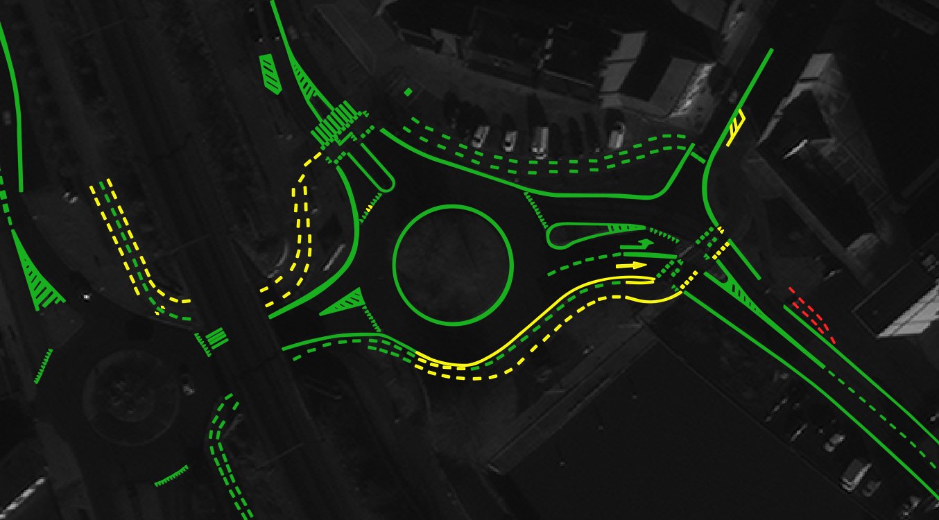
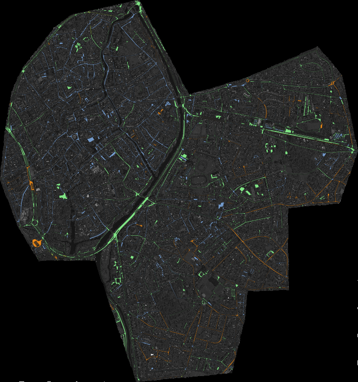
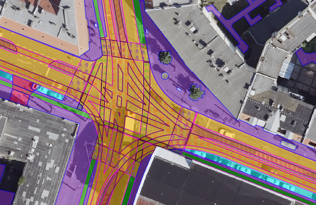
A sample of the sidewalk data extracted by Nazru AI in Sapporo, Japan .

What’s Next?
The City of Sapporo’s Urban Development Bureau has identified multiple applications for Nazru’s active transportation data in its urban planning initiatives. An immediate priority is enhancing the city’s existing sidewalk inventory with Nazru’s comprehensive dataset. The Bureau also plans to collaborate with specialized consulting firms to evaluate compliance with Japanese accessibility standards across Sapporo’s entire pedestrian network. Additionally, the data will be integrated into the city’s “Complete Streets” planning framework, helping to identify gaps in pedestrian infrastructure and prioritize future connectivity projects.
“Nazru’s data will play a key role in improving our sidewalk network assessments and identifying areas requiring upgrades,” said a representative from the Urban Development Bureau. “We anticipate that future projects focused on pedestrian safety and connectivity will greatly benefit from the detailed geospatial insights Nazru provides. While we are still in the early stages of utilizing this data, we are confident it will significantly shape our planning and investment strategies—particularly in prioritizing improvements for areas with the greatest need for enhanced accessibility and connectivity.”
Nazru is committed to building a digital twin of our planet’s built and natural environments. Using advanced artificial intelligence, Nazru converts high-resolution imagery into high-definition vector maps that form a dynamic digital representation of reality. These maps are used by governments and organizations in over 100 countries to support planning, development, and sustainability initiatives worldwide.