
Mapping the world digitally through AI
Nazru® leverages artificial intelligence to construct a digital twin of the world, transforming high-resolution geospatial imagery into detailed, precise, and up-to-date vector maps. These advanced datasets empower data-driven decision-making across diverse industries, enhancing accuracy and operational efficiency.

Our Capabilities
We harness the power of artificial intelligence to transform geospatial imagery into digitized data, enabling the rapid production of high-definition vector maps at scale—with precision comparable to that of a trained GIS expert.
Accurate
Our AI-powered mapping systems generate high-definition vector data with the precision of a skilled GIS professional, delivering a dependable source of truth for large-scale geospatial decision-making.
Scalable
We process millions of square kilometers of vector data monthly with unparalleled speed and scalability, covering all terrains to provide comprehensive and detailed insights into the real world.
Up-to-Date
Leveraging our global partner network, we integrate the most recent geospatial imagery, which our AI-driven systems rapidly analyze to create and maintain an up-to-date representation of reality.
Industries
Nazru revolutionizes mapping and geospatial analytics workflows across industries by harnessing cutting-edge AI to transform raw spatial data into actionable intelligence. Our solutions empower organizations to generate high-precision vector maps, streamline decision-making, and unlock new efficiencies—bridging the gap between advanced technology and real-world applications. From urban planning to logistics, Nazru delivers scalable, accurate, and cost-effective geospatial innovation tailored to the needs of modern enterprises.
Innovative Solutions
Explore our diverse range of services designed to meet your mapping and digital modeling needs. Our expertise combines advanced technology with reliable insights to support your projects effectively.
Enhance transportation networks, public safety, and stormwater management across your community by leveraging a digital representation of infrastructure and land use.
Enable data-driven strategic planning for nationwide initiatives in climate resilience, emergency preparedness, and rural broadband expansion through high-resolution geospatial intelligence.
Optimize project efficiency with high-fidelity, current, and comprehensive vector data that accurately reflects real-world conditions.
Enable precise property risk assessment, data-driven underwriting, and enhanced claims management through building-level geocoding and high-accuracy property intelligence.
Optimize network planning workflows and expand accessibility by leveraging a comprehensive overview of existing infrastructure and serviceable locations.
Leverage AI for good to support humanitarian aid and land management planning with real-time, high-resolution land cover data.
Learn more
Connect with NAZRU for Expert Guidance
Let’s transform your project with our expertise.
Subscribe for Updates
Stay informed about our latest advancements in aerial mapping and digital twinning. Join our newsletter to receive insights and updates directly to your inbox.
By subscribing, you agree to our Terms and Conditions.

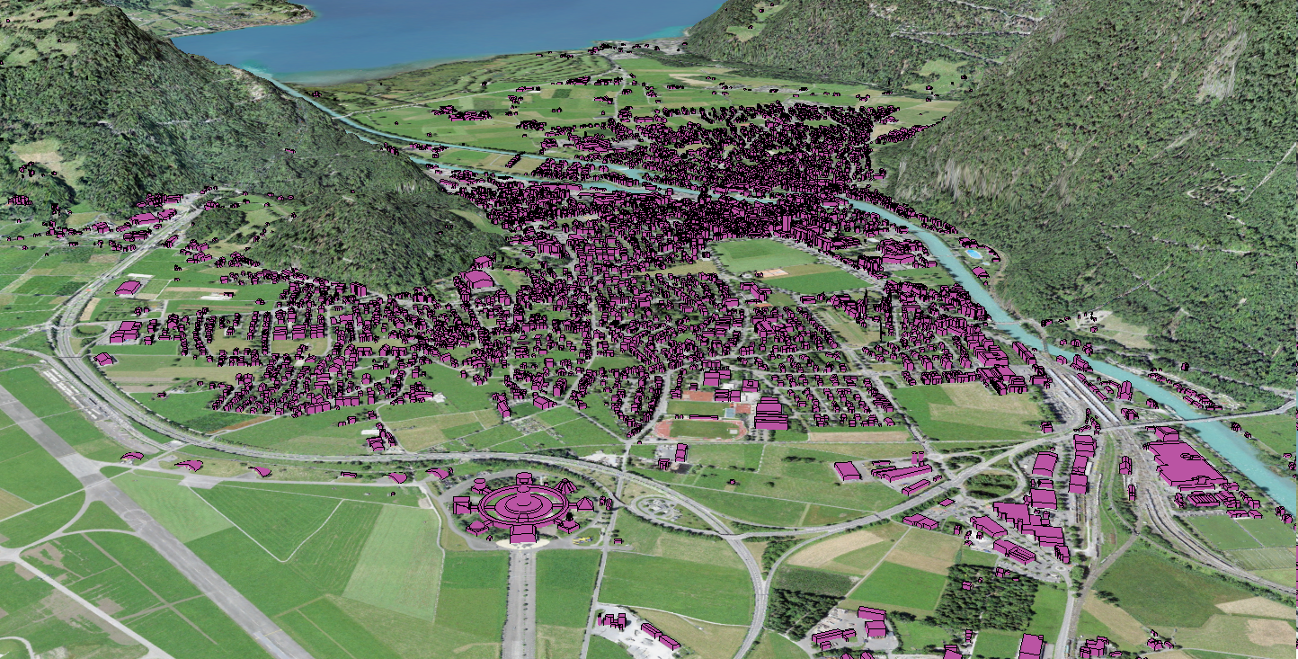
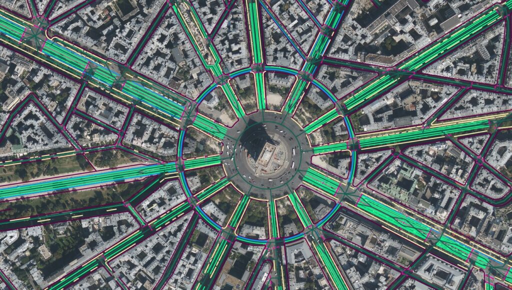
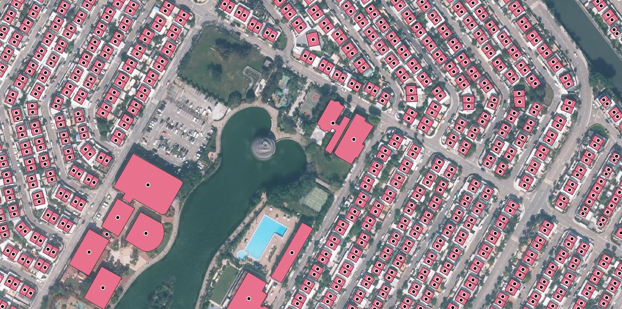
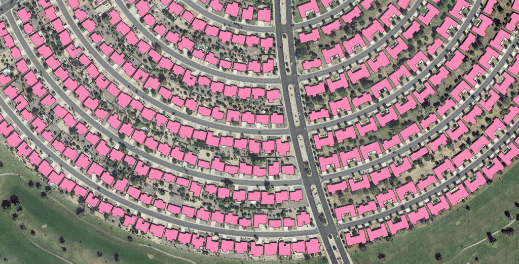
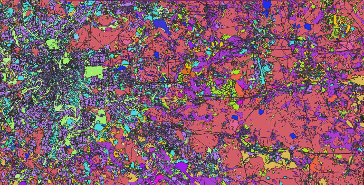
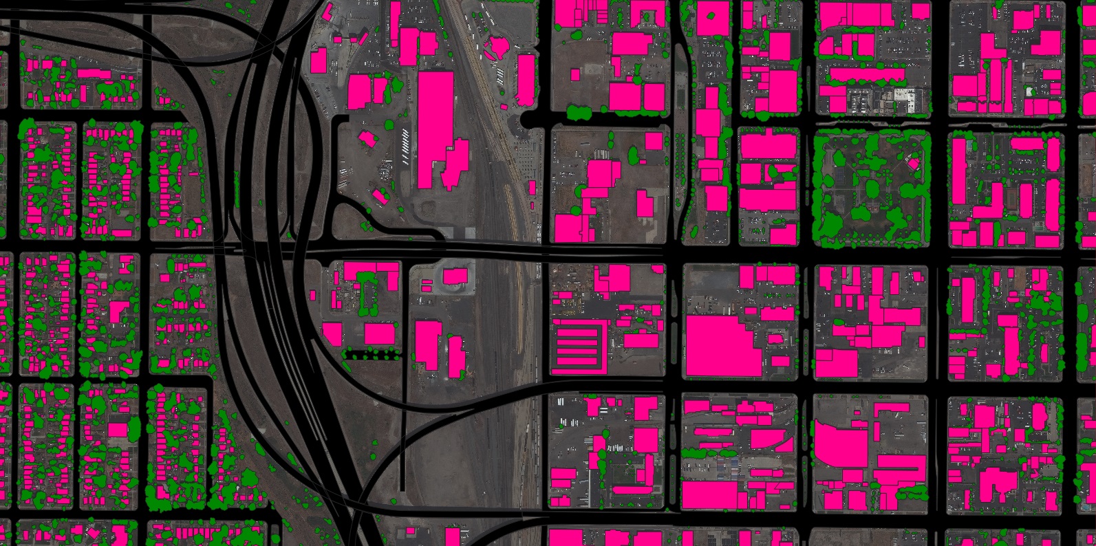
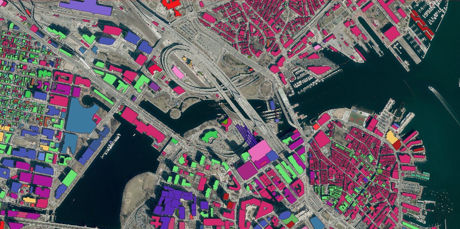
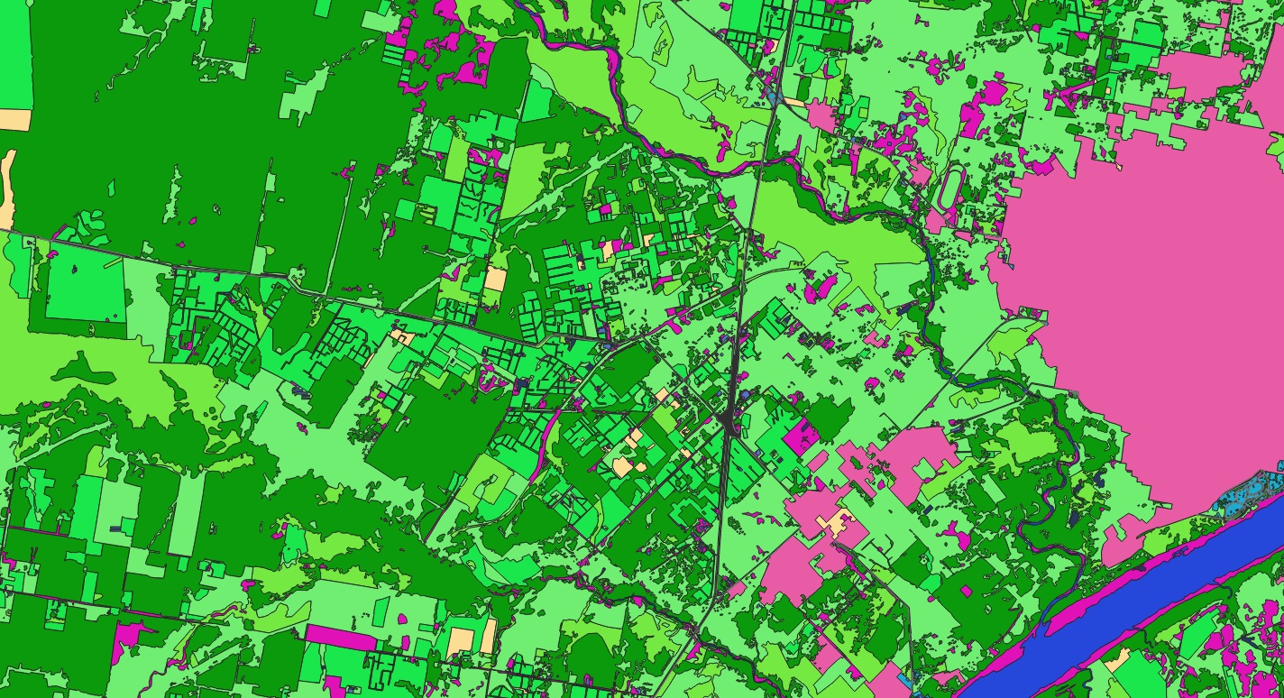
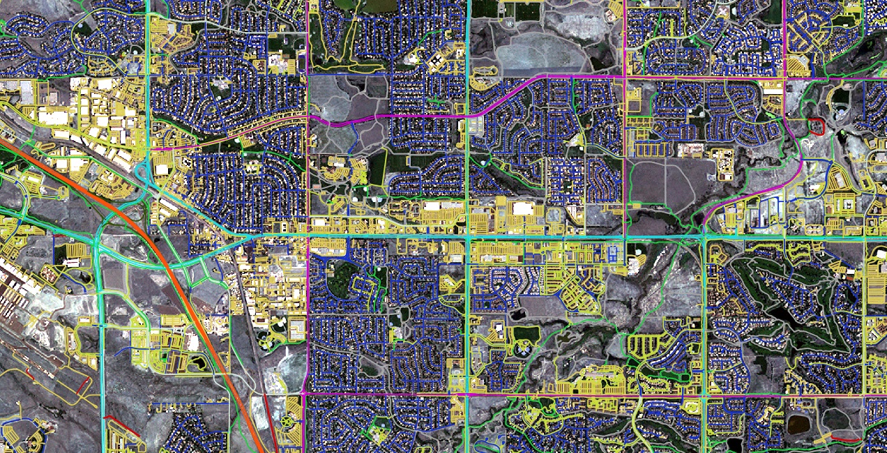
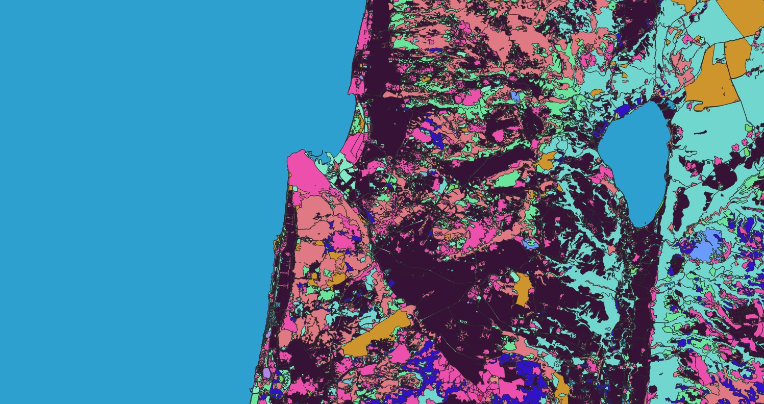
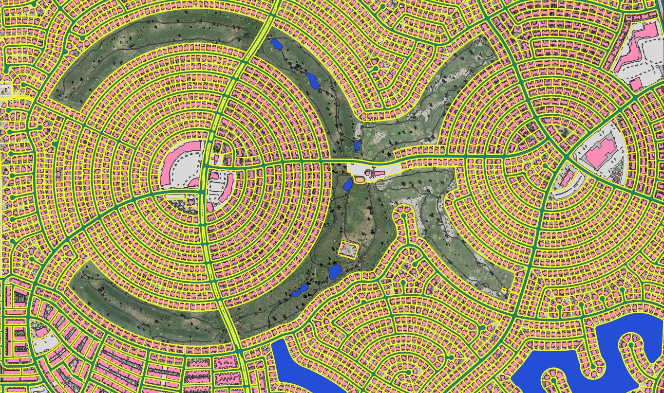
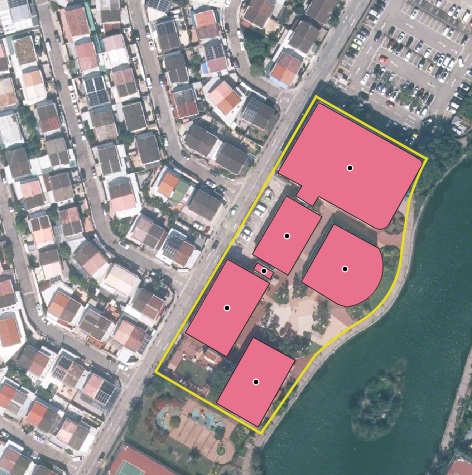
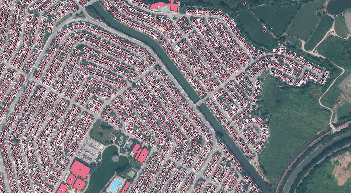
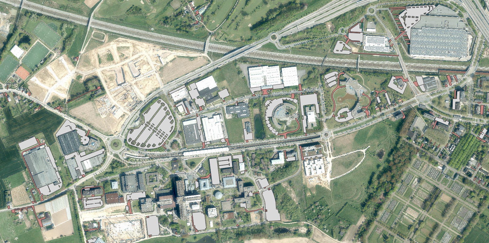
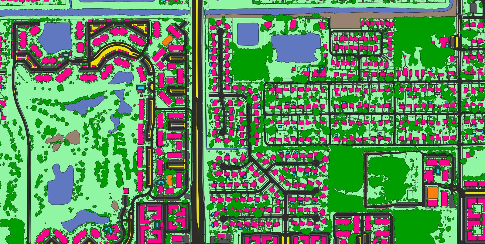
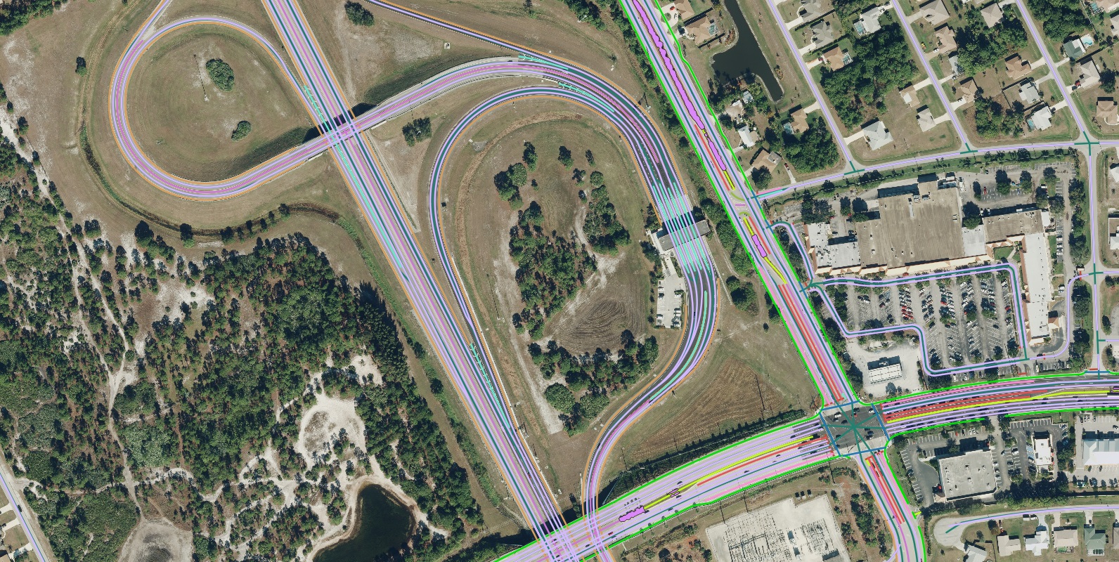
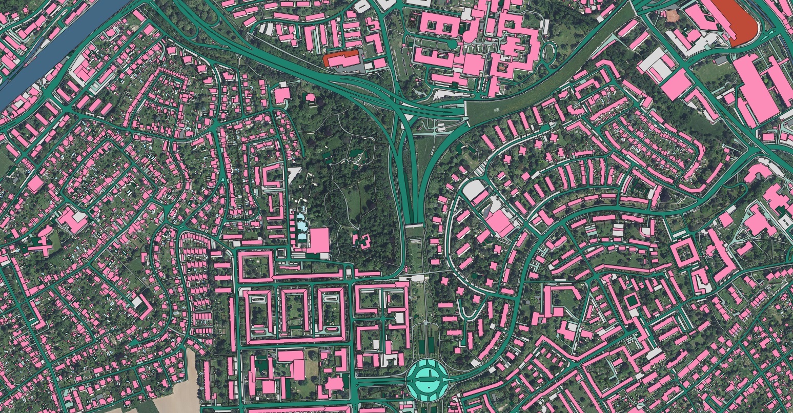
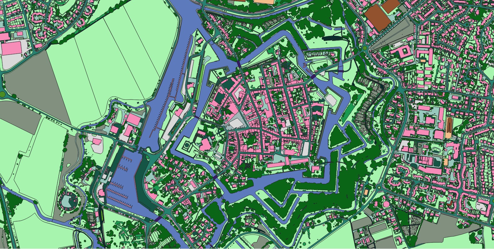
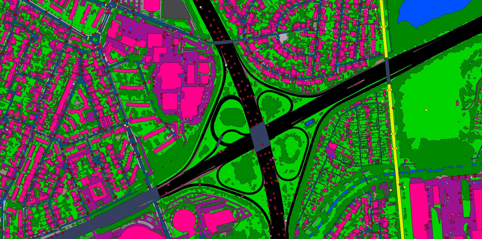
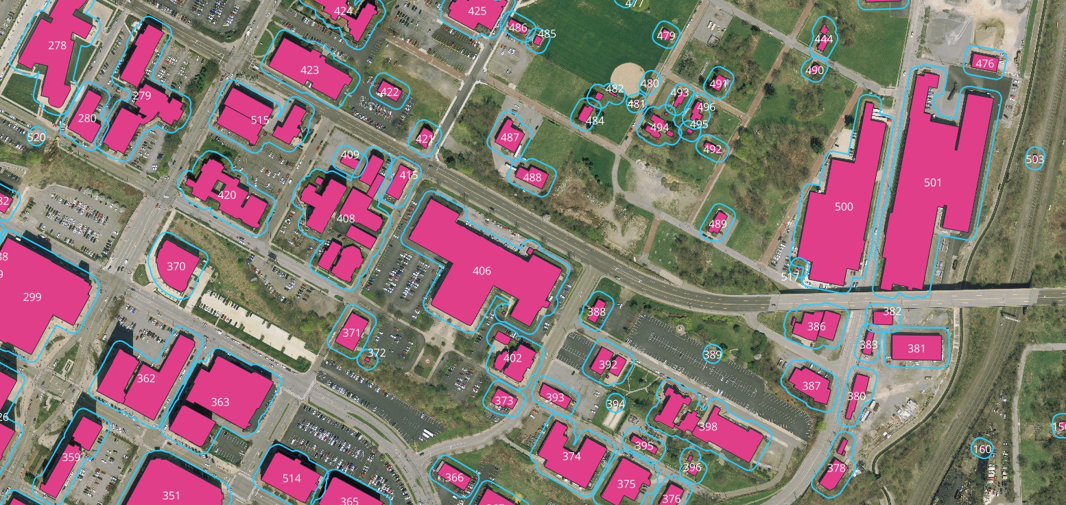
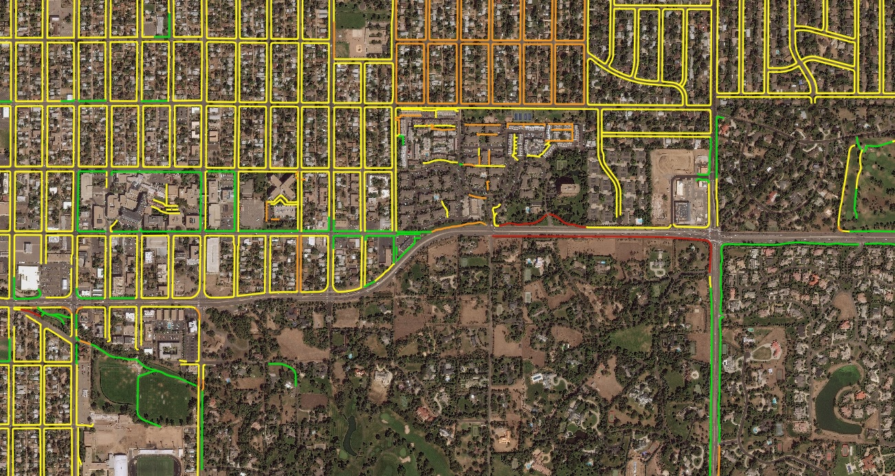
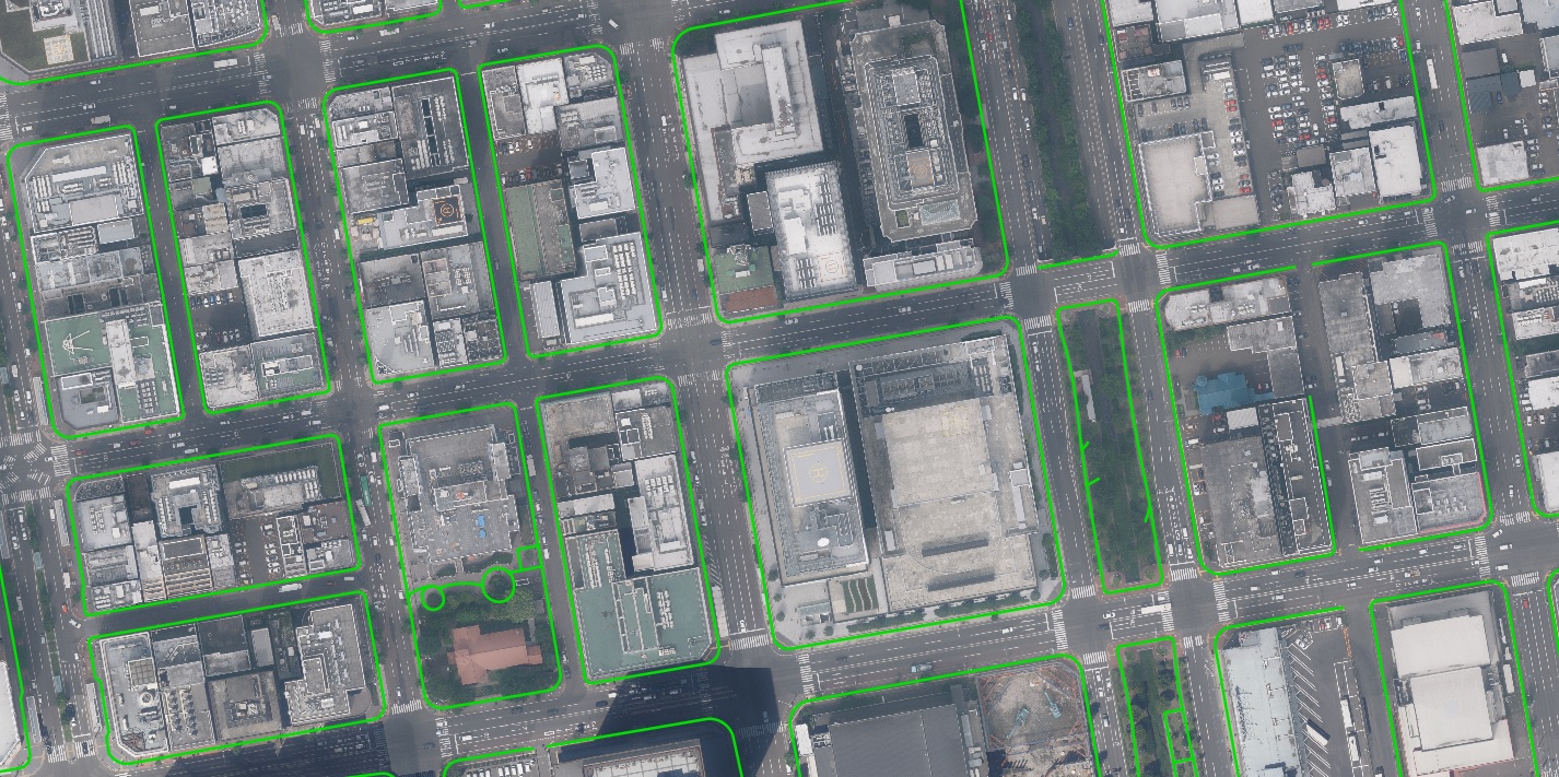
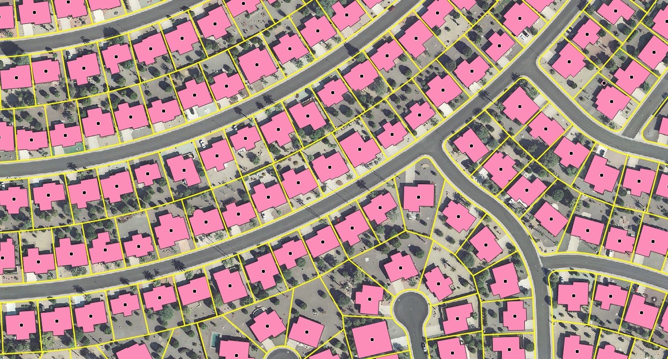
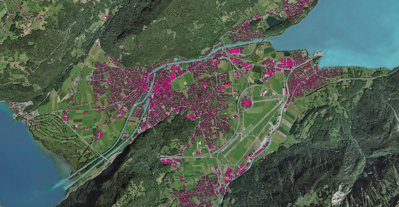
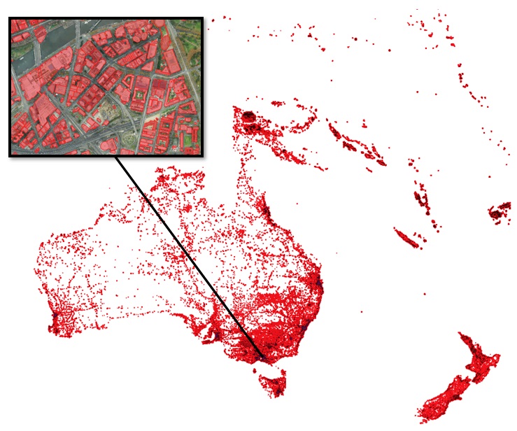
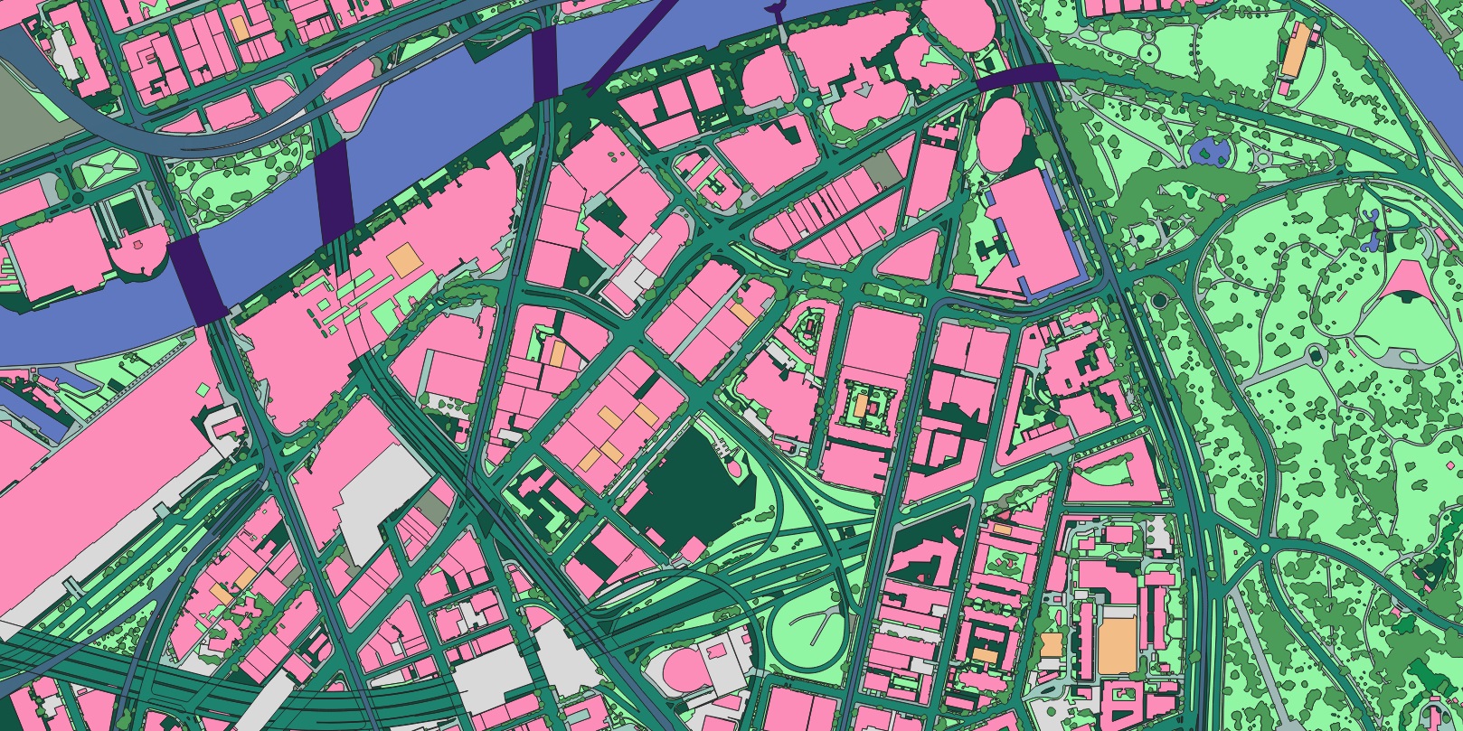
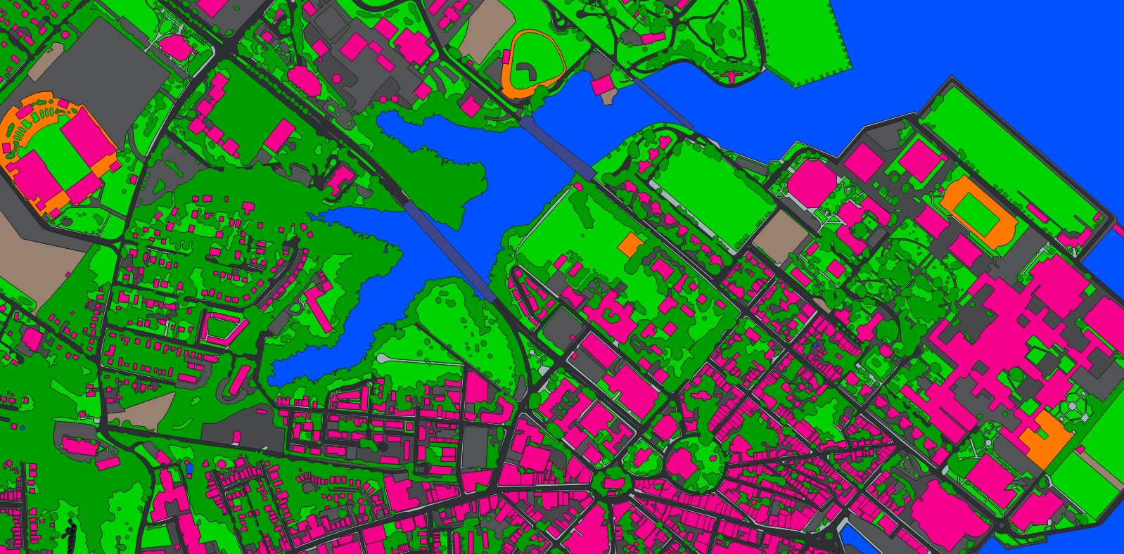
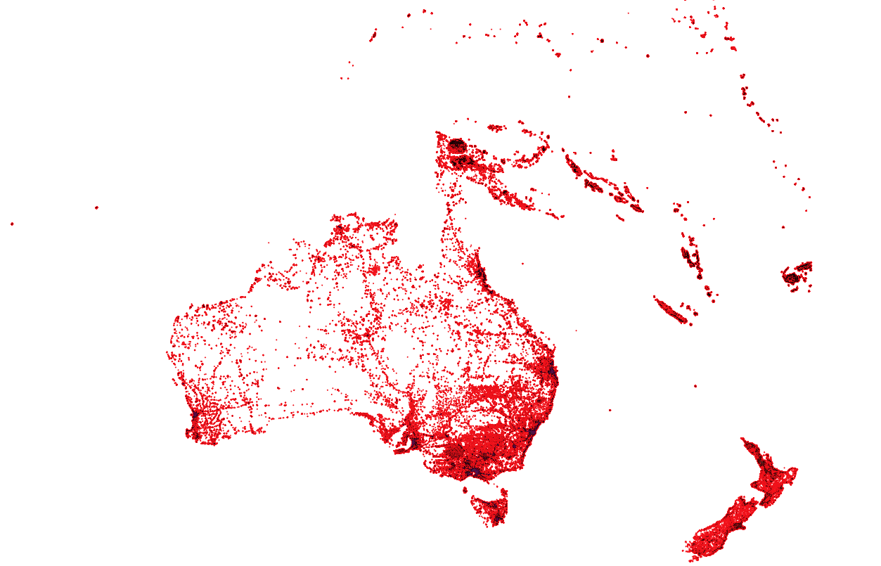
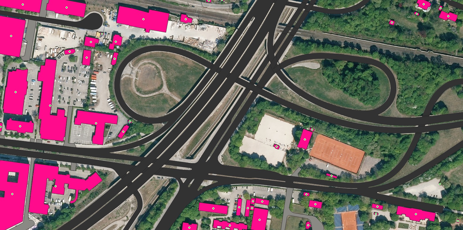
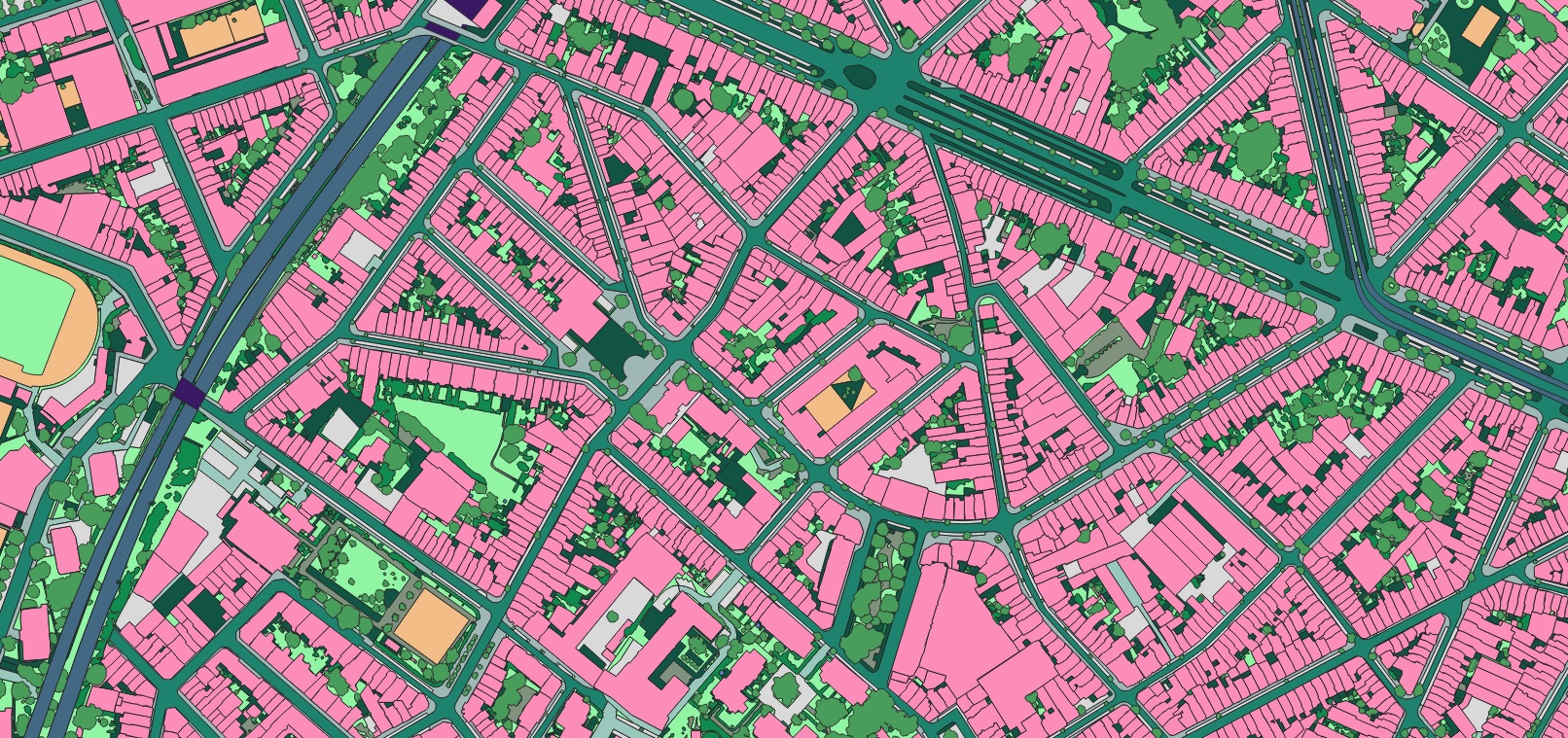
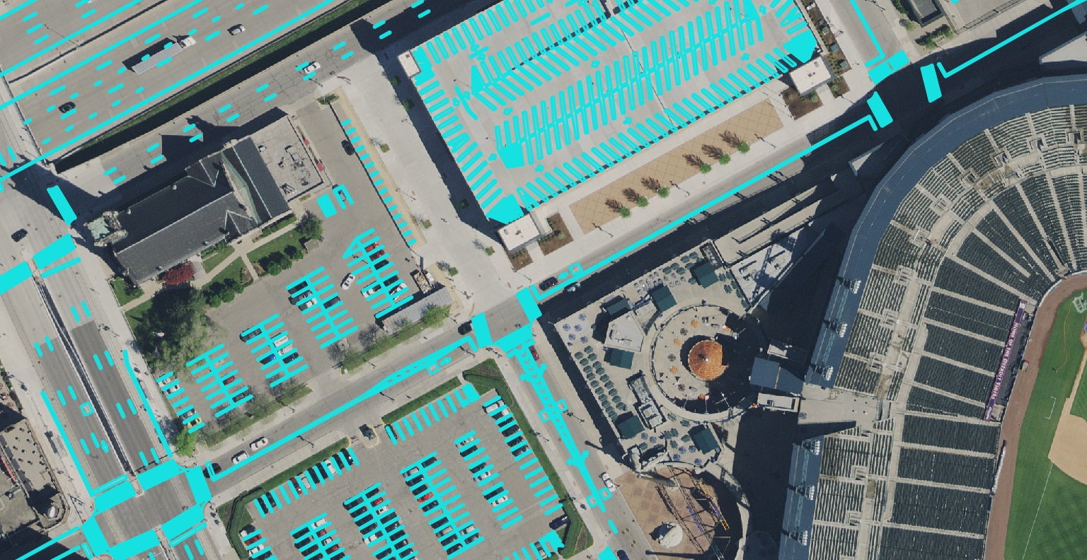
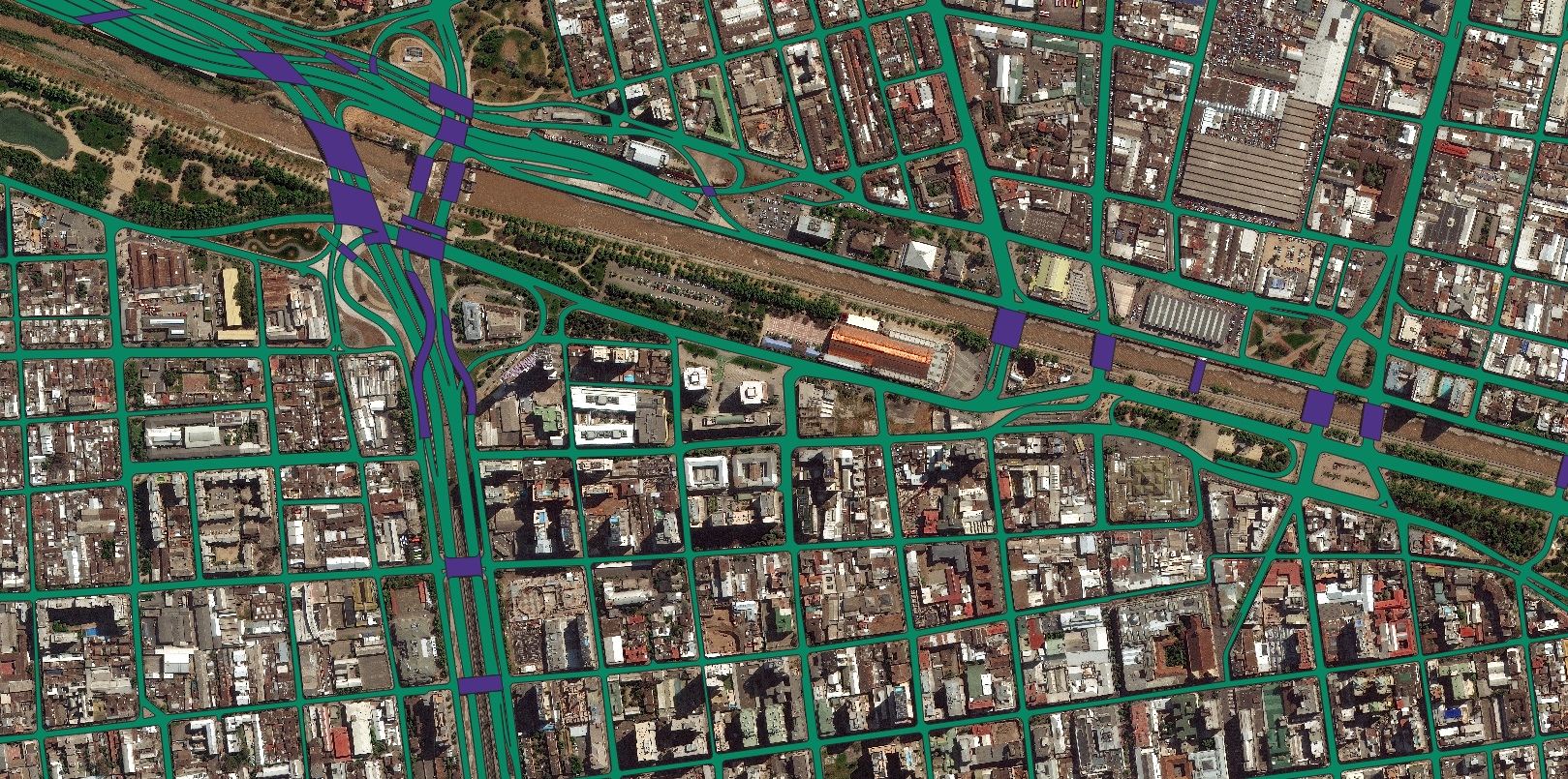
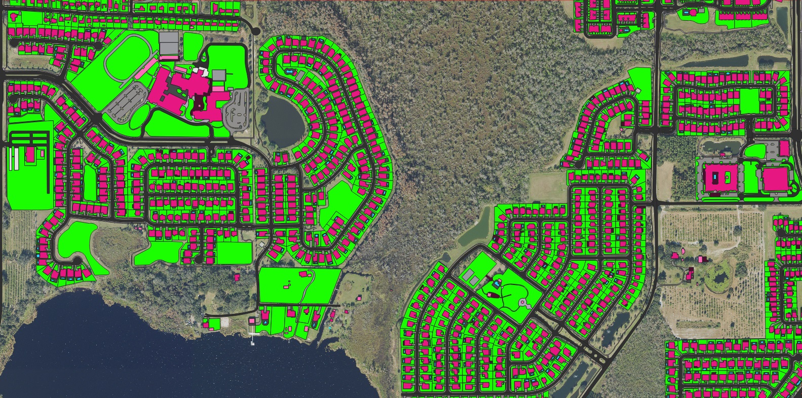
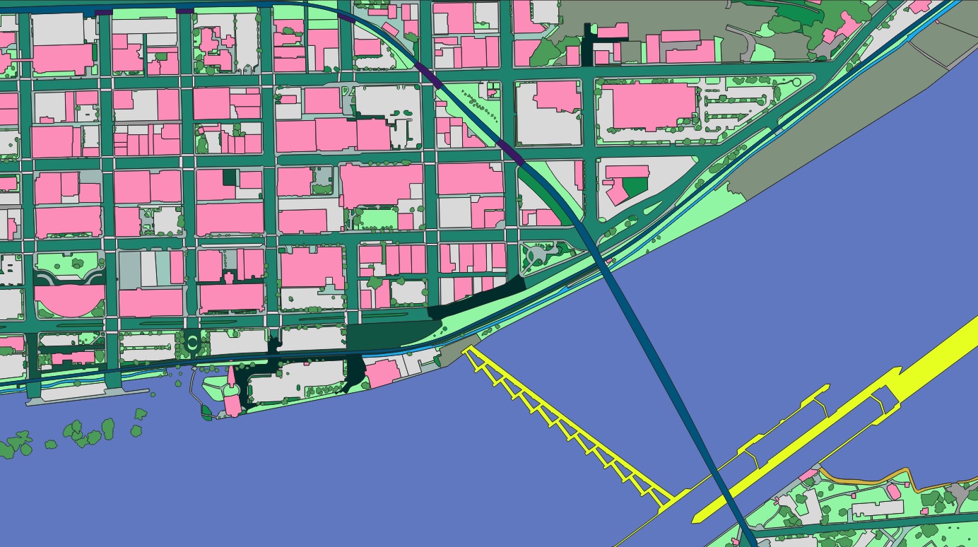
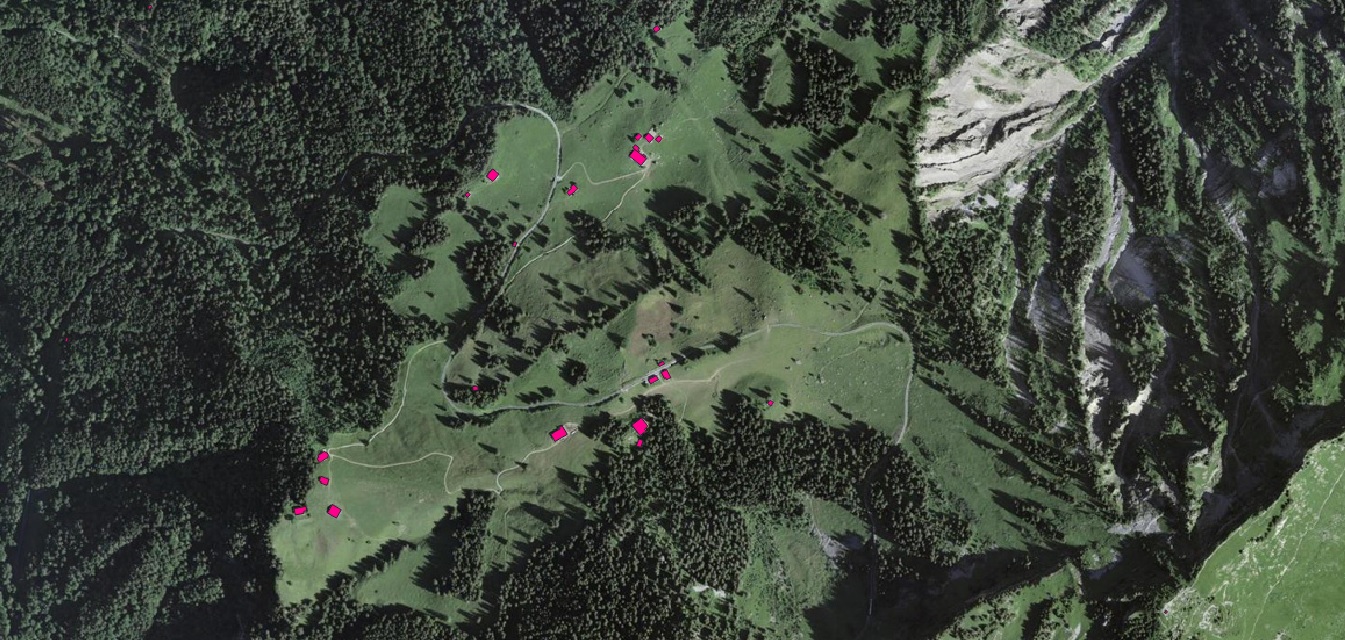
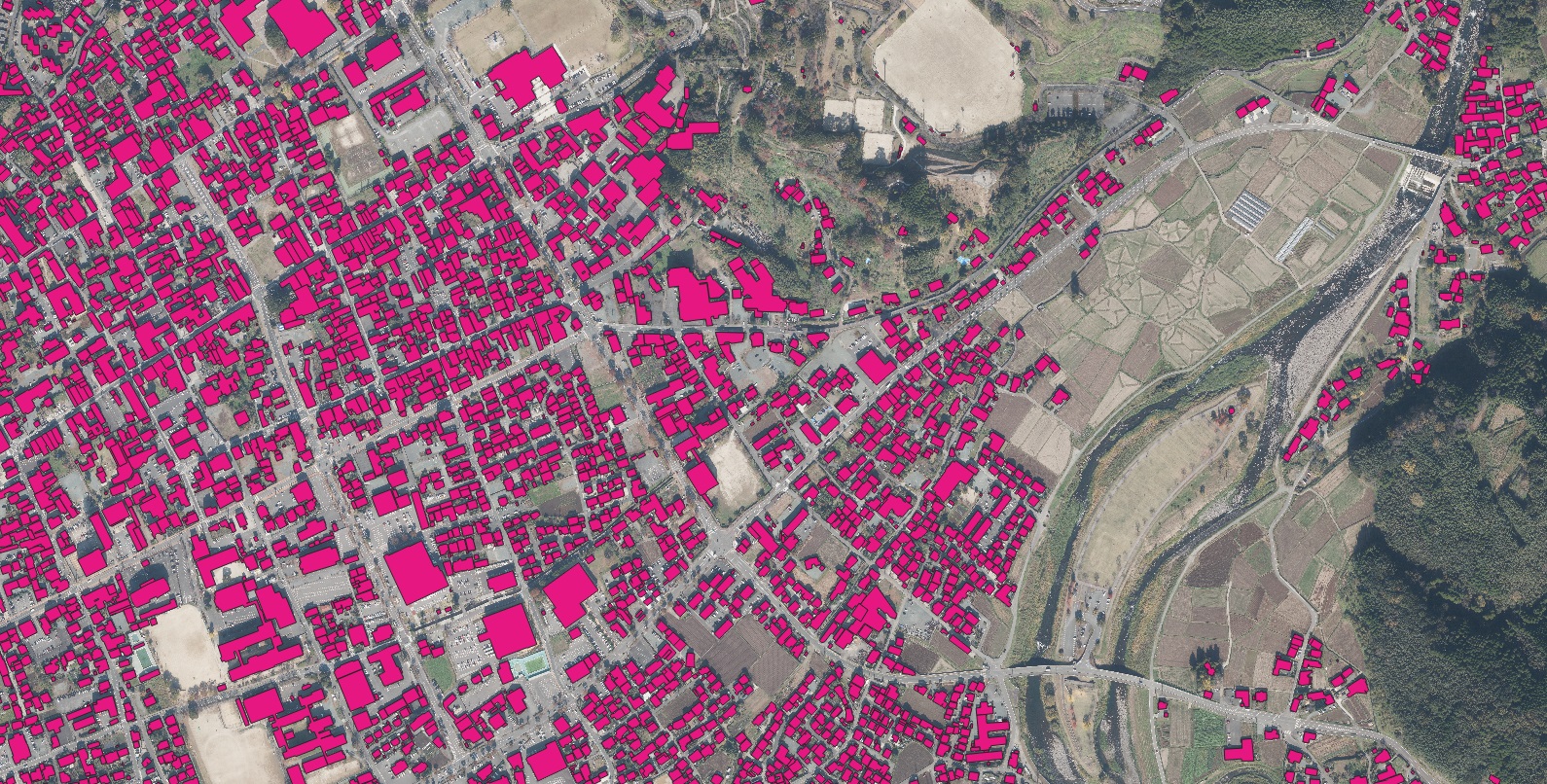
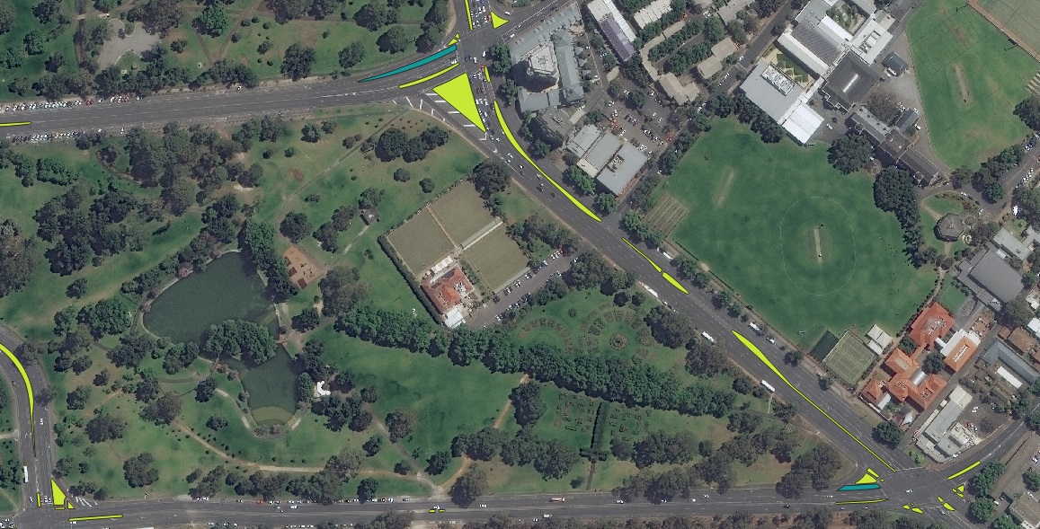
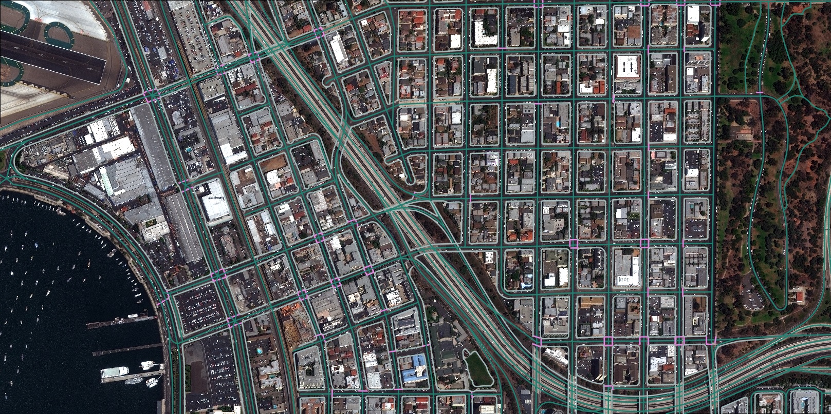
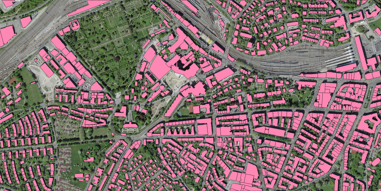
Nazru® uses AI to create a digital twin of the world, turning geospatial imagery into smart vector maps for better decision-making.
Products
Industries
- Federal Government
- Insurance
- Municipal & State Government
- Civil Engineering
- Telecommunications
- Non-Governmental Organizations (NGOs)