Mapping the Future
Charting worlds with AI — faster, smarter, more precise
Discover how our technology revolutionizes aerial mapping and digital twinning. Dive into innovative solutions that simplify complex landscapes.
Project Showcase
Explore a selection of our projects, each highlighting innovative aerial mapping and digital twinning solutions.
Our Portfolio
Discover Our Selected Projects
Explore a diverse collection of our work showcasing aerial mapping and digital twinning applications.
Advanced Mapping Techniques
Utilizing AI to enhance map accuracy, our innovative approach sets new standards in the industry.
Digital Twinning Mastery
Our digital twinning services provide precise, real-time representations of physical environments.
Innovative Cartography
Our techniques leverage AI to transform cartographic data into actionable insights and visualizations.
What Our Clients Say
Read some thoughts from clients who trusted our services.
Get in Touch with Us
If you have questions or wish to discuss potential collaborations, we are here to help. Reach out to us, and let’s explore opportunities together.
By clicking Contact Us, you agree to our Terms and Conditions.
Precision Matters
Transforming Landscapes with AI
Satisfaction Rate
Over 500 successful mapping projects delivered, showcasing our commitment to excellence in every detail.
Innovations Introduced
Utilized AI for over 1 million data points, providing unmatched accuracy and efficiency in mapping solutions.
Global Clients Served
A dedicated team of 20+ experts committed to delivering innovative solutions to clients worldwide.
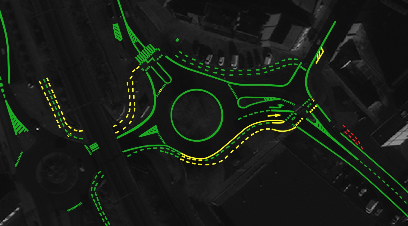
Roeselare Road Line Quality Classification (Case Study)Location: Roeselare, GermanyProject OverviewNazru's AI platform was deployed in Roeselare, Belgium, to automatically assess the quality of road markings (lines) using satellite and panchromatic
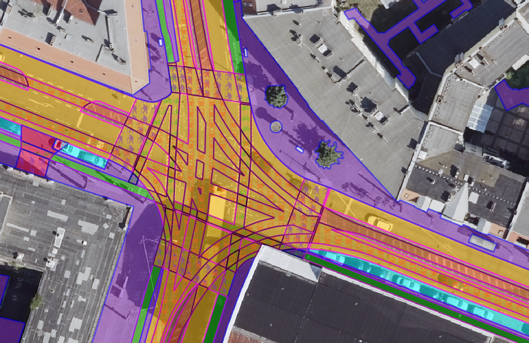
Bruges Road Surface Damage & Texture Classification (Case Study)Location: Bruges, BelgiumProject OverviewNazru's AI platform was deployed in Bruges, Belgium, to automatically detect and classify road surface damages and texture types
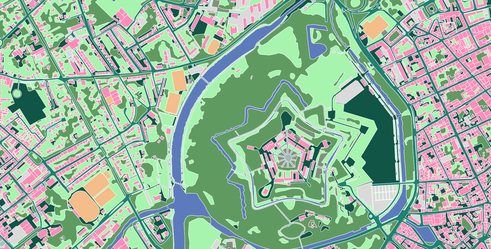
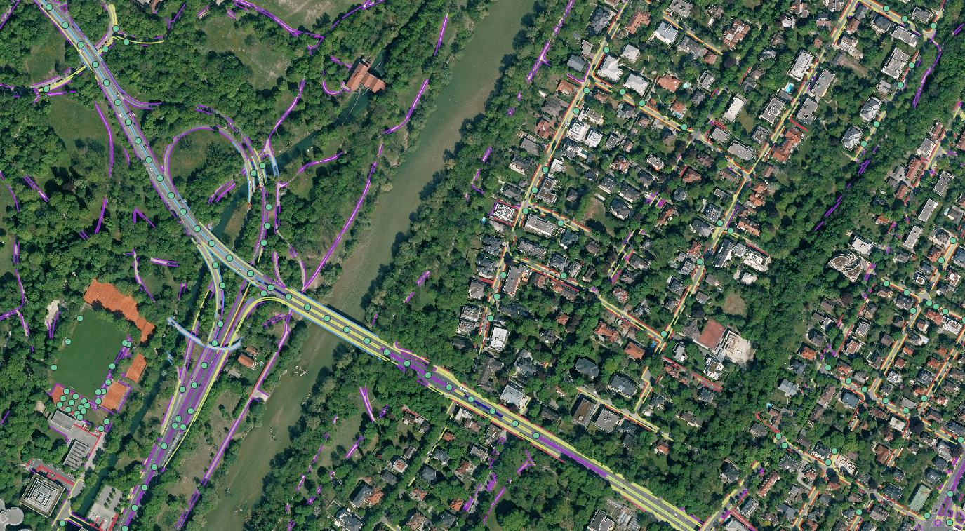
Berlin Multi‑Class Land Cover & Transportation Mapping (Case Study)Location: Berlin, GermanyProject OverviewNazru's AI platform was deployed to map Berlin's urban surface into 9 primary classes plus additional attributes. This project
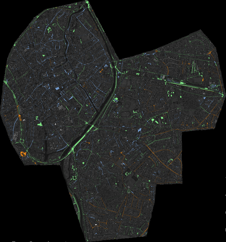
Roadside Infrastructure Detection (Case Study)Location: Munich, GermanyProject OverviewNazru's AI platform was deployed to automatically detect and classify roadside infrastructure elements into five distinct categories: curbstone, fence, guardrail, planar border between