Reducing Emergency Response Times by Optimizing Routes with Nazru
Enhancing Emergency Response through a Comprehensive Accessway Database
In emergency situations, time is a critical factor. An effective response necessitates the use of a caller’s location to identify the nearest available unit and to calculate the most efficient route. Failures in either of these steps can significantly impede the ability of responders to reach those in need promptly.
Public safety agencies in numerous jurisdictions rely on mapping technology to dispatch the closest responder and to determine the optimal route to emergency calls. However, it was observed that widely available consumer-grade mapping applications frequently provided incorrect unit assignments and routing, resulting in critical delays.
For example, first responders were often directed to a highway behind a building with no physical access, or to the incorrect side of a waterfront property. A recurring issue involved a gated community where emergency calls originated from a clubhouse situated on an unnamed private road, a scenario which standard routing applications failed to navigate correctly.
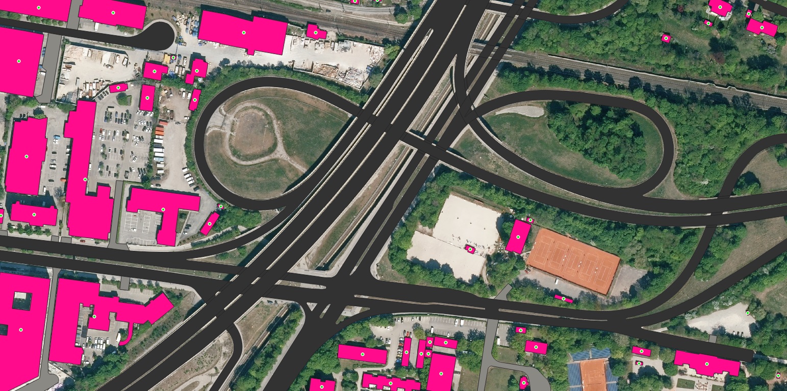
A sample of driveways and parking lots in Brussels Belgium County extracted by Nazru for emergency response optimization
Driveway
Parking
The inaccuracies were traced to the foundational data underpinning common routing systems. Most commercial applications rely on street centerline data within their algorithms, which simply associate addresses with the nearest road segment. Recognising this limitation, the local GIS authority identified an opportunity to significantly improve dispatch accuracy by developing a proprietary application. This solution would incorporate more detailed geospatial features, including connected pavement such as driveways and parking lots, which are essential for physically accessing a specific address.
In the endeavour to construct a comprehensive database of address, road, parking lot, and driveway features, the GIS authority encountered a significant challenge: the absence of a current, accurate, and complete data source. The initial approach involved the manual digitisation of these features from aerial imagery—a process that proved to be both time-consuming and labour-intensive, given the vast operational area containing thousands of address points and associated accessways.
Example of optimized routes for emergency response teams using Nazru driveway and parking data vs previous method of driveway and parking centerlines
Driveway
Parking
Original-driveway-and-parking-data
Partner with Nazru: Transforming Infrastructure Planning with AI-Powered Geospatial Data
Nazru leverages cutting-edge artificial intelligence technologies to produce unprecedented levels of accurate and detailed geospatial data at a global scale. Our solutions—including building footprint mapping, transportation networks, and land cover classification—empower government and private organizations to make more informed decisions in urban planning, emergency management, infrastructure development, and environmental sustainability, all supported by reliable, up-to-date information. To learn more about how Nazru’s solutions can enhance your specific projects, please contact our team of experts for a consultation.