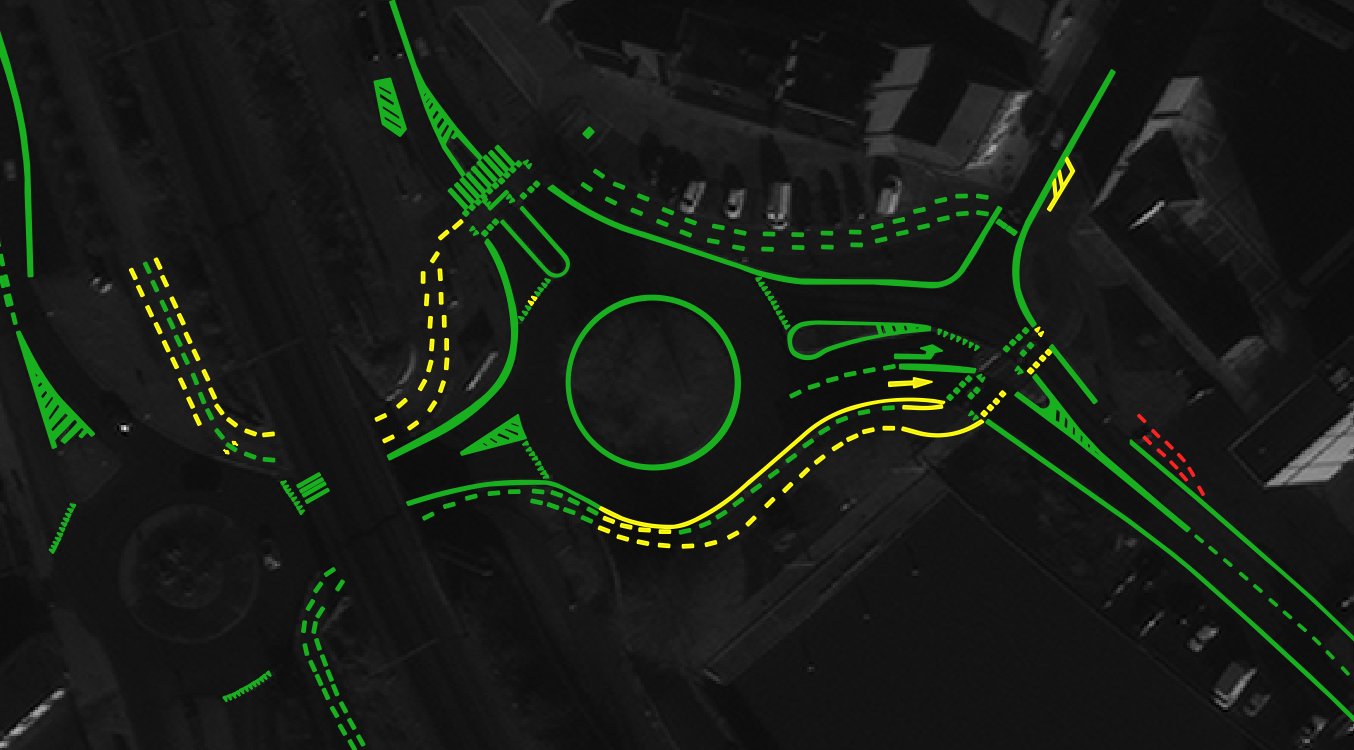
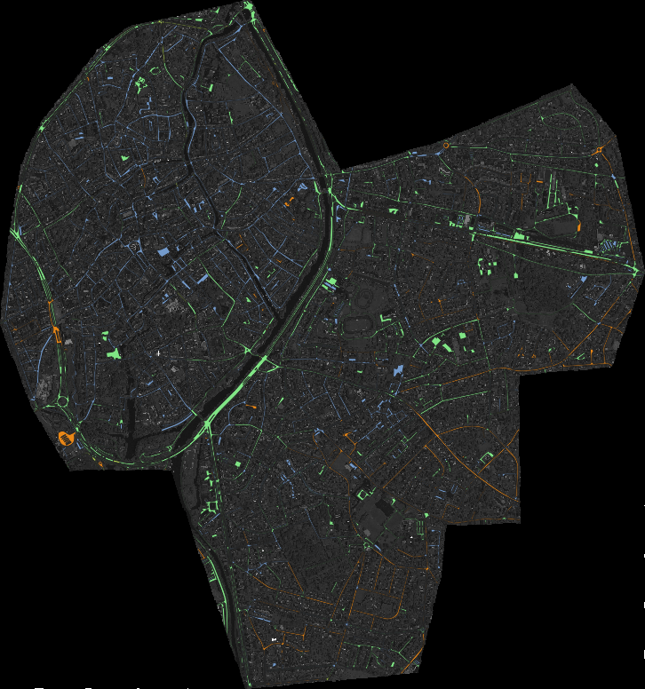
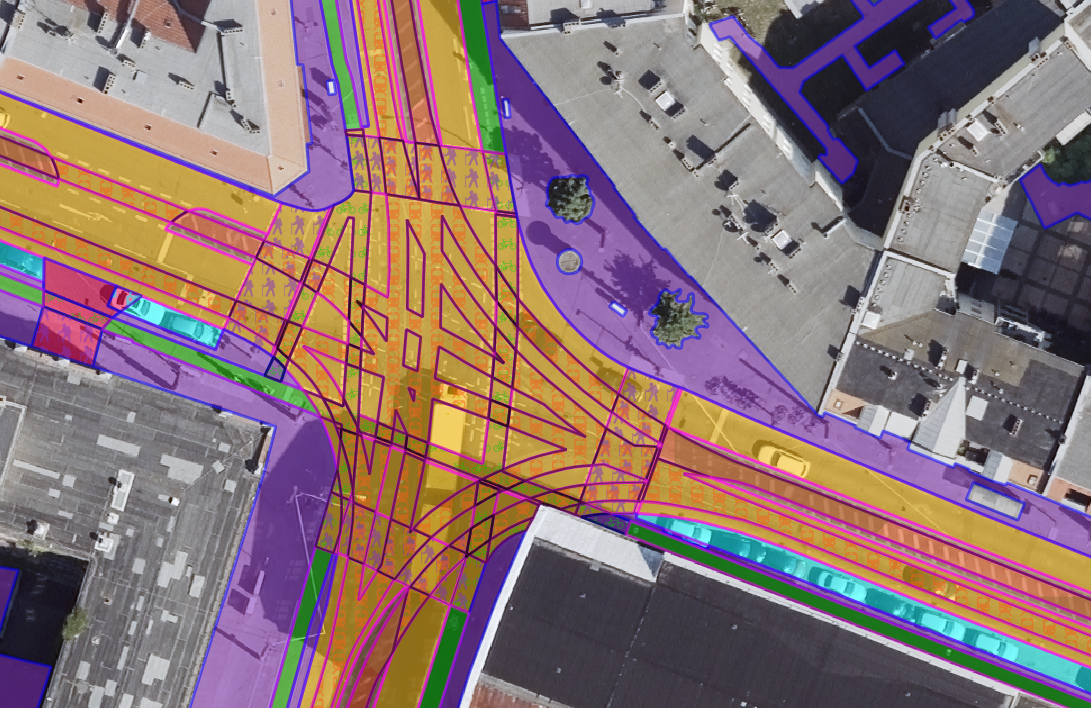
The San Francisco analysis tells an even more detailed story. In this complex urban environment, our higher-resolution imagery captures the intricate network of bicycle pathways, pedestrian routes, and service access roads that form the lifeblood of sustainable urban mobility. The system’s ability to distinguish between different types of transportation infrastructure reveals how people move through dense urban spaces, where micro-mobility options can be expanded, and how to better integrate different transportation modes. This level of detail is particularly valuable for cities aiming to promote active transportation while maintaining efficient vehicle access where needed.
What makes this technology truly transformative is its ability to see the city as a living, connected system rather than just a collection of roads. By understanding the functional purpose of each transportation element, cities can make more informed decisions about infrastructure investments, traffic management, and sustainable development. This approach recognizes that a bicycle path serves a different community need than a commercial delivery route, and that residential streets require different planning considerations than major thoroughfares.
The implications for urban transportation management are profound. Cities can now monitor changes in their transportation networks over time, plan new developments with better connectivity in mind, and ensure that transportation systems serve all residents equitably. The technology also supports more effective emergency planning, better public transit routing, and smarter infrastructure maintenance scheduling.
As we continue to refine this technology, we’re working with forward-thinking cities to apply these insights in practical ways that make urban mobility safer, more efficient, and more sustainable. From reducing congestion to improving pedestrian safety and promoting alternative transportation options, the detailed understanding of road networks provided by our system is helping shape the cities of tomorrow.
For urban planners, transportation departments, and city leaders looking to harness the power of spatial intelligence, our technology offers a new way to understand and optimize urban mobility. By seeing the complete picture of how cities move, we can work together to create urban environments that are not just smarter, but more livable and responsive to the needs of all who use them.