Advanced Geospatial Building Classification: Powering Data-Driven Decisions Across Industries
Our comprehensive Building Classification Dataset represents a significant leap forward in computer vision capabilities for geospatial analysis. This meticulously curated dataset features over 35 distinct, expertly labeled classes of structures—from residential and commercial buildings to specialized facilities like fire stations, universities, and transportation hubs. This granular level of detail provides an unprecedented foundation for training robust machine learning models to interpret the built environment with high accuracy.
Unlocking Value for Key Sectors
Insurance & Risk Management:
This dataset enables a transformative approach to risk assessment and claims processing. Insurance providers can leverage automated building type identification (e.g., house, apartment, industrial) to refine actuarial models, price policies based on precise structural attributes, and monitor portfolio exposure. In the wake of natural disasters, our technology facilitates rapid damage assessment by comparing pre- and post-event imagery, accelerating the claims process and improving loss estimation accuracy.
Municipal & State Government:
For government entities, this dataset serves as a powerful tool for intelligent urban management and public service optimization. It allows for the automated monitoring of urban development, identification of unauthorized construction, and accurate analysis of land use patterns. By understanding the distribution of building types—such as schools, hospitals, and public facilities—governments can make data-driven decisions regarding infrastructure planning, resource allocation, and future community needs, leading to more efficient and responsive governance.
Civil Engineering & Infrastructure Development:
Civil engineering firms and construction monitorings can utilize this data for large-scale project oversight and infrastructure auditing. The models can track the progression of construction sites, classify structures based on type and potential build quality, and conduct broad-scale inventories of existing infrastructure. This capability supports project management, ensures regulatory compliance, and aids in the planning of new civil works.
Telecommunications & Network Planning:
Telecom operators require precise geospatial intelligence for effective network rollout and capacity management. Our dataset allows for the critical distinction between a high-density apartment tower, a sprawling industrial warehouse, and a periodically crowded stadium. This enables engineers to perform sophisticated propagation modeling, identify optimal locations for new cell towers, and strategically plan network upgrades to meet the specific demands of diverse built environments, ensuring robust service quality.
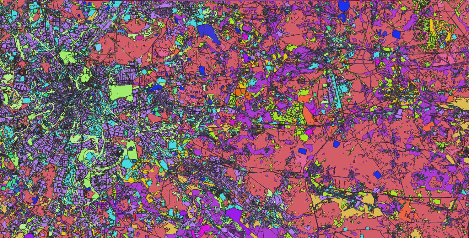
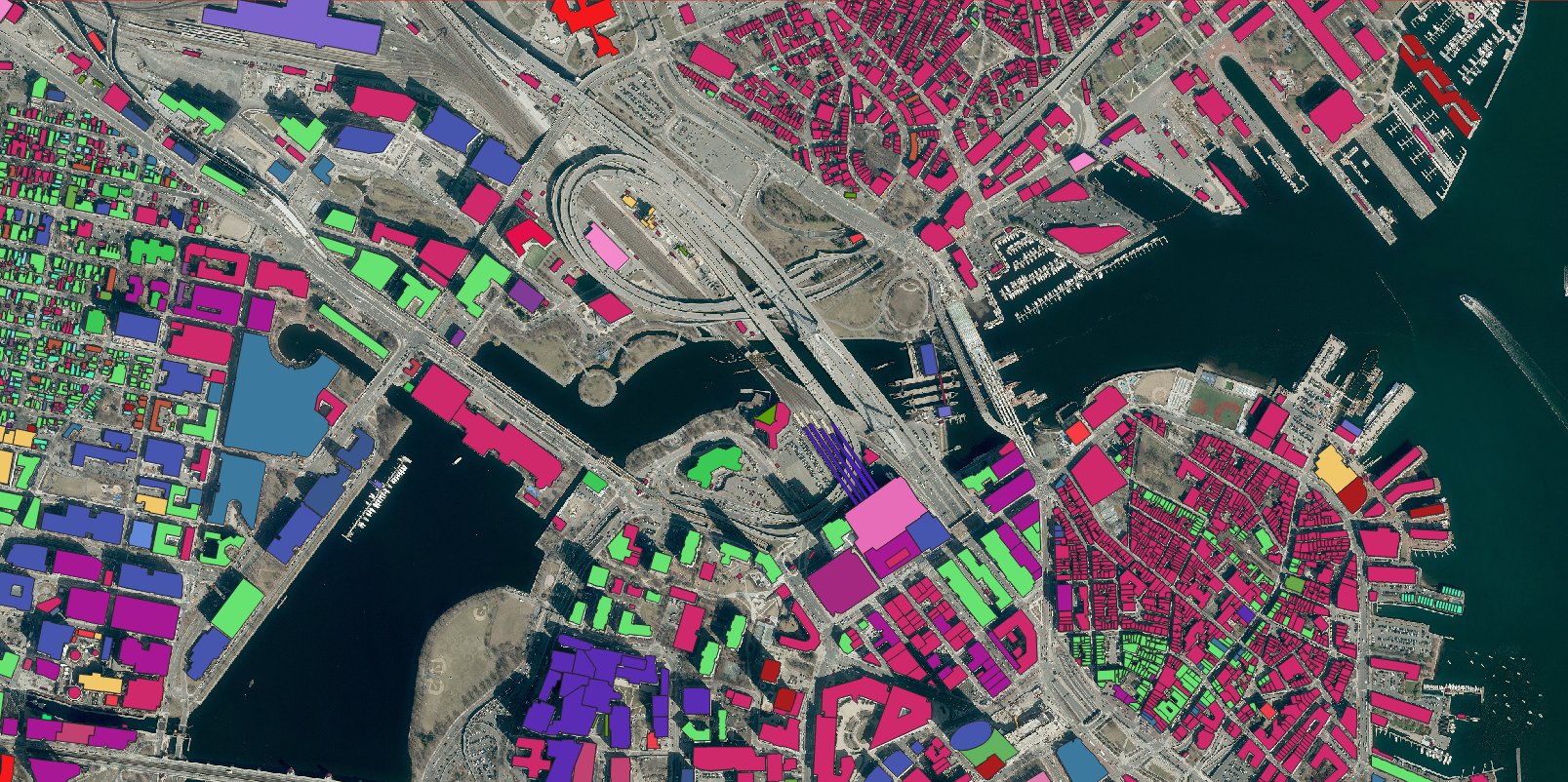
Foundations of Smart Cities: Building Type Classification Standard in Boston, Massachusetts, USA
Complete List of Dataset Classes
- apartments
- boathouse
- carport
- church
- college
- commercial
- construction
- detached
- dormitory
- fire_station
- garage
- garages
- government
- guardhouse
- hospital
- hotel
- house
- industrial
- kiosk
- no
- office
- parking
- public
- residential
- retail
- roof
- school
- semidetached_house
- service
- shed
- stadium
- temple
- terrace
- tower
- train_station
- transportation
- university
- warehouse
Formal Dataset Description
This comprehensive dataset provides a meticulously curated hierarchical framework for interpreting the built environment through advanced computer vision. Encompassing 38 distinct and expertly annotated classes, its scope ranges from large-scale public and institutional facilities—such as universities, hospitals, and industrial plants—to granular architectural elements and ancillary structures like roofs, sheds, and kiosks. The taxonomy offers exceptional granularity, enabling precise differentiation between residential types—from single-unit detached homes to multi-unit apartments and terraces—and across diverse commercial, logistical, and specialized functions, including retail, warehouses, and stadiums. Critically, it also captures transitional states, such as construction sites, and the absence of structures (no). The principal strength of this dataset lies in its capacity to bridge raw pixel data and actionable semantic understanding, empowering machine learning models to not merely detect a “building,” but to classify it accurately as a specific, functionally significant asset. This foundational capability is instrumental for developing robust and reliable AI-driven solutions across a multitude of sectors, including urban planning, risk assessment, telecommunications infrastructure, and the creation of intelligent digital twins.
Nazro Company is at the forefront of leveraging this sophisticated classification framework to develop cutting-edge AI solutions. We are actively working on projects that translate this data into actionable insights for our clients. For partnership inquiries and to explore integration possibilities, please contact us.