The Ultimate Guide to Impervious Surface Data
Impervious surface mapping refers to the process of creating a geospatial representation of land cover that does not allow water to permeate the soil. While numerous types of land cover exist globally, they can all be classified into two categories—pervious and impervious surfaces—to support various environmental applications.
 A sample of detailed land cover data, including both pervious and impervious surfaces in Boise, Idaho, USA
Pervious vs. Impervious Surfaces
All land cover can be categorized as either pervious or impervious. Pervious surfaces are permeable layers that allow water to infiltrate into the ground, whereas impervious surfaces are solid layers that prevent infiltration and result in runoff.
An illustration depicting stormwater interaction with natural ground cover and impervious surfaces. Source: United States Environmental Protection Agency.(Reference)
Types of Impervious Surfaces
Numerous types of impervious surfaces exist worldwide. Predominantly, these surfaces are anthropogenic; however, certain nonporous rock formations also qualify as impervious.
Common examples include:
- Roads
- Sidewalks
- Buildings
- Bridges
- Parking lots
- Sports fields (with artificial turf or compacted surfaces)
- Swimming pools
- Other artificial structures and features
Â
Every land classification interacts uniquely with rainfall due to its distinct properties. The contribution of a specific surface to water runoff is quantified using a runoff coefficient. This coefficient is calculated as the ratio of runoff volume to precipitation volume and is determined by factors such as soil type, surface gradient, permeability, and land use.
 A sample of impervious surfaces mapped over geospatial imagery in Dortmund, Germany
Top Applications of Impervious Surface Maps
Impervious surface mapping has long been a vital tool for environmental analysis, with its significance growing substantially in recent decades. The emergence of Geographic Information Systems (GIS) and advanced geospatial data has accelerated innovation in land cover classification. This progress enables analysts to derive critical insights into surface permeability and make more informed, data-driven decisions.
Mapping impervious surfaces is essential for understanding and mitigating climate change, a phenomenon that is altering hydrological cycles and increasing the frequency and economic impact of stormwater events. For instance, flood costs in the United States are rising steadily and are projected to increase from approximately $32 billion annually to over $40 billion by 2050. The visualization and analysis of impervious surface distribution are crucial for predicting, mitigating, and preventing damage from such climate-related events. This section details three primary applications for this data: stormwater mapping, flood modeling, and stormwater utility fee assessment.
Stormwater Mapping
An example of a detailed land cover map for stormwater analysis in Leverkusen, Germany
Stormwater mapping employs Geographic Information Systems (GIS) to analyze the effects of precipitation from weather events. This process entails cataloging all water features, both natural and artificial, and mapping land cover to classify surfaces according to their runoff potential and overflow risk. This technique enables municipalities and planning organizations to design and maintain infrastructure capable of supporting communities in a changing climate.
Typical stormwater maps include utility and sewer system components such as storm drains, pipe networks, and catch basins. By integrating these assets with land cover data, analysts can predict where runoff will accumulate and estimate overflow volumes based on existing infrastructure and climatic conditions. To refine these models, impervious surfaces can be assigned runoff coefficients that account for their specific surface roughness, illustrating their interaction with stormwater and the subsequent impact on infrastructure. Utilizing high-precision, current maps of both stormwater assets and land cover allows municipalities to monitor land use changes and develop infrastructure that enhances climate resilience, thereby mitigating the probability and severity of stormwater-related damage.
Flood modeling
A sample of land cover data used in flood modeling in Eppinghofen, Germany
Closely associated with stormwater mapping, flood modeling allows communities to forecast the impact of stormwater and prepare for potential flooding events. Many municipalities employ hydrologists within their stormwater teams to develop sophisticated flood models that guide planning decisions. However, flood modeling constitutes a specialized discipline with distinct applications. While municipal stormwater departments frequently create these models, they are also essential tools for environmental scientists, conservationists, meteorologists, and other researchers studying the effects of climate change.
Flood modeling is a complex science, typically managed by engineers or hydrologists who specialize in developing mathematical equations to predict the likelihood and consequences of flood events. Impervious surface data is a critical input for these equations, alongside data on pervious surfaces, elevation, and other environmental factors. Advanced models incorporate parameters for connected impervious surfaces, enabling analysts to trace the path of water as it interacts with multiple surfaces—for instance, rainfall landing on a roof, flowing onto pavement, and finally reaching the soil. By integrating these inputs, modelers can construct equations that account for surface roughness, permeability, and slope, allowing them to simulate various flood scenarios and accurately assess their potential impact.
Stormwater utility fee assessment
An example of land cover vector data for use in determining stormwater utility fees in Washington
Impervious surface mapping is also critical for municipal stormwater management administration. In response to climate change, rising infrastructure costs, and stricter environmental regulations, over 1,800 U.S. municipalities have implemented Stormwater Utility Fees (SUFs). These fees are typically based on a property’s total impervious surface area, as this is a direct indicator of its runoff impact. This approach not only generates essential revenue for stormwater system maintenance but also incentivizes sustainable land development practices.
Municipalities calculate SUFs using detailed stormwater maps containing impervious surface data. Utility departments determine the square footage of impervious surfaces on each property to assign fee rates, a process similar to how modelers calculate surface roughness for runoff predictions. A fundamental aspect of this process is ensuring fees are assigned equitably, which necessitates accurate and current impervious surface data for all calculations.
Methodologies for Mapping Impervious Surfaces
Geographic Information Systems (GIS) and geospatial data are indispensable for creating digital representations of the environment used by stormwater teams, flood modelers, and utility departments. While GIS offers a wide array of analytical tools for efficient and scalable analysis, the task of collecting and maintaining accurate land cover data remains challenging. The following section outlines several methods for curating impervious surface data, each varying in efficiency, accuracy, and scalability.
Conducting Land Use Surveys
Some municipalities develop impervious surface maps by conducting on-the-ground land cover surveys. Although various tools can quickly import this survey data into GIS programs, the process itself requires personnel to physically visit and assess each site. While the results from these surveys are typically highly accurate, the data risks becoming outdated immediately following any construction or maintenance activity. Given the significant time investment required to survey an entire municipality, data collected through this method should be carefully evaluated for currency before being used in critical decision-making.
Manual Digitization and Classification
To ensure high data quality, many municipalities manually digitize and classify land cover from geospatial imagery. This method, while tedious and time-consuming, provides stormwater teams with greater control over the data. Teams can select the source imagery’s resolution and currency and apply their own classification methodologies. However, digitizing impervious features with the necessary level of detail for decision-making demands considerable time and resources, especially across large or densely developed areas. Furthermore, data can become stale quickly, as teams often lack the resources to continuously re-digitize their area of interest.
Leveraging AI to Extract Impervious Surface Layers
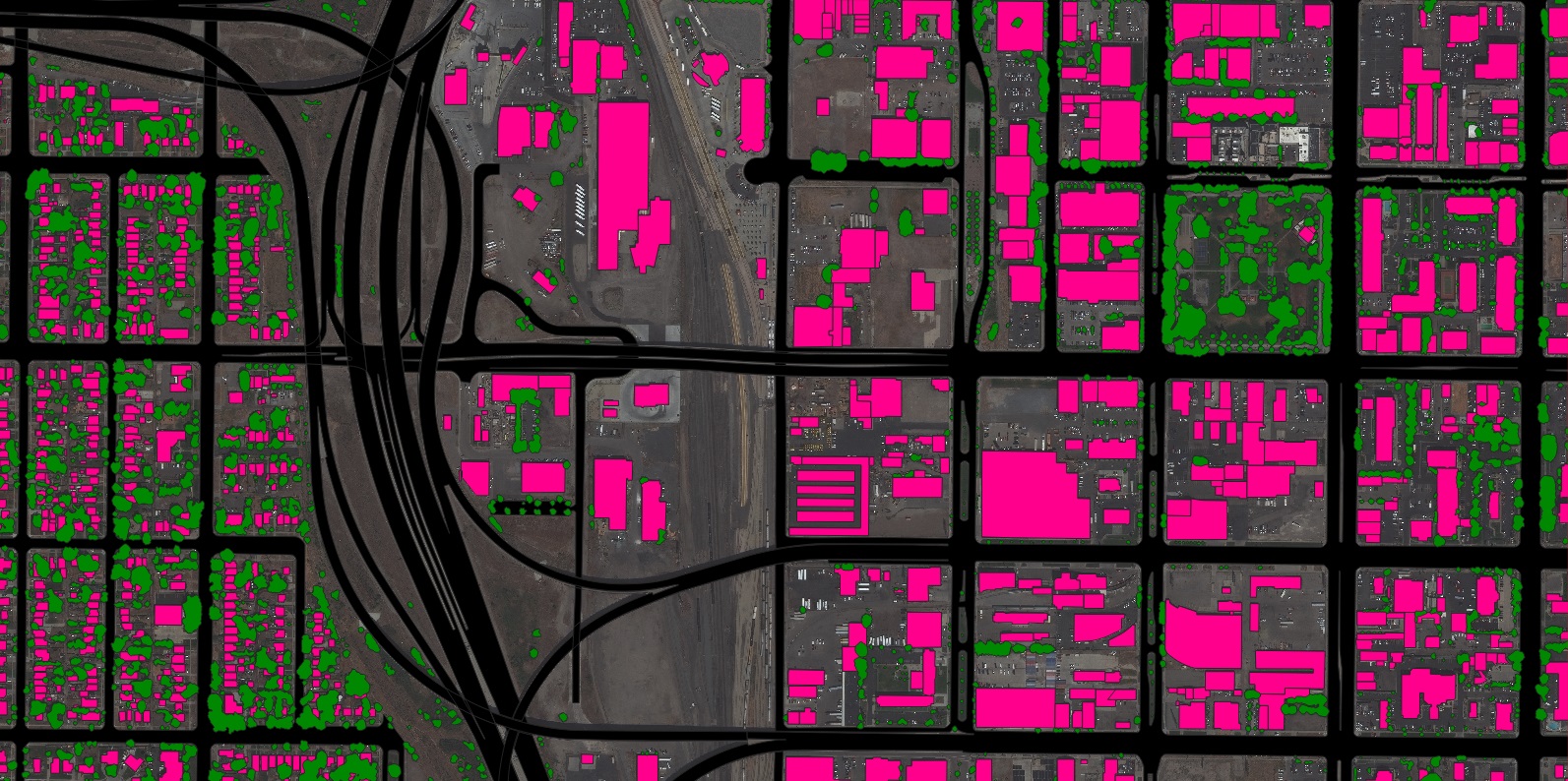
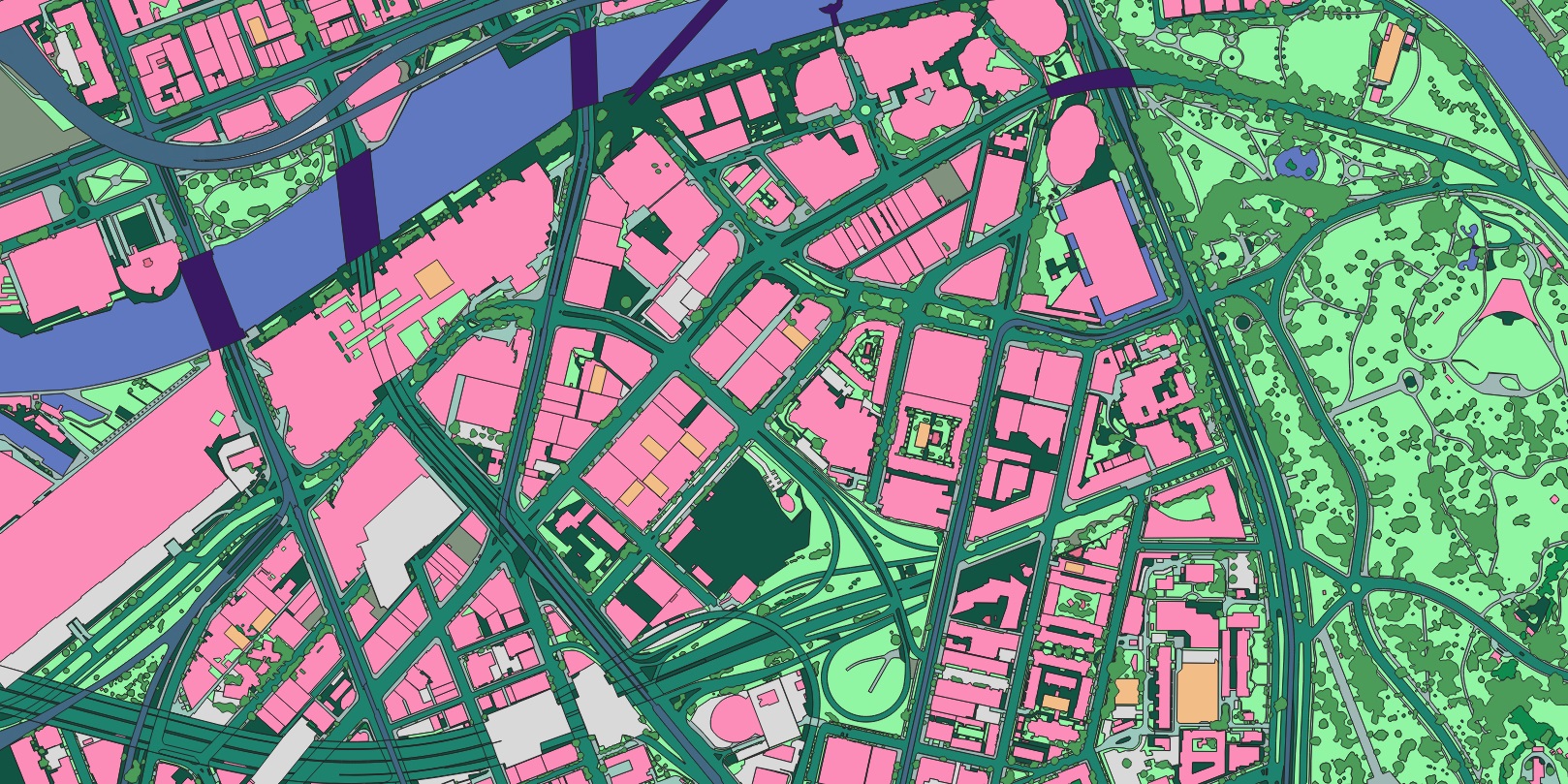
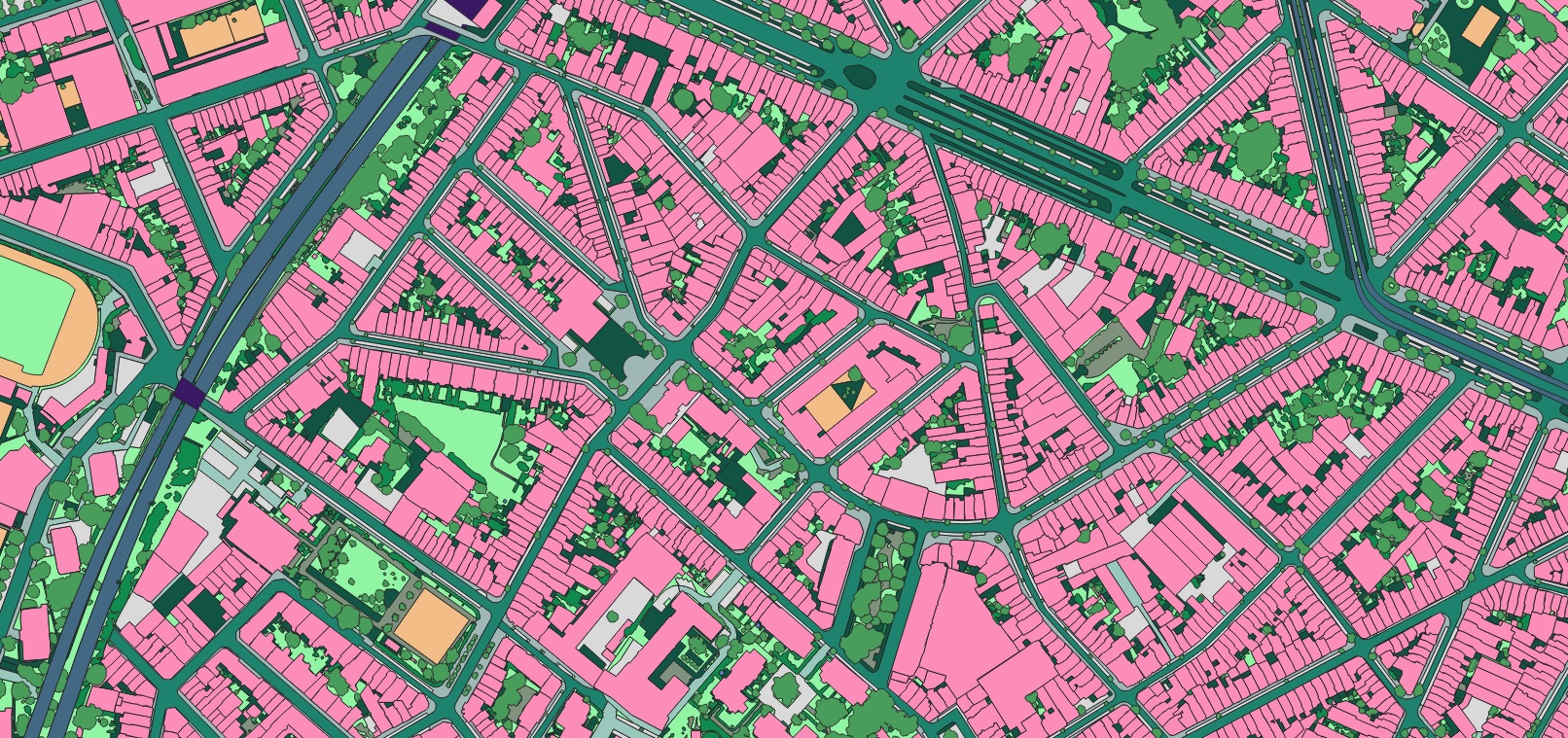
Recent advancements in Artificial Intelligence (AI) have enabled the scaling of feature digitization without compromising the accuracy expected by GIS professionals. AI-based mapping systems ingest geospatial imagery and extract vector features in a fraction of the time required for manual digitization. The resulting vector layers are classified into various land cover types, including both impervious and pervious surfaces, to support applications like stormwater mapping, flood modeling, and fee assessment. The scale and efficiency of AI allow for much more frequent data updates, ensuring that maps and models reflect the current environment. In addition to maintaining data currency, these systems extract and classify features with expert-level accuracy, providing geospatial analysts with a reliable source of truth without the burden of manual digitization.
Case Studies: AI-Powered Impervious Surface Mapping
This AI-driven methodology has been successfully deployed in collaboration with numerous municipalities, government agencies, and engineering firms for various impervious surface mapping applications. The following section highlights several exemplars of using AI-based technology for this purpose.
Leverage AI-Powered Impervious Surface Mapping
To discover how our AI-based systems enhance the accuracy and efficiency of impervious surface mapping for your projects, please contact our team to get started.