Berlin Multi‑Class Land Cover & Transportation Mapping (Case Study)
Location: Berlin, Germany
Project Overview
Nazru’s AI platform was deployed to map Berlin’s urban surface into 9 primary classes plus additional attributes. This project involved automated detection of: Road, Keep‑out area, Road shoulder, Parking area, Access way, Bikeway, Footway, Railroad bed, and Water. In addition, special flags were assigned for Unsure, Difficult, Construction, Elevated, Traffic island, and Invisible conditions.
The Challenge
The client needed a high‑resolution, semantically rich map of Berlin’s transportation corridors and adjacent land covers. Traditional methods could not simultaneously distinguish between road, shoulder, bikeway, footway, access ways, and keep‑out areas. Furthermore, handling ambiguous regions (Unsure/Difficult), construction zones, elevated structures, and invisible occluded areas required advanced AI logic.
The Nazru Solution
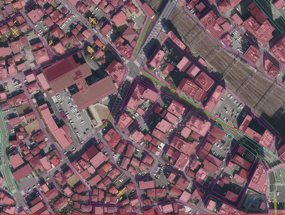
Nazru’s platform integrated high‑resolution aerial and satellite imagery with a rule‑based AI inference engine. Our algorithms automatically classified each region into polygon features according to the following 9 primary classes:
Class | Description |
|---|---|
| Road | Paved vehicular travel lanes |
| Keep‑out area | Restricted or inaccessible zones (e.g., private property, medians, off‑limits areas) |
| Road shoulder | Unpaved or paved edge adjacent to road, typically not for driving |
| Parking area | Designated off‑street or on‑street parking zones |
| Access way | Driveways, service roads, or connector paths |
| Bikeway | Dedicated bicycle lanes or paths |
| Footway | Sidewalks, pedestrian paths, or footpaths |
| Railroad bed | Railway corridor including tracks and ballast |
| Water | Rivers, lakes, canals, or drainage features |
Additional attributes (binary flags) per polygon:
Unsure – low‑confidence prediction
Difficult – challenging lighting or occlusion
Construction – active construction zone with temporary layout
Elevated – road or path on a bridge or viaduct
Traffic island – raised or painted median/island within roadway
Invisible – feature completely occluded (e.g., under trees or shadows)
Key Results & Benefits
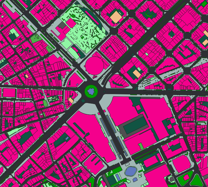
A unified, 9‑class polygon map of Berlin’s transportation network and water bodies
Clear separation of road, shoulder, parking, access ways, bikeway, footway, railroad, keep‑out areas, and water
Flags for ambiguous, difficult, construction, elevated, traffic island, and invisible regions – enabling quality‑aware downstream analysis
Fully automated, scalable workflow suitable for city‑wide annual updates
Key Technologies Used
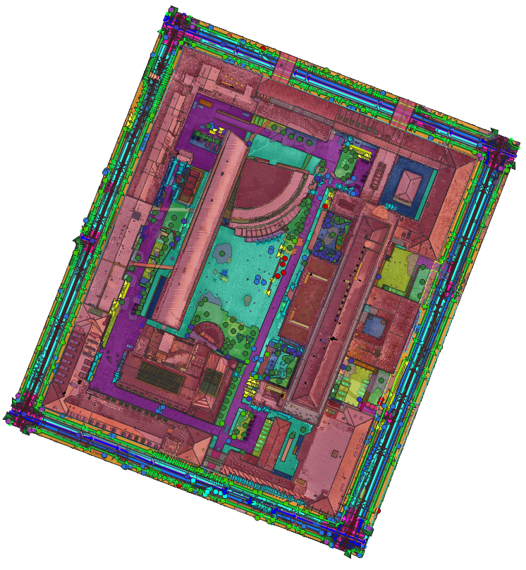
AI‑based semantic segmentation (polygon extraction)
Rule‑based reasoning for shared classes and ambiguous cases
Binary flag extraction for confidence, occlusion, and special conditions
Output Format (Only Polygon)
Deliverables are provided exclusively as vector polygons in the following formats:
Shapefile (.shp)
GeoJSON
KML/KMZ
Polygon attribute table includes:
class_name– one of the 9 primary classesunsure(True/False)difficult(True/False)construction(True/False)elevated(True/False)traffic_island(True/False)invisible(True/False)