Berlin Urban Mobility & Parking Analytics (Case Study)
Location: Berlin, Germany
Project Overview
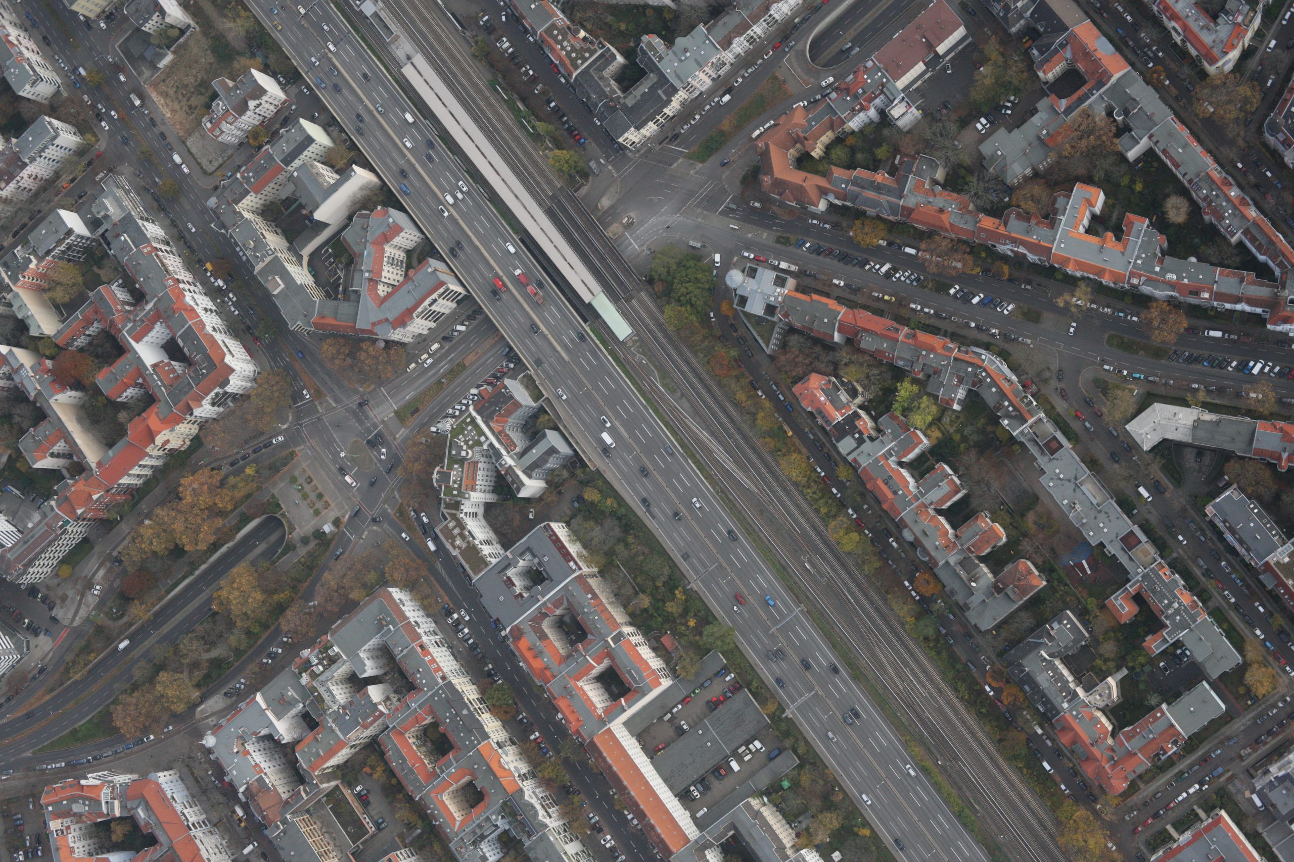
Nazru’s AI platform was deployed to create an intelligent map of Berlin’s urban mobility infrastructure. This project involved extracting roads (as a single class) and analyzing parking occupancy while also identifying access routes to parking lots.
The Challenge
The client was dealing with fragmented and outdated data on road networks, parking status, and connections to parking facilities. Traditional methods could not automatically extract road features, determine parking occupancy, or map access routes leading to parking lots.
The Nazru Solution
Nazru’s platform addressed this challenge by integrating multiple data sources:
High‑resolution aerial and satellite imagery processed by proprietary AI models.
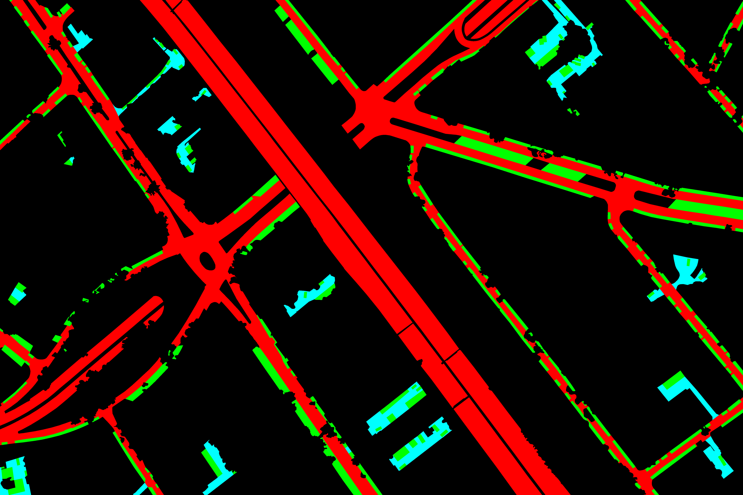
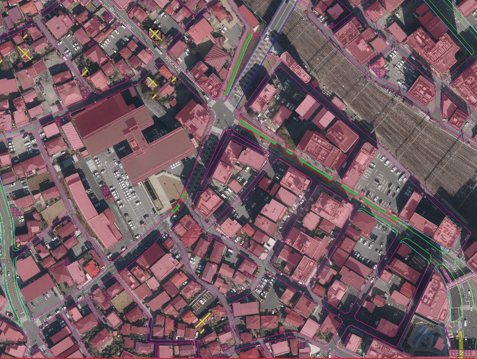
AI‑powered automatic feature extraction: Our algorithms automatically identified and classified:
Roads – as a single class (without further subdivision into primary, secondary, residential, etc.).
Parking space analysis – identifying occupied parking stalls within lots.
Access routes to parking lots – mapping the entry and exit paths as well as internal circulation lanes that guide vehicles from the main road network into parking areas.
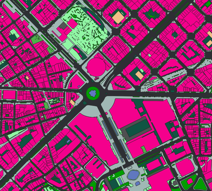
Key Results & Benefits
Production of a unified, up‑to‑date map of Berlin’s road network
Creation of a complete inventory of occupied parking spaces across parking lots
Clear mapping of access routes to parking lots, improving navigation and traffic flow
Delivery of an automated workflow for continuous monitoring and easy updates
Key Technologies Used
AI‑based image segmentation
Automatic linear feature extraction (roads and access routes)