Bruges Road Surface Damage & Texture Classification (Case Study)
Location: Bruges, Belgium
Project Overview
Nazru’s AI platform was deployed in Bruges, Belgium, to automatically detect and classify road surface damages and texture types using satellite and panchromatic (pan) imagery. This project involved identifying cracks, patches, and seams, as well as classifying surface material into three categories: asphalt, pavers (cobblestone), and concrete.
The Challenge
Bruges has a historic city centre with a mix of modern asphalt roads and traditional cobblestone pavements. The client needed a comprehensive inventory of surface distresses (cracks, patches, seams) differentiated by pavement type. Manual inspection was slow, subjective, and disruptive to traffic. No automated solution existed to simultaneously map damages and recognise surface material from satellite and panchromatic imagery.
The Nazru Solution
Nazru’s platform integrated high‑resolution satellite imagery and panchromatic (pan) imagery with deep learning models. Our algorithms automatically:
Detected and classified three damage types:
Cracks – fatigue, transverse, edge, or random cracking
Patches – repaired or overlaid areas
Seams – longitudinal construction joints or working cracks
Classified road surface texture into:
Asphalt – smooth, blacktop surface
Pavers (Cobblestone) – traditional stone blocks, often in historic zones
Concrete – rigid, jointed cementitious pavement
Fused panchromatic (high‑resolution structural detail) with multispectral satellite data for improved accuracy
Geolocated each damage instance and surface segment
Key Results & Benefits
City‑wide digital map of road damages and surface types for Bruges
Clear distinction between asphalt, cobblestone, and concrete areas
Damage prioritisation tailored to each surface type
Automated workflow reducing manual survey time and improving safety
Key Technologies Used
AI‑based semantic segmentation on fused satellite + panchromatic imagery
Material recognition using spectral and textural features
Linear and polygonal feature extraction
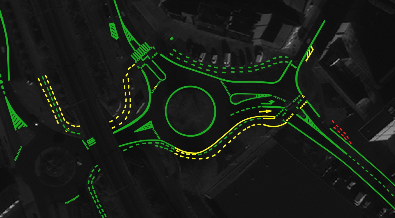
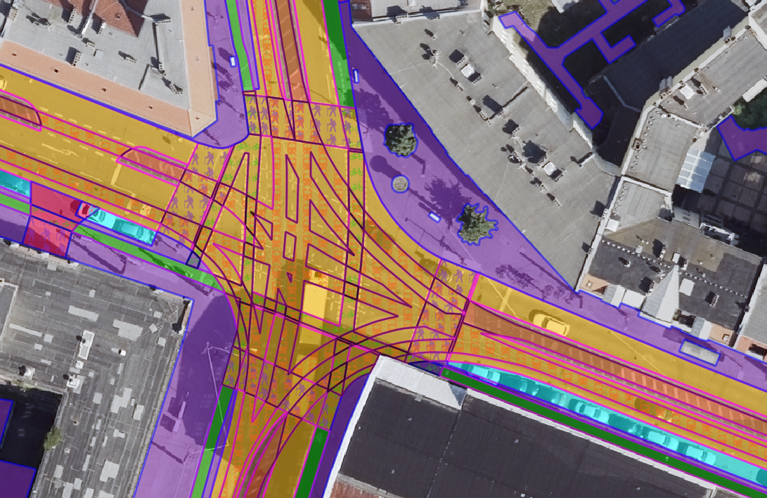
Sample image for Bruges, Belgium – AI‑based detection of road damage and surface texture using satellite and panchromatic (pan) imagery