European Environment Agency Partners with Nazru AI to Enhance Continental Wildfire Resilience
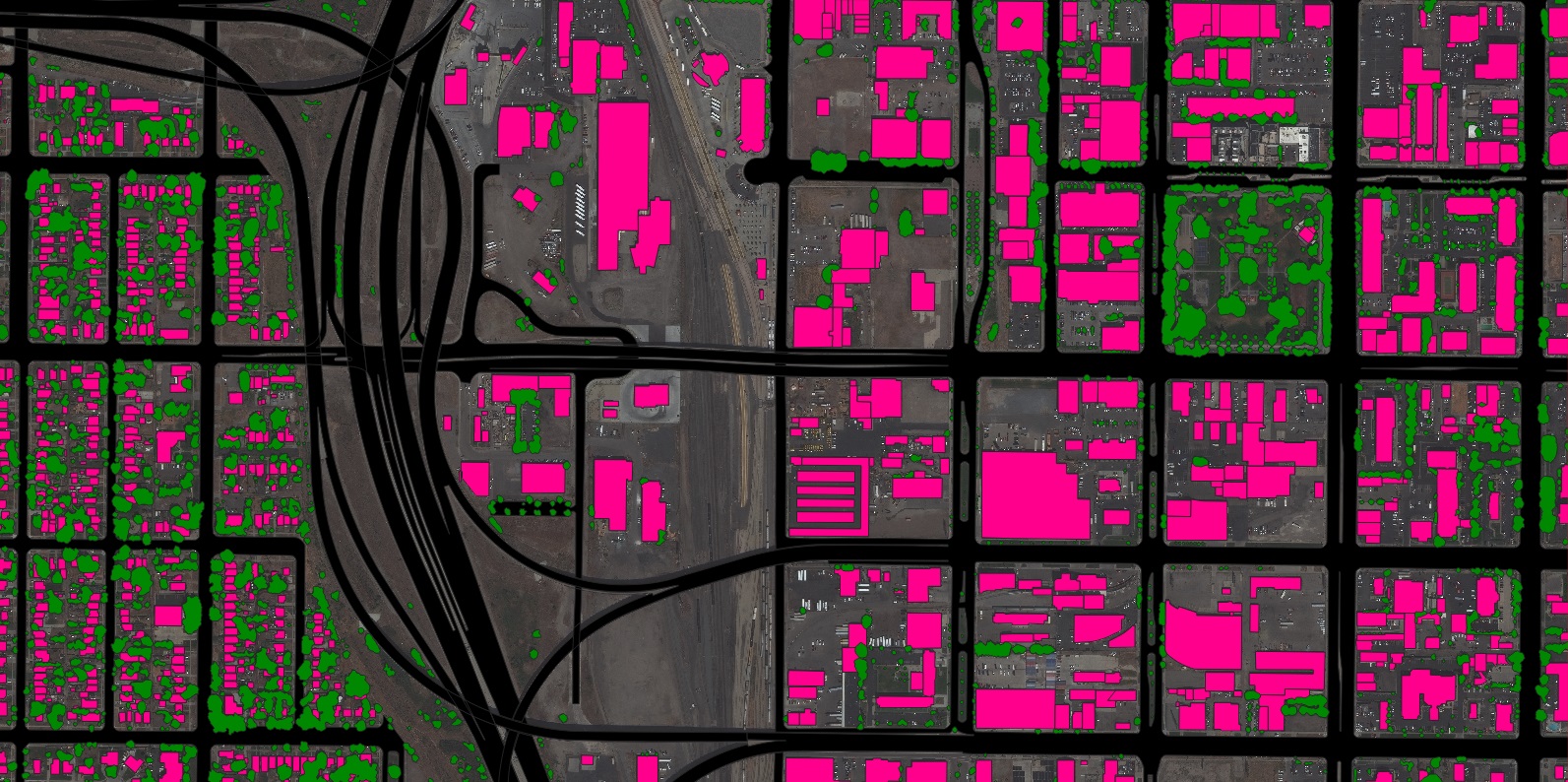
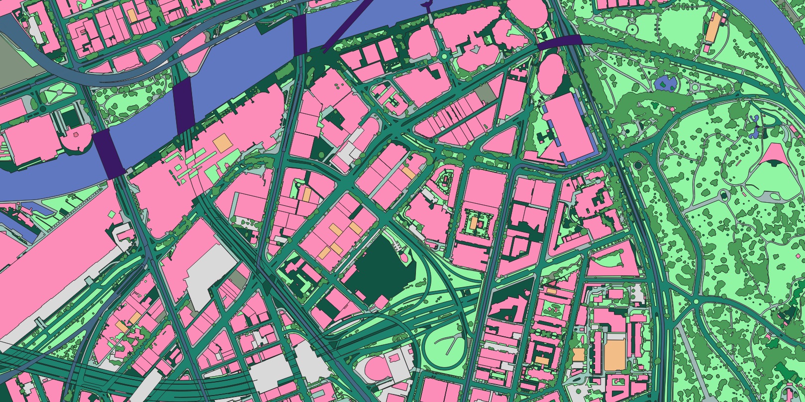
The European Environment Agency (EEA) today announced a strategic partnership with Nazru AI to deliver comprehensive, high-precision mapping data across European Union member states. This collaboration will support the EU’s expanding wildfire mitigation capabilities through detailed building footprint, tree canopy, water body, and land cover mapping.
The EEA relies on accurate building footprint data for multiple critical applications including fire protection, land use planning, hazard zoning, and cross-border emergency response coordination. With rapid urbanization and climate change altering Europe’s landscape, regularly updated geospatial data is essential for effective risk assessment and resource allocation. Nazru’s AI-derived datasets will play a crucial role in analyzing community vulnerability to wildfires and ensuring new developments are properly accounted for in continental hazard models.
Key applications of this data include:
Supporting fuel reduction initiatives in the wildland-urban interface
Creating public awareness visualizations to encourage community preparedness
Enabling rapid damage assessment and recovery prioritization post-incident
Informing the EU’s Forest Strategy and Civil Protection Mechanism operations
“The increasing frequency and intensity of wildfires across Europe demands unprecedented levels of accurate, timely information about our built and natural environments,” stated Klaus Schmidt, Director of Emergency Response Coordination at the EEA. “Through our partnership with Nazru, we’re building a comprehensive, reliable database that will fundamentally enhance our ability to protect communities and preserve Europe’s natural heritage.”
“Nazru is honored to support the European Environment Agency’s vital mission,” said Dr. Elena Petrova, Chief Executive Officer of Nazru AI. “The EEA’s work in coordinating cross-border emergency response and environmental protection is more critical than ever, and we’re committed to providing the foundational geospatial intelligence needed to make informed decisions across the continent.”
This initiative supports the implementation of the EU Disaster Resilience Goals and will be integrated into the European Forest Fire Information System (EFFIS), providing standardized geospatial data across all member states for the first time.
About the European Environment Agency
The European Environment Agency (EEA) is an agency of the European Union that provides independent information on the environment, supporting sustainable development and environmental protection across Europe. The EEA plays a critical role in implementing EU environmental policies and coordinating cross-border emergency response efforts. Learn more at https://www.eea.europa.eu/
About Nazru AI
Nazru AI is building the foundational geospatial intelligence for a sustainable future. We harness artificial intelligence to convert high-resolution imagery into precise, scalable vector map data that creates a digital representation of our physical world. Nazru’s data powers decision-making for government agencies, commercial organizations, and non-profits across more than 50 countries worldwide, supporting applications from climate resilience to urban planning and disaster response.