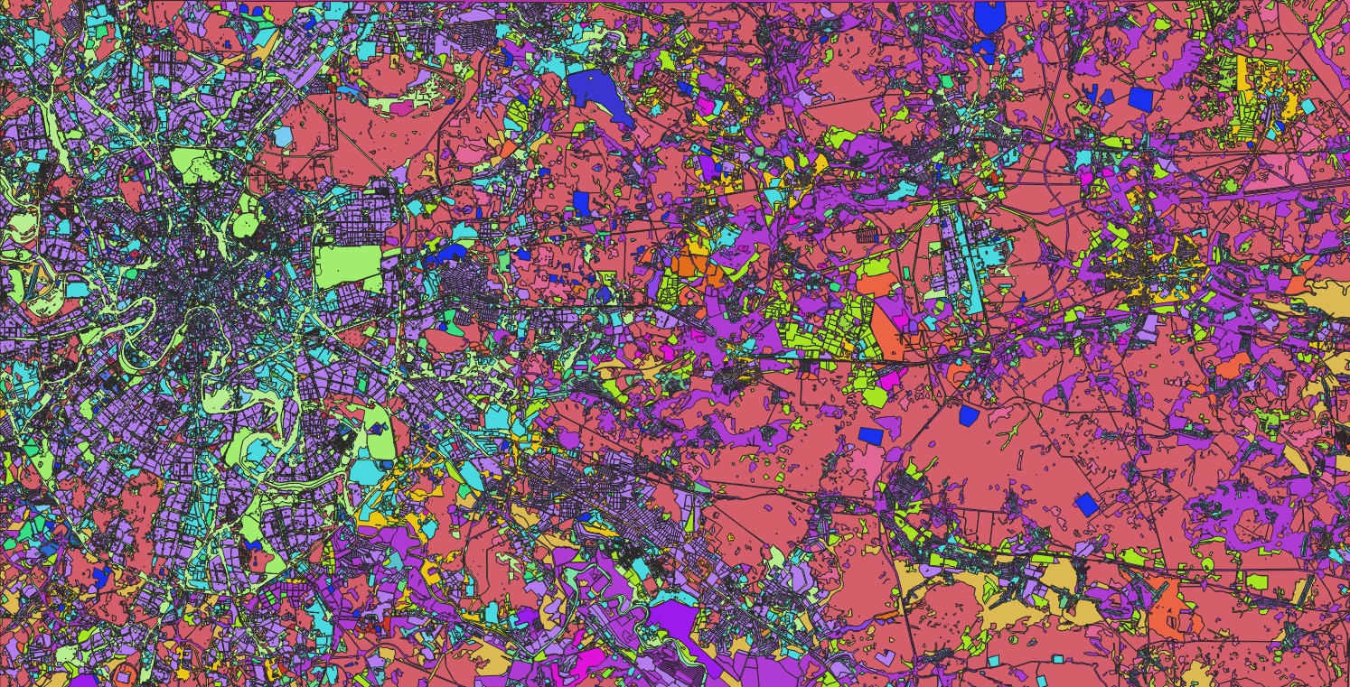
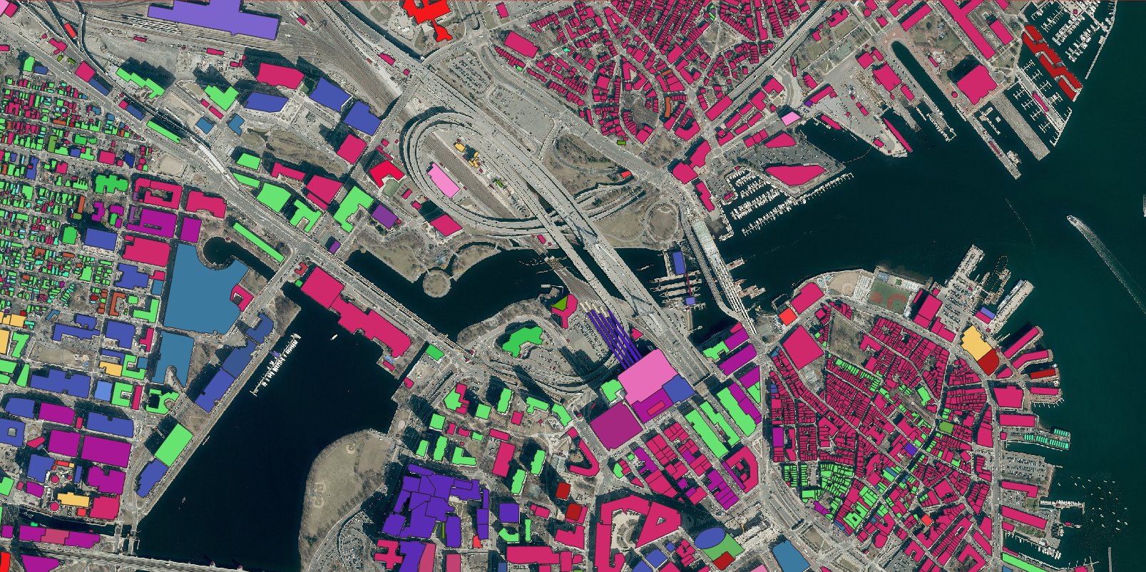
Nazru AI today announced a groundbreaking achievement in geospatial mapping: the completion of a comprehensive, high-precision vector map of every building across the continent of Australia and Oceania. This monumental dataset covers over 8 million square kilometers, representing the most detailed and complete building inventory ever created for the region.
The project successfully mapped structures across all 14 countries in Oceania, from dense urban centers in Australia and New Zealand to remote island communities throughout the Pacific. The vector dataset includes detailed building footprints with precise geographic coordinates, roof types, and structural attributes, providing unprecedented visibility into the built environment across this vast and diverse region.
Key Applications and Benefits:
Disaster Management: Enable precise emergency response planning and damage assessment for natural disasters including bushfires, cyclones, and floods
Urban Planning: Support sustainable development and infrastructure projects with complete building stock data
Population Estimation: Improve demographic modeling and resource allocation in both urban and remote areas
Climate Resilience: Facilitate coastal zone management and sea-level rise impact studies
Telecommunications: Optimize network planning and connectivity solutions for underserved communities
The mapping project utilized Nazru AI’s advanced deep learning algorithms, processing high-resolution satellite imagery to automatically detect and vectorize building structures with remarkable accuracy. The technology successfully identified buildings across diverse environments—from high-density cities like Sydney and Auckland to traditional structures in Pacific island nations.
Government agencies, research institutions, and private sector organizations can leverage this data for a wide range of applications, from environmental monitoring to commercial market analysis. The dataset particularly benefits regional initiatives addressing climate change adaptation and sustainable development goals.
This continent-scale mapping achievement demonstrates Nazru AI’s commitment to creating comprehensive geospatial solutions that support informed decision-making and sustainable development across global communities.