Mapping Our Planet: A New Era of Land Cover Intelligence


A detailed visualization showing the distribution of multiple land cover classes across a diverse landscape in Perth, Australia


A detailed visualization showing the distribution of multiple land cover classes across a diverse landscape in Beira, Africa
The addition of pasture, residential, and wild_grass categories significantly enhances our ability to understand human-environment interactions. Pasture lands represent the intersection of agriculture and natural systems, supporting livestock while maintaining green cover. Wild_grass areas capture natural grasslands that play crucial ecological roles in carbon sequestration and habitat provision, distinct from managed agricultural lands. The specific identification of residential areas within the broader urban_built category allows for more precise urban planning and population density analysis.


A detailed visualization showing the distribution of multiple land cover classes across a diverse landscape in Concordia, USA
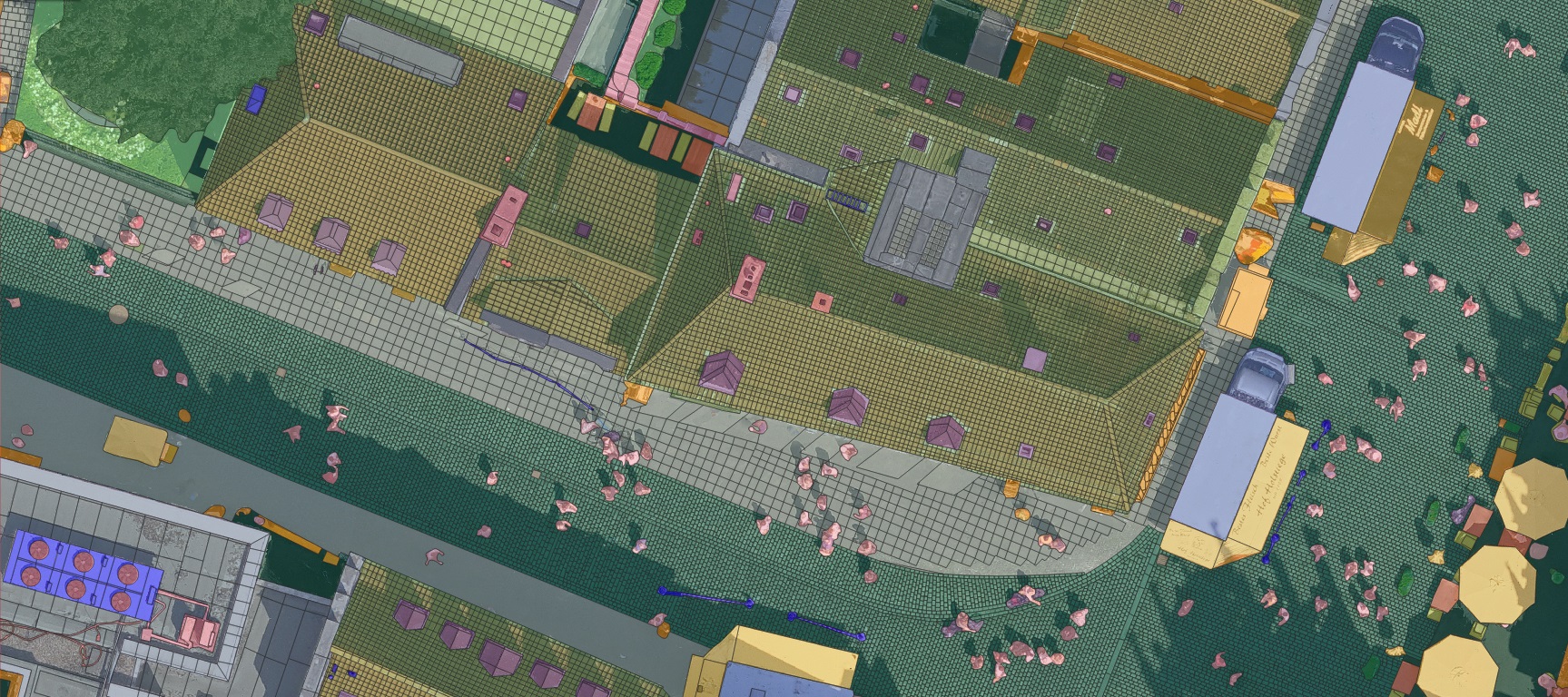
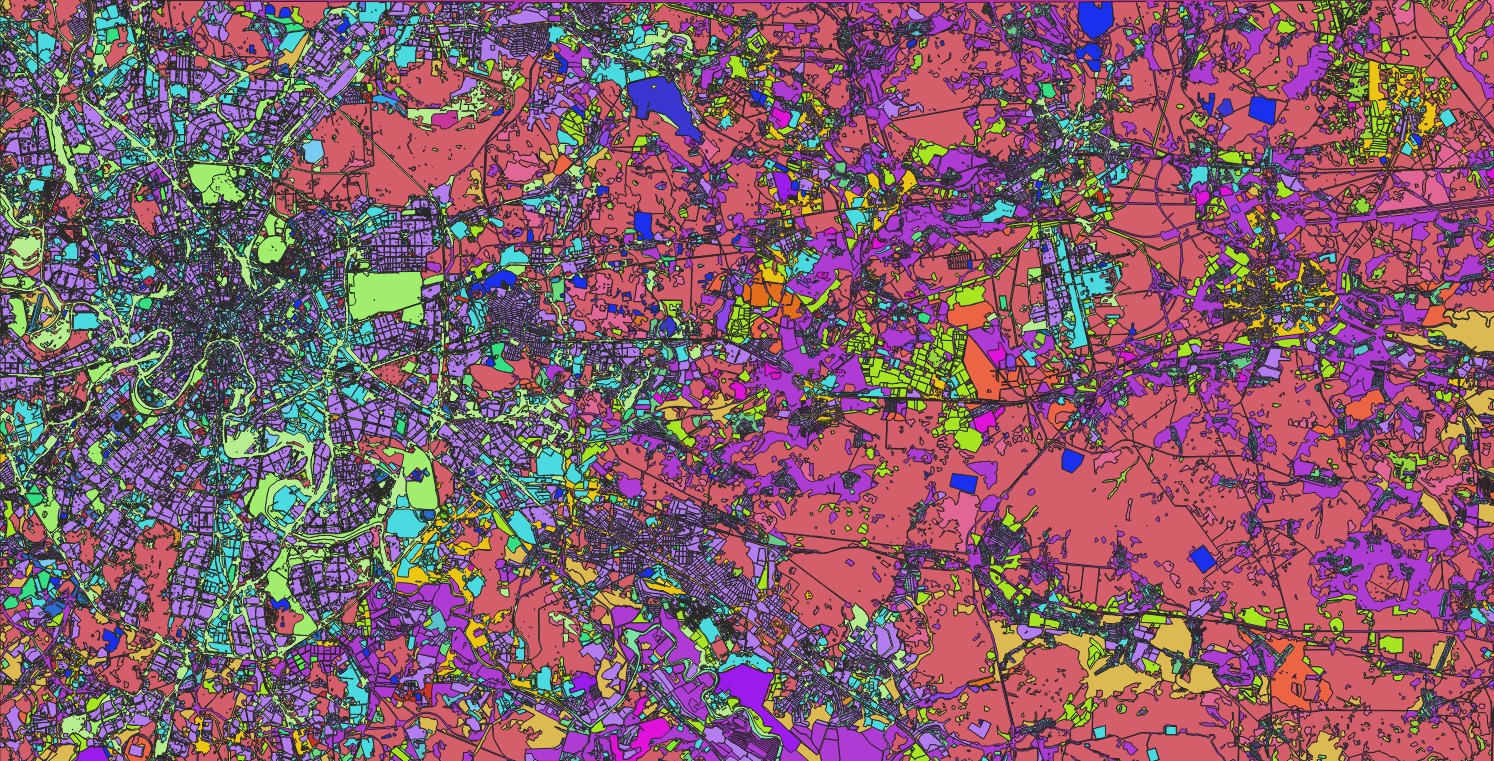
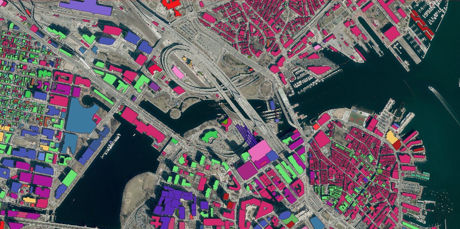
Consider the complex gradients that our system can now map with enhanced precision. We can track how residential neighborhoods transition through open_space_developed areas to pasture lands, then to cultivated_crops, and finally to natural wild_grass or shrubland environments. This detailed understanding of landscape continuity helps planners and conservationists make better decisions about urban expansion, agricultural development, and natural habitat preservation.
The classification of wetland areas and water bodies alongside these new categories provides even more powerful insights into watershed management. Understanding how residential areas interact with water sources, or how pasture lands affect wetland ecosystems, enables more sustainable land use planning and environmental protection strategies.
What sets our approach apart is the nuanced understanding of how these land cover types interact and evolve. The system recognizes that industrial zones have different environmental impacts than residential areas, that transportation corridors create unique ecological edges, and that the preservation of natural wild_grass areas alongside managed pasture lands contributes to regional biodiversity.
The applications of this enhanced classification system span multiple sectors. Urban planners can now better understand the interface between residential development and natural areas. Agricultural managers can monitor the balance between cultivated_crops, pasture, and natural vegetation. Conservation organizations can track the preservation of wild_grass ecosystems and their relationship to surrounding land uses.
At Nazru, we are proud to collaborate with government agencies, research institutions, and private organizations to implement this technology in practical applications that transform how we understand and manage our planet’s surface. From monitoring agricultural land use changes to planning sustainable urban expansion, from protecting natural grasslands to optimizing pasture management, Nazru‘s enhanced land cover classification system provides the detailed understanding necessary for informed decision-making and strategic planning.
For environmental scientists, urban planners, agricultural managers, and policy makers seeking to leverage the power of spatial intelligence, Nazru offers innovative solutions for comprehending and analyzing complex land use and land cover patterns. By converting satellite imagery into actionable intelligence about Earth’s surface, Nazru is committed to helping create a sustainable future where human development and environmental conservation coexist in harmonious balance.