Nazru Delivers Advanced HD Mapping for Urban Planning in Orlando, Florida
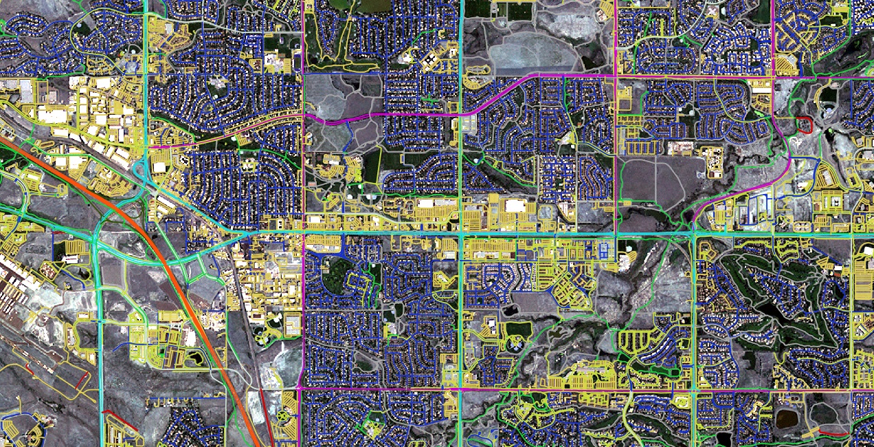
ORLANDO, FL – Nazru today announced the successful completion of a project to provide comprehensive high-definition (HD) mapping data for the Orlando, Florida metropolitan region. Executed in partnership with local transportation and urban planning agencies, this initiative has created a detailed map of land cover and transportation infrastructure to support regional development.
The resulting dataset provides metropolitan planning organizations (MPOs) with accurate and scalable geospatial intelligence. This information is critical for informed decision-making across key areas such as transportation planning, housing policy, economic development, environmental conservation, and open space management.
Navigating the data standardization and maintenance challenges common to major metropolitan areas, Nazru’s solution ensures all regional stakeholders have access to consistent, up-to-date information. This partnership has empowered local agencies to enhance infrastructure projects and community programs tailored to the unique needs of the Orlando community. Nazru is committed to supporting its partners in building local capacity and providing scalable resources for sustainable growth.
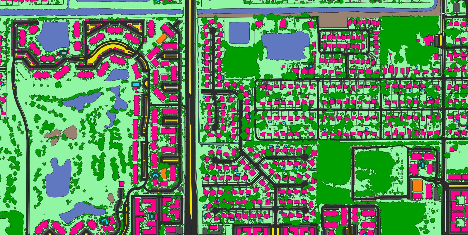
A sample of detailed land cover data extracted by Nazru in Orlando, Florida, USA, a valuable input to infrastructure development and planning
Building
Pavement
Driveway
Grass
Forest
Road
Sidewalk
Parking
Sport-ground
Water
Swimming-pool
Median
Crosswalk
Nazru’s Advanced Mapping Partnership Drives Innovation in Orlando
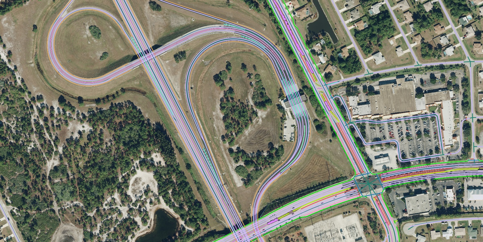
Nazru’s partnership with key Orlando transportation and urban planning agencies is delivering an unprecedented level of detail and accuracy for the metropolitan region.
By leveraging its advanced, AI-based mapping technology, Nazru ingests high-resolution geospatial imagery and outputs highly precise, large-scale maps of transportation and land cover features. The system extracts numerous distinct features—including land cover types such as roads, sidewalks, and crosswalks, alongside advanced transportation elements like turning lanes, medians, and stoplines—to create a complete picture of the region’s land use and pedestrian mobility network. Digitizing these features manually would require thousands of hours; however, Nazru’s AI extracts them with human-like precision from up-to-date imagery in a fraction of the time.
This detailed data is being utilized by local and regional agencies to support a wide range of critical applications, including:
State and regional long-range transportation plans
Multi-modal traffic analysis
Active transportation planning
Vision Zero safety initiatives
Americans with Disabilities Act (ADA) compliance
Stormwater and flood management
Performance-based capital program monitoring
Intersection and corridor analysis
Urban tree canopy management
The resulting dataset provides metropolitan planning organizations (MPOs) with accurate and scalable geospatial intelligence. This information is critical for informed decision-making across key areas such as transportation planning, housing policy, economic development, environmental conservation, and open space management.
Navigating the data standardization and maintenance challenges common to major metropolitan areas, Nazru’s solution ensures all regional stakeholders have access to consistent, up-to-date information. This partnership has empowered local agencies to enhance infrastructure projects and community programs tailored to the unique needs of the Orlando community. Nazru is committed to supporting its partners in building local capacity and providing scalable resources for sustainable growth.
About Nazru
Nazru is dedicated to building intelligent digital representations of our built and natural environments. By harnessing the power of artificial intelligence, Nazru converts high-resolution imagery into highly accurate, high-definition (HD) vector maps. These maps serve as a dynamic digital representation of reality, which are then integrated into critical decision-making platforms to provide unique, scalable insights. The HD vector maps developed by Nazru support a wide array of essential applications for commercial and government partners, with a proven track record of successful implementations across numerous communities.