Skip to content

Roadside Infrastructure Detection (Case Study)

Location: Munich, Germany

Project Overview

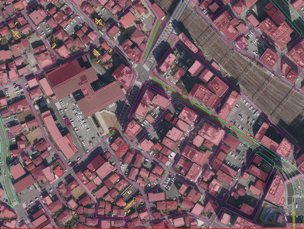
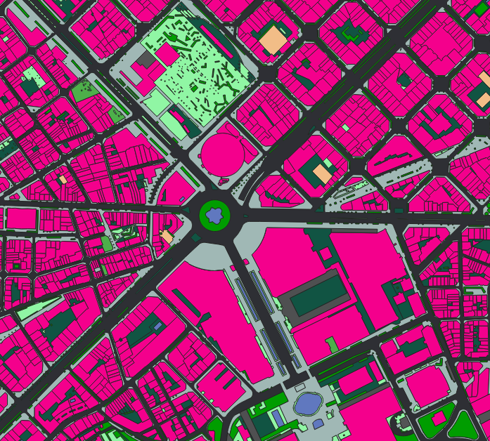
Nazru’s AI platform was deployed to automatically detect and classify roadside infrastructure elements into five distinct categories: curbstone, fence, guardrail, planar border between paved and unpaved area, and pole. This project provided a comprehensive digital inventory of linear and point features essential for road asset management, safety analysis, and autonomous navigation.

The Challenge

The client lacked an up‑to‑date, spatially accurate map of roadside infrastructure. Manual field surveys were costly, time‑consuming, and often incomplete. There was no automated method to distinguish between different feature types (e.g., curbstone vs. guardrail) or to capture the precise boundary between paved and unpaved surfaces.

The Nazru Solution

Nazru’s platform integrated high‑resolution aerial or mobile mapping imagery with deep learning models. Our algorithms automatically detected and classified the following five feature classes:

  • Curbstone – raised edges separating roadway from sidewalk or gutter

  • Fence – barriers alongside roads (e.g., metal, wood, or mesh fences)

  • Guardrail – impact‑absorbing barriers typically installed on roadside or median

  • Planar border between paved and unpaved area – transitional boundary where asphalt/concrete meets gravel, soil, or vegetation

  • Pole – vertical structures such as utility poles, streetlight poles, traffic sign poles, or camera masts

Each detected feature was geolocated and attributed with its class type.

Key Results & Benefits

  • Complete digital inventory of roadside assets across the road network

  • Clear classification of five distinct infrastructure types

  • Accurate mapping of paved/unpaved boundaries for maintenance and drainage planning

  • Automated workflow reducing manual inspection costs and improving data consistency

Key Technologies Used

  • AI‑based object detection and segmentation (point, line, and polygon)

  • Edge detection for curbstone and planar borders

  • Linear feature extraction for fences and guardrails

  • Point feature detection for poles

Output Formats: Raster & Vector

All deliverables are provided in both raster and vector formats to support GIS, CAD, web mapping, and AI training.

Raster outputs:

  • Original and orthorectified high‑resolution imagery

  • Binary masks for each feature class (curbstone, fence, guardrail, border, pole)

  • Class‑coloured segmentation maps

Vector outputs:(Shapefile, GeoJSON, KML)

  • Curbstone – Line geometry 

  • Fence – Line or polygon geometry

  • Guardrail – Line geometry

  • Planar border – Line geometry with attribute type: paved_unpaved

  • Pole – Point geometry with pole subtype (if applicable)

Munich, Germany – AI‑detected roadside assets: curbstone, fence, guardrail, paved/unpaved border, and pole.