Roeselare Road Line Quality Classification (Case Study)
Location: Roeselare, Germany
Project Overview
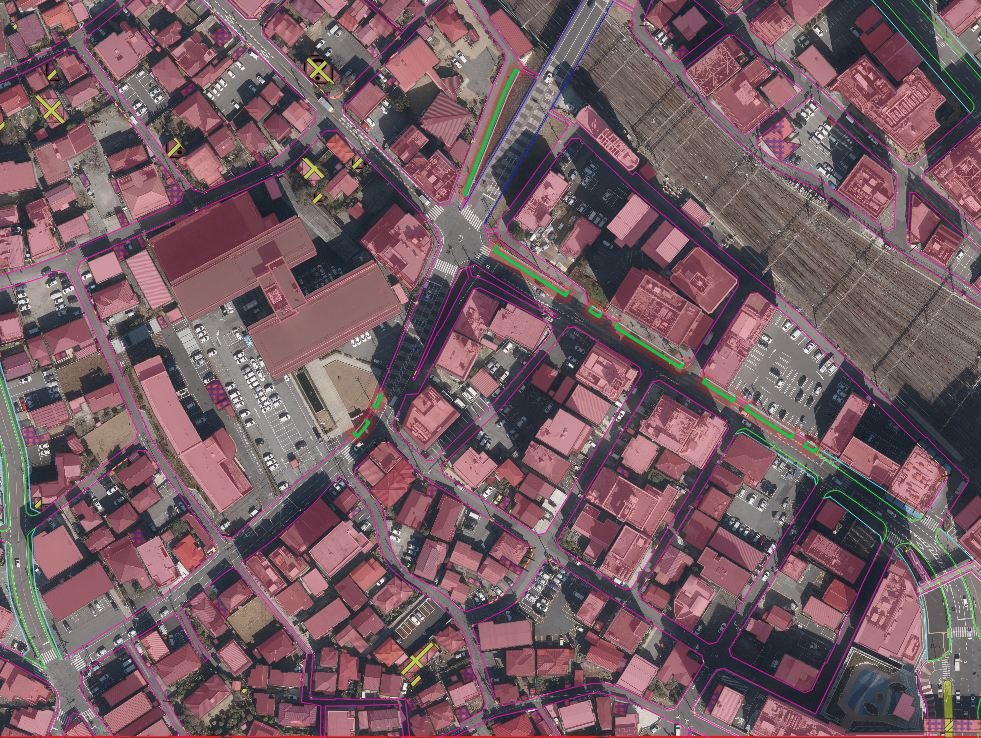
Nazru’s AI platform was deployed in Roeselare, Belgium, to automatically assess the quality of road markings (lines) using satellite and panchromatic (pan) imagery. This project involved classifying each road line segment into three quality levels: Good, Medium, and Bad. All outputs are delivered as polygon features only.
The Challenge
The client needed a city‑wide, objective, and repeatable assessment of road line visibility and integrity. Traditional manual surveys were slow, inconsistent, and disruptive to traffic. There was no automated method to distinguish between high‑quality, partially faded, and severely deteriorated lines from remote sensing data.
The Nazru Solution
Nazru’s platform integrated high‑resolution satellite imagery and panchromatic (pan) imagery with deep learning models. Our algorithms automatically:
Detected road line segments (both continuous and dashed)
Assessed line quality based on contrast, continuity, and visibility against the road surface
Classified each line segment into three categories:
Good – clearly visible, high contrast, intact
Medium – partially faded or worn but still discernible
Bad – heavily faded, broken, or barely visible
Fused panchromatic (high‑resolution structural detail) with multispectral satellite data for improved accuracy
Key Results & Benefits
City‑wide digital map of road line quality for Roeselare
Objective, automated, and scalable quality grading (Good/Medium/Bad)
Prioritised maintenance planning based on bad/medium line segments
Reduced manual inspection cost and improved safety
Key Technologies Used
AI‑based line detection and segmentation
Quality grading using contrast, edge strength, and pattern consistency
Fusion of panchromatic and multispectral satellite imagery
Output Format (Only Polygon)
Deliverables are provided exclusively as vector polygons in the following formats:
Shapefile (.shp)
GeoJSON
KML/KMZ
Polygon attribute table includes:
marking_type – one of: dashed_line, solid_line, arrow, other
Sample image for Roeselare, Belgium – AI‑based road marking type and quality classification with polygon output only (satellite + panchromatic imagery)