Skip to content

The Application of Predictive Analytics and Geographic Information Systems in Nazru's Transportation Planning

Transportation agencies at all levels of government are focused on creating safer networks, promoting active and accessible transportation, and reducing their carbon footprint. Achieving these objectives requires a comprehensive understanding of the current transportation system and its assets. This foundational knowledge is critical for identifying necessary improvements and enabling informed decision-making. For instance, selecting appropriate safety measures, ensuring access to community resources for non-drivers, and encouraging zero-emission travel all depend on a detailed inventory of existing infrastructure. Nazru provides this essential geospatial data to cities and transportation agencies, delivering a precise and up-to-date view of their infrastructure, which is vital for effective planning and strategic investment.

Overcoming Challenges in Geospatial Data: From Fragmented Sources to AI-Powered Solutions

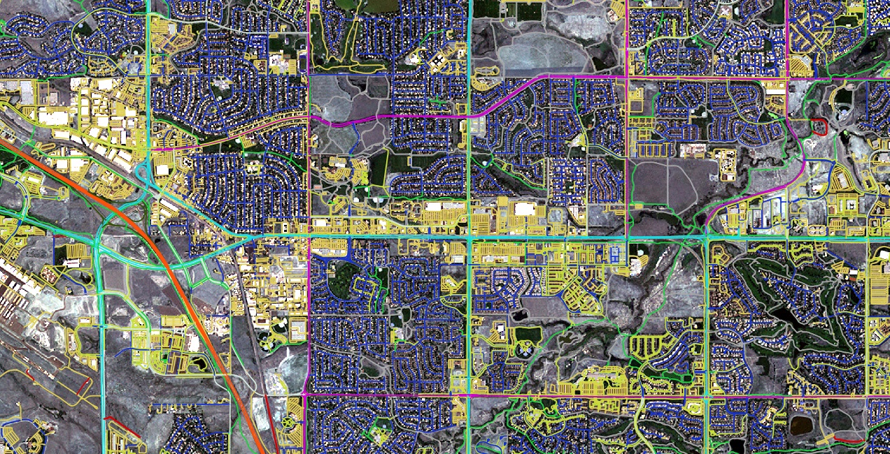
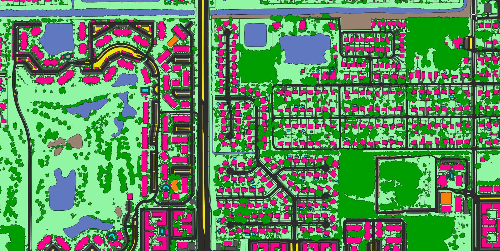
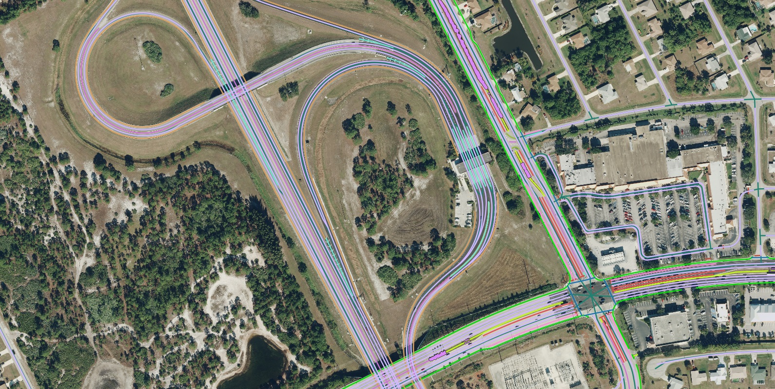
A persistent challenge for transportation agencies has been accessing high-quality, up-to-date foundational map data, often forcing them to choose between affordability, accuracy, speed, and scalability. For example, acquiring accurate data has traditionally required cities to manually digitize features from imagery—a process that is both time-consuming and costly, rendering frequent updates impractical. Conversely, many automated software solutions fail to deliver complete results, often capturing only 60-70% of the required data and necessitating significant manual correction to address inaccuracies.

Nazru’s AI-powered systems overcome these hurdles by leveraging high-resolution aerial imagery from an extensive network of partners to automatically generate high-precision vector map data. This approach eliminates the need for manual digitization while maintaining the accuracy standards of a GIS professional. The resulting comprehensive, accurate, and current data empowers Departments of Transportation (DOTs), Metropolitan Planning Organizations (MPOs), Councils of Governments (COGs), and cities worldwide to make informed investment decisions, enhance infrastructure projects, and create positive community impacts. Furthermore, Nazru’s AI normalizes data, enabling true updates to existing maps rather than requiring complete recreations. This capability is crucial for agencies to effectively monitor the impact of their decisions and adjust strategies in a timely manner.

A sample of advanced transportation features extracted by Nazru AI in Eppinghofen, Germany .
Slip-turn-lane
Palnting-strip
Through-lane
Right-turn-lane
Left-turn-lane
Marked-bike-lane
Shoulder
Sidewalk
Crosswalk
Painted-median
Raised-median

Understanding Safety Risk with Shoulder Presence and Width

Nazru’s data significantly advances transportation planning by providing detailed insights into critical infrastructure features, such as road shoulders, which are essential for conducting comprehensive safety analyses. It is well-established that while urban areas experience a higher frequency of crashes, rural roads have a significantly higher crash fatality rate. In these contexts, infrastructure features like shoulders act as a vital buffer to reduce collision risks and mitigate severity. Accurate mapping of shoulder presence and width provides planners and engineers with a realistic understanding of safety risks, enabling them to identify and prioritize areas for improvement.

Although studies confirm that shoulder infrastructure can reduce crash severity by providing a recovery area, maintaining accurate data for rural roads is particularly challenging. Shoulders are often mapped infrequently or their dimensions are estimated based on design guidelines rather than real-world measurements, leading to potential inaccuracies. For instance, varying shoulder widths—which can range from 2 to 8 feet—may be misrepresented, resulting in an overestimation of the safety protection they offer. This can inadvertently lead to increased crash risks if interventions are not properly targeted.

In contrast, Nazru’s data, derived from high-resolution imagery, enables the rapid generation of precise and up-to-date maps of shoulder locations and widths across an entire road network. This detailed and reliable information empowers agencies to conduct accurate risk assessments, develop targeted and effective safety strategies, and make tangible progress toward their goals of reducing fatalities and ensuring safer conditions for all road users, including pedestrians and cyclists.

 A sample of transportation features extracted by Nazru AI in Munster, Germany.
Road-centerline
Sidewalk
Shoulder

Optimizing Safety with Strategic Median Placement

Medians represent a widely adopted and cost-effective safety measure within transportation networks. While decisions regarding median placement are traditionally informed by crash data and daily traffic volume, a thorough understanding of the existing infrastructure—including sidewalks, crosswalks, intersection controls, and lane types—is essential. Contemporary safety guidelines recommend a holistic evaluation of these factors alongside the current presence and type of medians. By integrating comprehensive, accurate, and up-to-date data on physical infrastructure with information on traffic volumes, crash history, and land use, planners can systematically identify optimal locations for median installation and other safety countermeasures. This data-driven approach transforms safety investment decisions from reactive to proactive and evidence-based. Furthermore, these integrated data layers are instrumental in enhancing safety for vulnerable road users and supporting the adoption of zero-emission transportation alternatives. Without a clear and detailed understanding of the existing roadway system, prioritizing such changes within budgetary constraints is challenging. The detailed infrastructure data that Nazru provides empowers decision-makers to effectively prioritize strategies, ensuring that safety improvements are both impactful and feasible.

Enhancing Pedestrian Safety with Sidewalk and Bike Lane Data

The image below, created for Denver, Colorado, USA, illustrates sidewalks categorized by width. This visualization underscores the importance of detailed sidewalk data for comprehensive safety analysis. It is important to note that overlaying data on sidewalk gaps with census data concerning vehicle access can powerfully support equitable investment decisions. For instance, sidewalks narrower than 3 feet fail to meet the standards of the Americans with Disabilities Act (ADA) or the Public Right-of-Way Accessibility Guidelines (PROWAG), rendering them uncomfortable and potentially hazardous for pedestrians. Nazru’s data is critical for identifying these non-compliant areas, enabling agencies to prioritize improvements that directly enhance accessibility, comfort, and safety, thereby advancing broader community objectives.

 A sample of Nazru’s sidewalks, categorized by width, in Denver, Colorado, USA.
Sidewalks-less-than-3ft
Sidewalks-greater-than-3ft-less than-4ft
Sidewalks-between-4ft-to-6ft
Sidwalks-greater-than-6ft

In a similar manner, Nazru’s data layers are indispensable for identifying and enhancing bicycle lane infrastructure. They provide detailed information on the presence of both protected and unprotected bike lanes, as well as their precise widths. Analyzing this data in conjunction with details about vehicular lane configurations, average turning radii, and the frequency of on-street parking offers a comprehensive understanding of the roadway environment. This integrated view is crucial for designing bike lanes that are safer and more comfortable for cyclists.

By incorporating this detailed bicycle lane data with other infrastructure details, traffic conditions, and land use information, planners can make strategically informed investment decisions. This approach serves to enhance connectivity for cyclists and improve the overall safety and efficiency of the transportation network.

Driving a Safe and Sustainable Future with Accurate Data

Our world is in a constant state of evolution, and maintaining an accurate understanding of these changes is paramount. As cities grow and transform, reliance on outdated information can severely hinder effective policy-making and the monitoring of critical safety, equity, and sustainability initiatives. A comprehensive and current understanding of physical infrastructure is the foundation for informed decisions that enhance road safety for vulnerable users, advance Vision Zero goals, support air quality and CO₂ reduction strategies, and drive broader community benefits.

Nazru delivers the high-precision geospatial data necessary for this task, providing the speed, affordability, and reliability that modern governance and planning demand. By offering a precise and up-to-date digital view of the built environment, Nazru empowers organizations to move from reactive measures to proactive, evidence-based strategy.