Barcelona Land Cover & Transportation Mapping (Case Study)
Project Overview
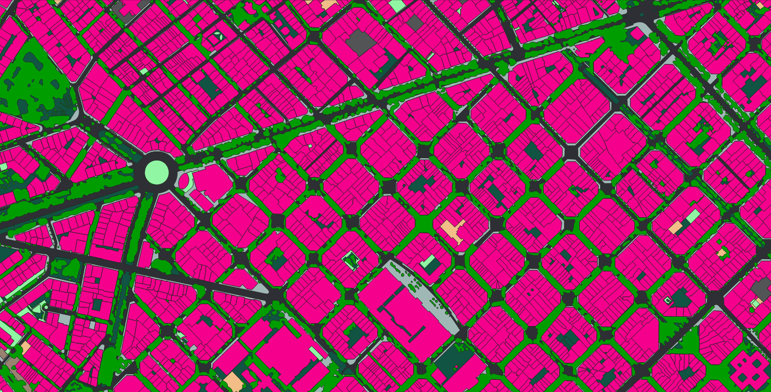
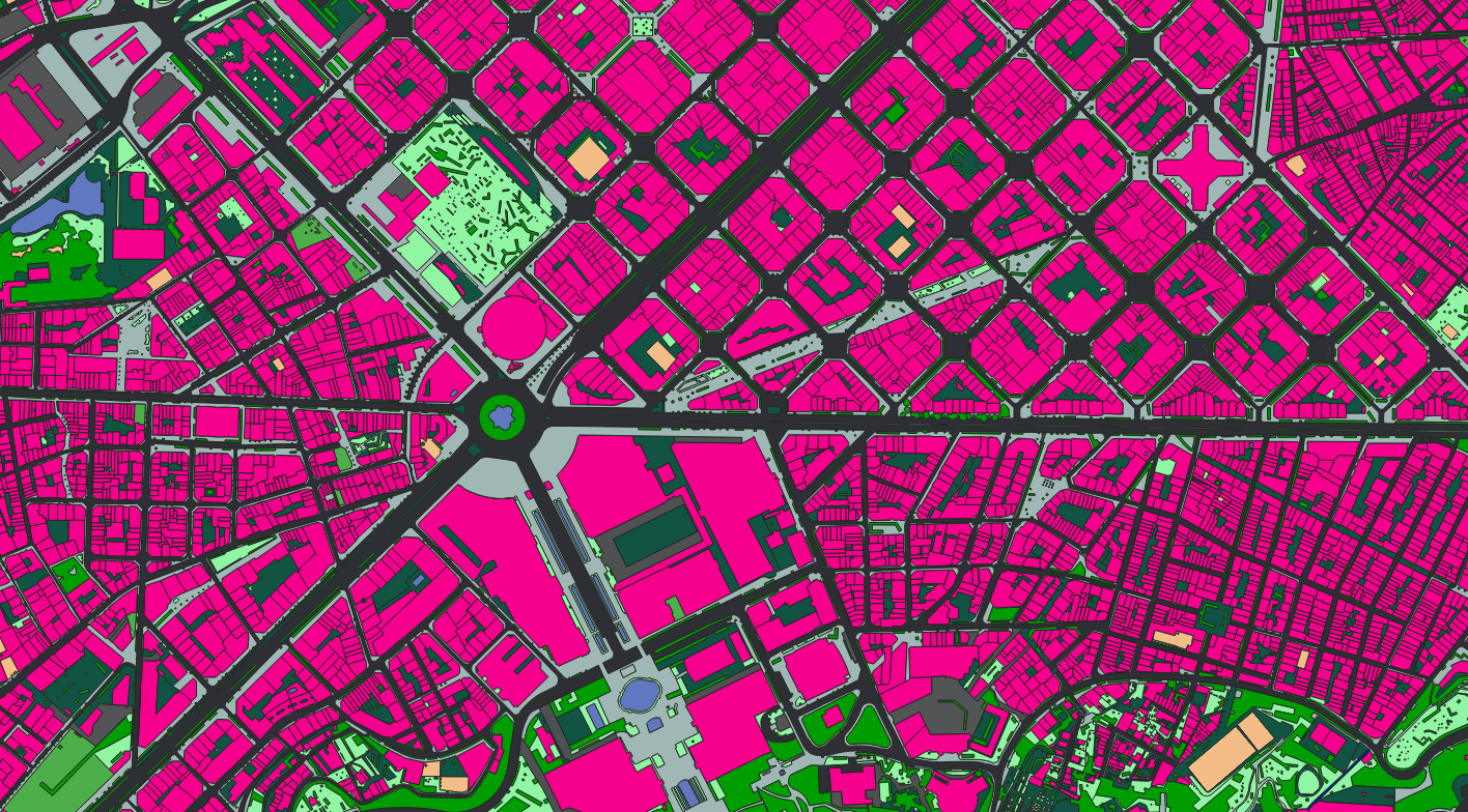
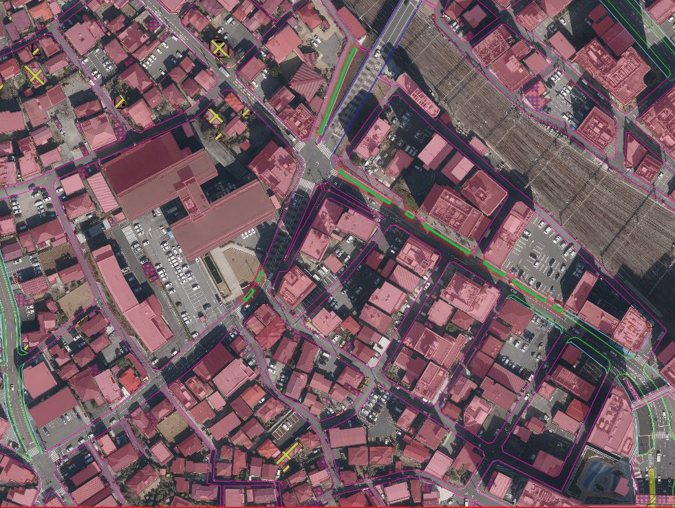
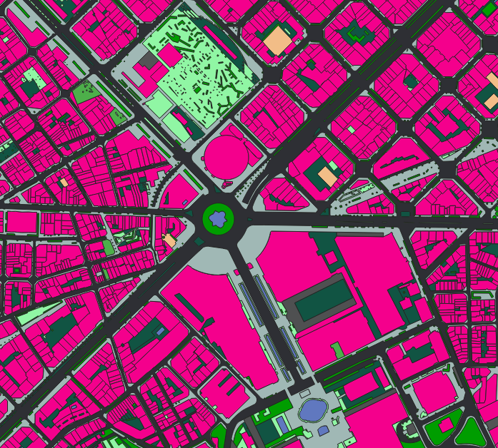
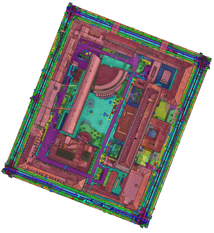
Nazru’s AI platform was deployed in Barcelona, Spain, to automatically map land cover and transportation features into 13 polygon classes. This project involved classifying the entire project area into: building, road, driveway, water, sport‑ground, pavement, bridge, sidewalk, bareland, forest, parking, railway, and grass.
The Challenge
The city of Barcelona required a high‑resolution, polygon‑based land cover inventory for urban planning, environmental monitoring, and infrastructure management. Traditional methods (manual digitisation or low‑resolution land use maps) could not provide the detailed separation of road, driveway, sidewalk, pavement, parking, railway, and various natural and man‑made surfaces. An automated, scalable solution was needed.
The Nazru Solution
Nazru’s platform integrated high‑resolution satellite and aerial imagery with deep learning models for semantic segmentation. Our algorithms automatically classified every pixel (and then vectorised into polygons) into one of 13 classes:
Class | Description |
|---|---|
building | Any permanent structure with roof (residential, commercial, industrial) |
road | Vehicular travel lanes (paved) |
driveway | Private or semi‑private access road (e.g., to houses, garages) |
water | Rivers, lakes, reservoirs, canals, or fountains |
sport‑ground | Athletic fields, tennis courts, stadiums, running tracks |
pavement | Sealed surfaces not used for driving (plazas, large paved areas) |
bridge | Elevated road or path over water, railway, or depression |
sidewalk | Pedestrian walkways adjacent to roads |
bareland | Unpaved, unvegetated soil, sand, or rock |
forest | Dense tree cover (natural or planted woodland) |
parking | Open‑air or structured parking areas (surface lots, garages – as polygon extent) |
railway | Railroad corridors including tracks and ballast |
grass | Mowed lawns, meadows, or grassy open spaces (non‑forest vegetation) |
All outputs were generated as clean polygons (no raster or line outputs) with full attribution.

Sample image from Barcelona, Spain – AI‑based polygon land cover classification
Key Results & Benefits
First‑time, city‑wide polygon land cover map of Barcelona with 13 detailed classes.
Clear separation of road, driveway, sidewalk, pavement, parking, and railway – enabling precise transportation asset management.
Distinction between forest, grass, and bareland for environmental monitoring and green space planning.
Automated workflow from satellite/aerial imagery, reducing manual effort by over 90% compared to traditional digitisation.
Polygons ready for direct integration into GIS, CAD, and urban digital twins.
Key Technologies Used
AI‑based semantic segmentation (pixel‑level classification)
Polygon vectorisation (conversion of raster masks to clean, topologically correct polygons)
Multi‑class deep learning with attention mechanisms for fine‑grained separation of similar classes (road vs. driveway vs. pavement vs. sidewalk)
Geospatial attribute assignment (class name, area in m², perimeter)
Output Format (Polygon Only)
Formats: Shapefile (.shp), GeoJSON, KML/KMZ
