SAR‑Based Land Cover Classification – TerraSAR‑X, Hawaii, USA
Location: Hawaii, USA
Satellite / Sensor: TerraSAR‑X
Resolution & Polarization: 25‑cm to 40‑m, HH Polarization
Product Types: Staring SpotLight, High Res SpotLight, SpotLight, StripMap, ScanSAR, Wide ScanSAR
Data Format: CoSSC (.COS files) – Coregistered Single Look Slant Range Complex (interferometric capability)
Output format: Polygon (vector) – recommended for GIS integration
Project Overview
Nazru’s AI platform was deployed to classify land cover and extract main arterial roads over Hawaii using TerraSAR‑X Synthetic Aperture Radar (SAR) data. The project mapped the area into five distinct classes: Water, Built‑up, Woodland, Agriculture, and Road (Main Arteries). The use of SAR data enables all‑weather, day‑and‑night imaging, providing reliable classification even in cloudy or rainy conditions – common in tropical Hawaii.
The Challenge
In addition to the general challenges of SAR‑based classification (speckle noise, geometric distortions, polarimetric complexity), this project specifically required:
Distinguishing roads from built‑up areas – both can exhibit high backscatter due to double‑bounce scattering (road‑building or road‑vehicle interactions).
Detecting main arterial roads – wide, well‑structured highways and primary roads that have consistent geometric patterns.
Differentiating roads from other linear features – such as rivers, coastlines, or vegetation boundaries.
Handling multiple product types – from Staring SpotLight (very high resolution) to Wide ScanSAR (lower resolution) with adaptive processing.
The Nazru Solution
Nazru’s platform integrated TerraSAR‑X HH‑polarised SAR imagery with a deep learning model specifically designed for SAR classification and linear feature extraction. The pipeline:
Pre‑processing – speckle filtering (e.g., Lee filter), radiometric calibration, terrain correction (using DEM), and geocoding.
Feature extraction – texture features, polarimetric parameters (backscatter intensity), and geometric features to capture linearity and orientation.
Classification – pixel‑wise assignment to one of five classes:
Water – smooth surfaces produce low backscatter (specular reflection).
Built‑up – strong double‑bounce scattering between ground and walls produces high backscatter.
Woodland – volume scattering from canopy produces moderate backscatter.
Agriculture – variable backscatter depending on crop type, density, and moisture.
Road (Main Arteries) – strong double‑bounce scattering from road‑building interactions, combined with linear geometry and consistent width, distinguishing them from general built‑up areas.
Road‑specific detection – using morphological operations and line‑extraction algorithms to extract continuous road networks from classified pixels, followed by vectorisation.
Post‑processing – raster‑to‑polygon conversion with noise removal and minimum mapping unit (MMU) filtering.
Class definitions (based on SAR response):
| Class | SAR Signature | Description |
|---|---|---|
Water | Low backscatter (dark) | Smooth surfaces (ocean, lakes, reservoirs) – specular reflection away from the sensor |
Built‑up | High backscatter (bright) | Urban areas, buildings, and infrastructure – strong double‑bounce scattering |
Woodland | Moderate backscatter (textured) | Forested areas, tree canopies – volume scattering from branches and leaves |
Agriculture | Variable backscatter (seasonal) | Crops, pastures, and orchards – backscatter depends on crop growth stage, type, and soil moisture |
Road (Main Arteries) | High backscatter + linear geometry | Highways, primary roads, and arterial routes – strong double‑bounce scattering with road‑building or road‑vehicle interactions, plus characteristic linear shape and consistent width |
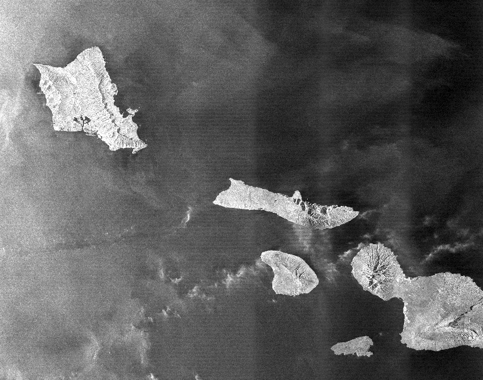
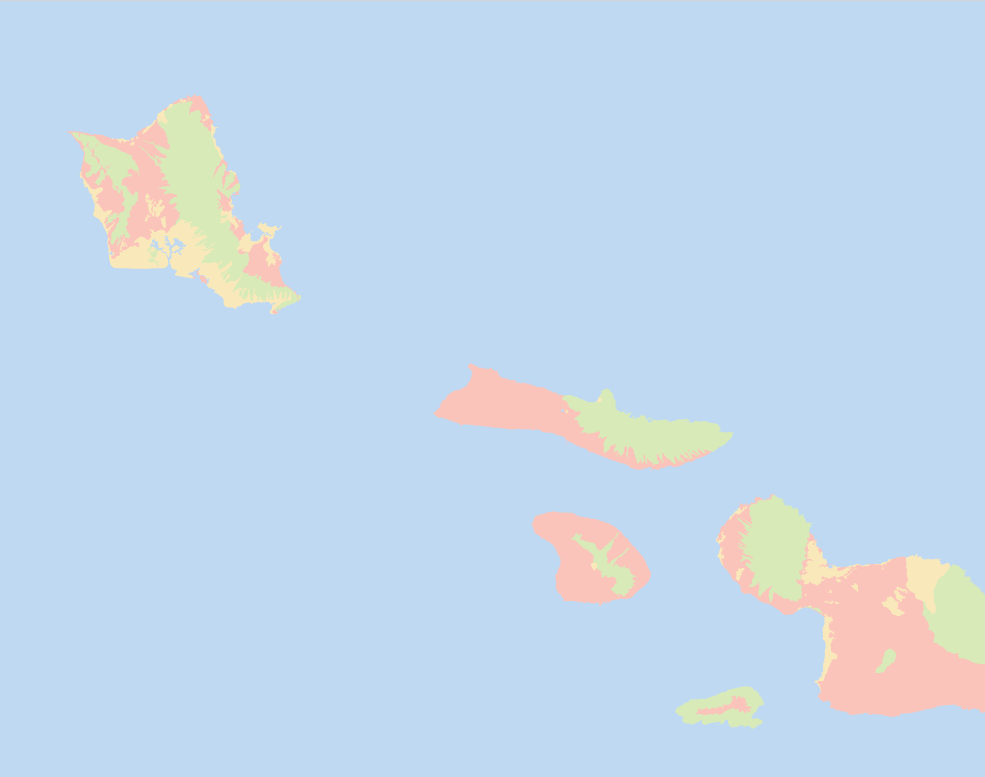
Sample TerraSAR‑X SAR image over Hawaii, USA – AI‑based land cover classification from HH‑polarised data.
Key Results & Benefits
All‑weather, day‑and‑night mapping – SAR data is unaffected by cloud cover, making it ideal for Hawaii’s tropical climate.
Interferometric capability – CoSSC data allows phase‑based analysis for elevation and deformation monitoring (optional).
Clear separation of five classes – including reliable extraction of main arterial roads.
Supports:
Disaster management (flood mapping, volcanic activity monitoring, road access assessment).
Urban development tracking (built‑up expansion and road network changes).
Agricultural monitoring (crop identification and condition).
Forest monitoring (deforestation, biomass estimation).
Transportation planning (road network mapping and condition assessment).
Flexible resolution – from Staring SpotLight (25‑cm) for detailed road mapping to ScanSAR (40‑m) for wide‑area coverage.
GIS‑ready – polygon outputs with class attributes and area measurements.
Key Technologies Used
SAR‑specific AI classification – deep learning models trained on polarimetric and texture features.
Road extraction algorithms – morphological operations, line detection (Hough transform), and graph‑based network extraction.
Speckle filtering – Lee filter, Gamma MAP, or non‑local means for noise reduction.
Terrain correction – DEM‑based orthorectification to remove geometric distortions.
Multi‑temporal analysis – using multiple acquisitions to capture seasonal changes and improve classification accuracy.
Interferometric coherence – used to distinguish built‑up, roads, and vegetation (optional enhancement).
Polygon vectorisation – conversion of classified rasters to clean, topologically correct polygons.