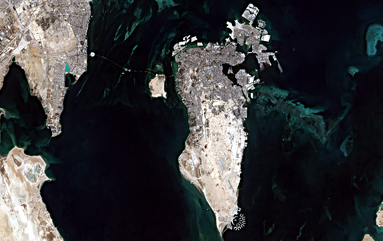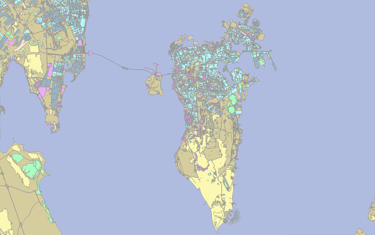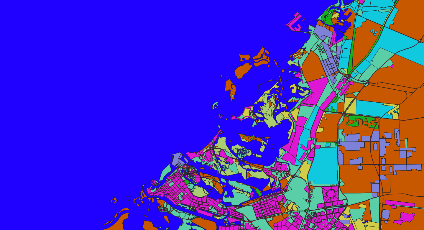
Land Cover & Land Use Classification – Bahrain & Eastern Saudi Arabia (10m Satellite Imagery)
Imagery type: 10‑metre resolution multispectral satellite imagery (e.g., Sentinel‑2)
Output format: Polygon (vector) – recommended for GIS integration
Project Overview
Nazru’s AI platform was deployed to produce a detailed land cover and land use map over Bahrain and the Eastern Province of Saudi Arabia using 10‑metre resolution satellite imagery. The project classified the area into 14 distinct classes, covering natural and human‑modified landscapes: water, wetland, pasture, residential, wild_grass, urban_built, transportation, shrubland, sand_desert, open_space_developed, industrial, forest, cultivated_crops, and bare_soil. The output supports urban planning, environmental monitoring, agricultural assessment, and infrastructure development in this rapidly growing Gulf region.
The Challenge
Classifying land cover in Bahrain and Eastern Saudi Arabia from 10m satellite data presents specific challenges:
Arid and coastal landscape – vast sand deserts with limited vegetation, but important coastal wetlands, mangroves, and oases.
Urban expansion – rapid growth in cities like Manama (Bahrain) and Dammam‑Al Khobar‑Dhahran metropolitan area (Saudi Arabia) creates complex built‑up patterns.
Separation of similar classes –
residentialvs.urban_builtvs.open_space_developed;sand_desertvs.bare_soil;wild_grassvs.pasturevs.shrubland;wetlandvs.water.Agricultural areas – limited but visible around oases (e.g., Al‑Ahsa Oasis) and irrigated farms.
Industrial zones – oil and gas facilities, ports, and industrial areas in both Bahrain and Saudi Arabia.
Transportation networks – roads, highways (including King Fahd Causeway), and other transport corridors.
The Nazru Solution
Nazru’s platform integrated multi‑spectral satellite bands with a deep learning semantic segmentation model. The pipeline:
Pre‑processing – atmospheric correction, cloud masking, and resampling to consistent 10m resolution.
Classification – pixel‑wise assignment to one of 14 classes using a model trained on Gulf region landscapes.
Post‑processing – raster‑to‑polygon conversion with noise removal and minimum mapping unit (MMU) filtering.
Accuracy assessment – validated against high‑resolution reference data (e.g., Google Earth, Planet imagery).
Class definitions (contextualised for Bahrain & Eastern Saudi Arabia):
| Class | Description |
|---|---|
water | Arabian Gulf, coastal lagoons, artificial canals, and inland water bodies |
wetland | Coastal sabkhas, tidal flats, mangroves, and seasonally inundated areas |
pasture | Grazing lands, semi‑natural grasslands used for livestock (limited in the region) |
residential | Dense residential areas (villas, apartment blocks, traditional housing) |
wild_grass | Sparse natural grasses, steppe vegetation, and seasonal herbs |
urban_built | Mixed‑use built‑up areas – commercial, institutional, and high‑density urban centres |
transportation | Roads, highways, airports, and other transport corridors |
shrubland | Areas dominated by low, woody shrubs (natural vegetation) |
sand_desert | Active sand dunes, sand sheets, and desert surfaces |
open_space_developed | Developed open spaces – parks, golf courses, sports fields, and vacant lots |
industrial | Oil and gas facilities, refineries, ports, factories, and industrial zones |
forest | Tree‑covered areas – including mangroves, date palm plantations, and urban tree cover |
cultivated_crops | Irrigated farmlands, orchards, date palm groves, and oases |
bare_soil | Unvegetated soil, salt flats, and rocky surfaces (not sand dunes) |
Key Results & Benefits
Detailed 14‑class land cover map of Bahrain and Eastern Saudi Arabia at 10m resolution.
Clear separation of natural (sand, bare soil, shrubland, grassland, wetland, water, forest) and human‑modified (residential, urban, industrial, transport, agriculture, open space) landscapes.
Supports:
Urban planning and infrastructure development (monitoring city expansion).
Environmental conservation (wetland and mangrove protection, desertification monitoring).
Agricultural monitoring (date palm and oasis assessment).
Industrial and transportation network mapping.
Scalable – can be applied to time‑series data for seasonal and annual change detection.
GIS‑ready – polygon outputs with class attributes and area measurements.
Key Technologies Used
Semantic segmentation (U‑Net / DeepLabV3+) for pixel‑wise classification.
Multi‑spectral indices – NDVI, NDWI, SAVI, and custom indices for arid land discrimination.
Polygon vectorisation – clean, topologically correct polygons.
Atmospheric correction – using standard pre‑processing pipelines (e.g., Sen2Cor).