Land Cover Classification – Cyprus (10m Satellite Imagery)
Location: Cyprus (Island nation in the Eastern Mediterranean)
Project Overview
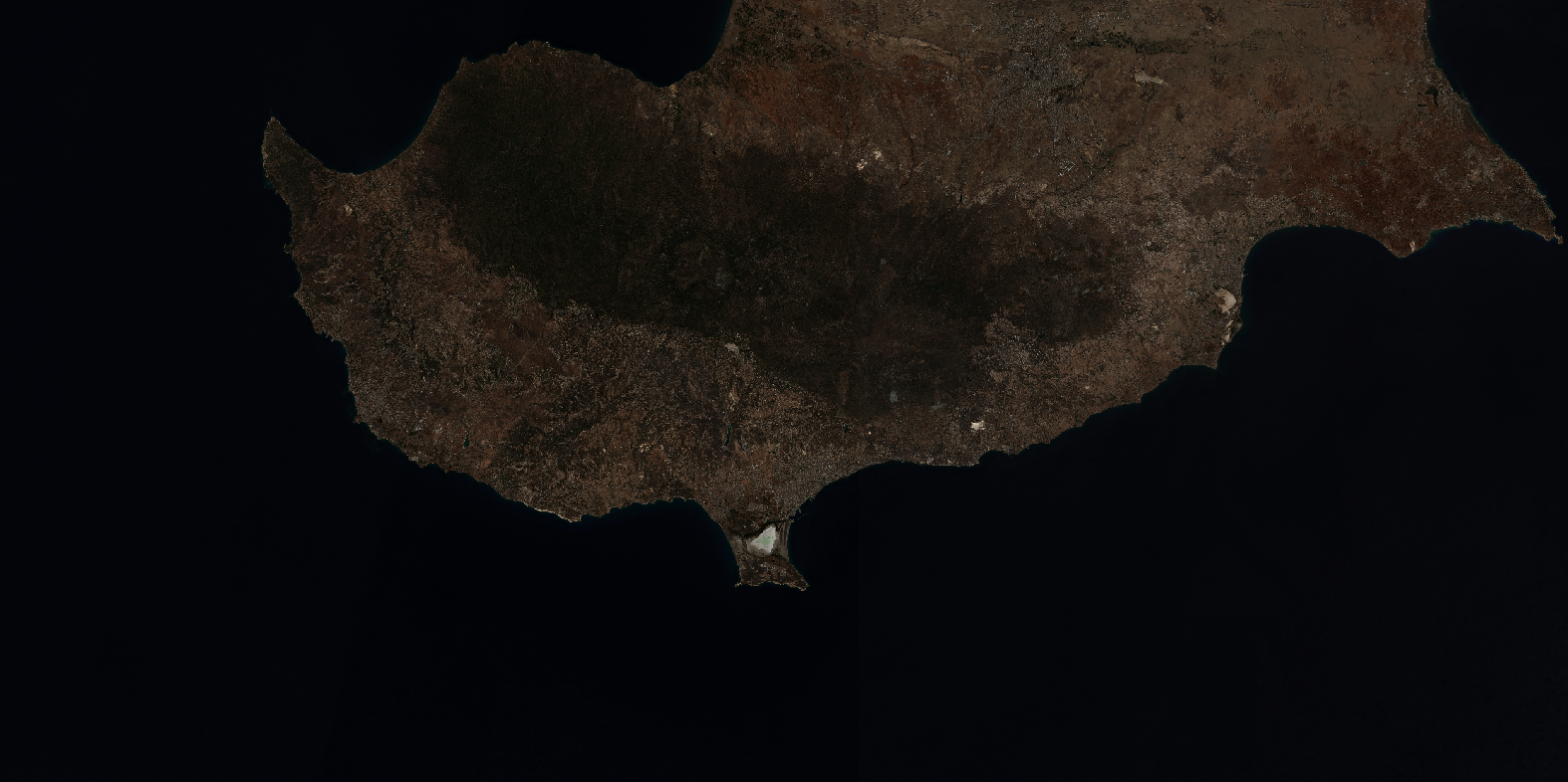
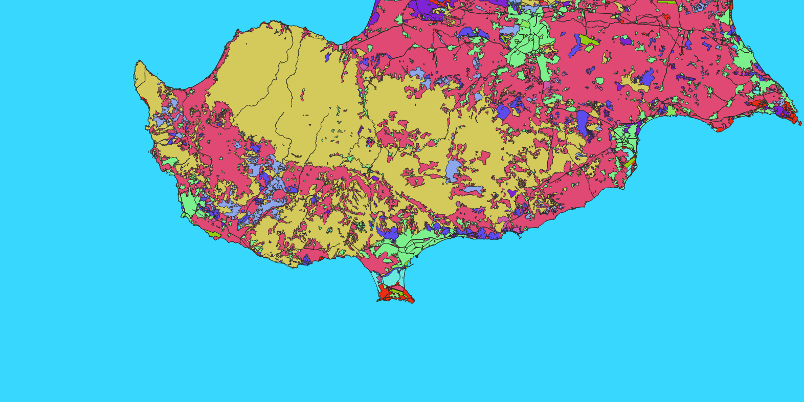
Nazru’s AI platform was deployed to classify land cover across Cyprus using 10‑metre resolution satellite imagery. The project mapped the island into nine distinct classes: bare_soil, cultivated_crops, forest, industrial, transportation, urban_built, water, wetland, and wild_grass. The output supports environmental monitoring, agricultural planning, and sustainable development assessment for the region.
The Challenge
Classifying land cover over Cyprus from 10m satellite data faces specific challenges:
Mediterranean climate – hot, dry summers and mild, wet winters cause seasonal vegetation changes, affecting classification accuracy.
Spectral similarity – wild_grass and cultivated_crops can be difficult to separate, especially in transitional seasons.
Urban and industrial areas – cities like Nicosia, Limassol, and Larnaca have complex built‑up patterns mixed with vegetation.
Water bodies – reservoirs and seasonal rivers may vary in extent, requiring careful temporal selection.
Agricultural diversity – includes olive groves, vineyards, citrus orchards, and cereal crops.
The Nazru Solution
Nazru’s platform integrated multi‑spectral satellite bands with a deep learning semantic segmentation model. The pipeline:
Pre‑processing – atmospheric correction, cloud masking, and resampling to consistent 10m resolution.
Classification – pixel‑wise assignment to one of nine classes using a model trained on Mediterranean landscapes.
Post‑processing – raster‑to‑polygon conversion with noise removal and minimum mapping unit (MMU) filtering.
Accuracy assessment – validated against high‑resolution reference data or field surveys.
Class definitions (same as previous project):
Class
Description
bare_soil
Unvegetated soil, sand, or rock surfaces
cultivated_crops
Active agricultural fields, orchards, vineyards
forest
Dense tree cover (natural pine forests, e.g., Troodos Mountains)
industrial
Factories, warehouses, industrial zones
transportation
Roads, highways, airports, and transport corridors
urban_built
Residential, commercial, and mixed‑use built‑up areas
water
Reservoirs, dams, rivers, and coastal water bodies
wetland
Marshlands, salt flats (e.g., Larnaca Salt Lake), and seasonally inundated areas
wild_grass
Natural grasslands, steppe, and Mediterranean scrubland (maquis)
Key Results & Benefits
Comprehensive land cover map of Cyprus at 10m resolution.
Clear separation of agricultural land, natural vegetation, urban, industrial, transport, water, wetlands, and bare soil.