Leveraging Airbus Imagery & Nazru Vector Maps for Land Administration
Nazru vector map of Annapolis, Maryland, USA derived from Airbus imagery
Local governments rely on high-resolution digital maps to support a range of critical applications — from planning smart city initiatives and transportation projects to modeling flood risks and ensuring equitable property tax assessments. As urban areas expand, the need for accurate and up-to-date land use/land cover (LU/LC) data becomes ever more essential for advanced analytics and informed decision-making.
However, acquiring both the high-quality imagery and the corresponding LU/LC layers remains a significant challenge for land administration authorities worldwide.
Key challenges include:
Sourcing Current Imagery: Accessing up-to-date, high-resolution imagery is often difficult and costly, particularly for public sector organizations with limited budgets.
Labor-Intensive Digitization: Manually delineating land use and land cover polygons is a time-consuming and resource-heavy process, making it impractical for large-scale or frequent updates.
Limitations of Automated Solutions: While automated feature extraction tools are available, many produce inaccurate or inconsistent results, leading to unreliable datasets that require extensive manual correction.
These barriers hinder the ability of governments to maintain current, accurate spatial data — a foundational element of effective land governance and sustainable urban development.
Solution & Applications
Nazru vector map of Lyon, France derived from Airbus imagery
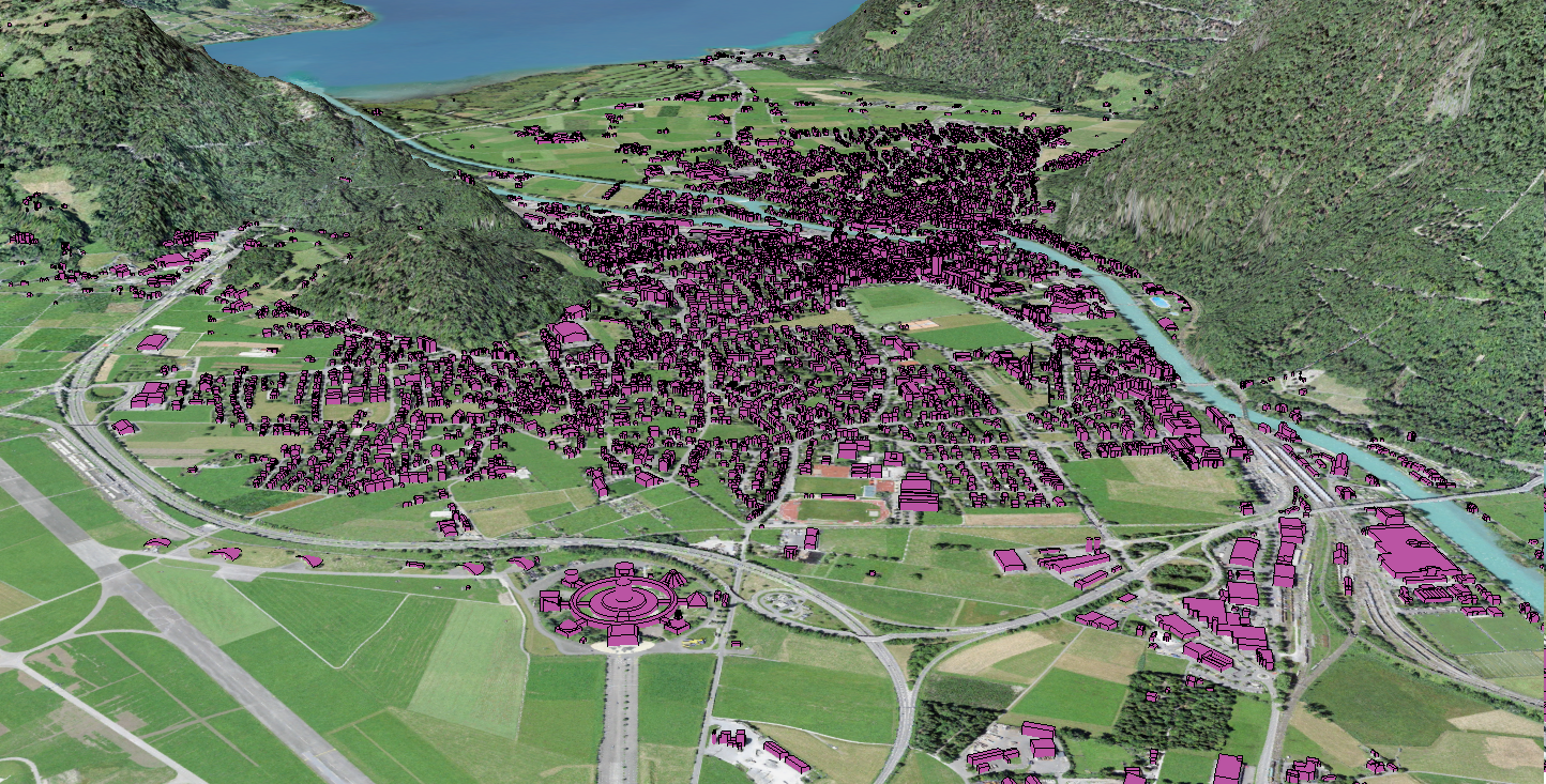
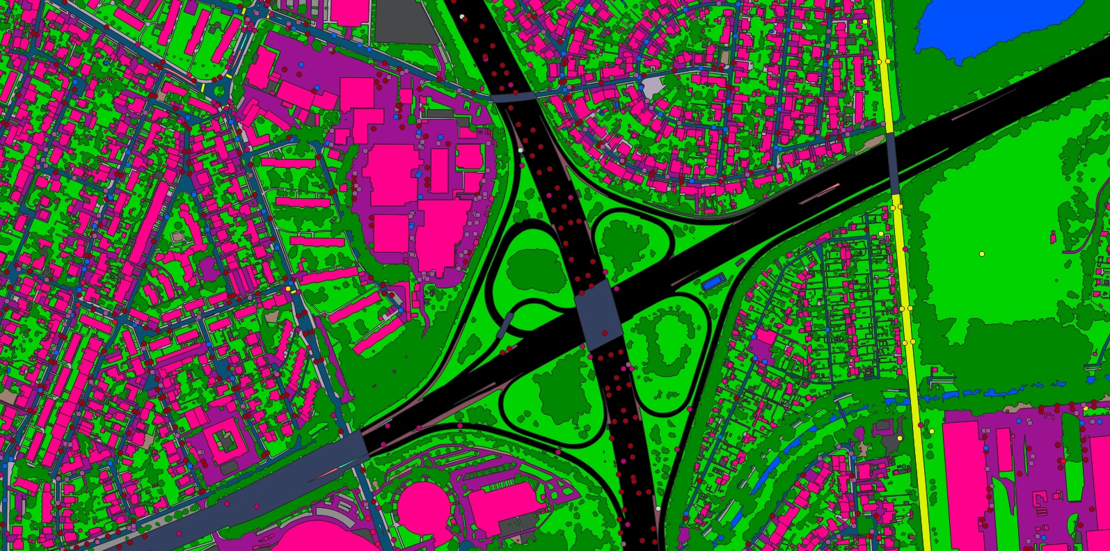
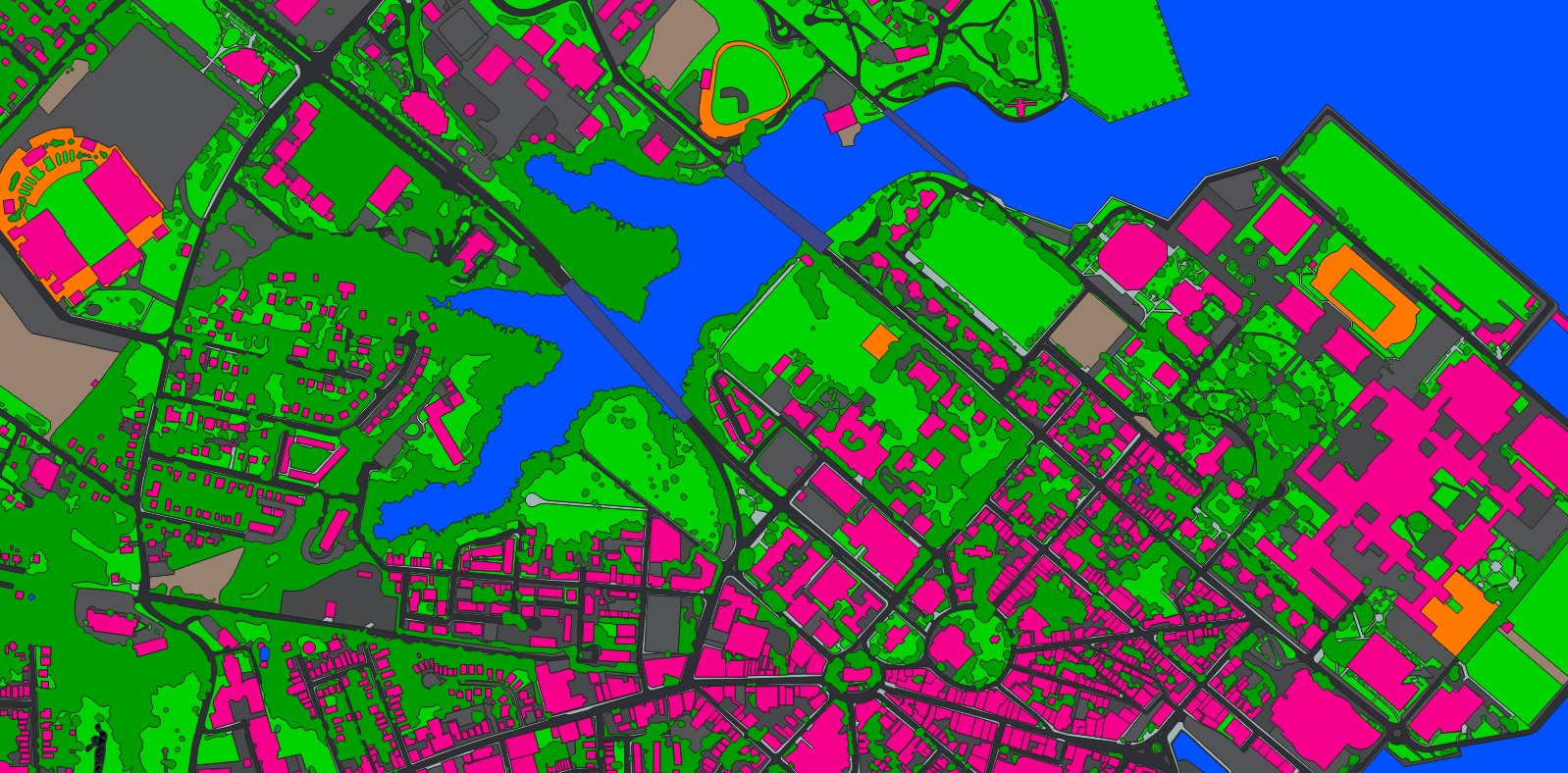
By leveraging up-to-date imagery from Airbus and Nazru AI’s advanced artificial intelligence extraction capabilities, municipal customers can now request rapidly extracted digital maps. In addition to Airbus’ high-resolution satellite imagery, Nazru Vector Maps can be requested through the OneAtlas platform or upon demand. These products – available from city to continental scale – support numerous land administration applications, including:
Flood Modelling, Mapping & Risk Assessment:
Using land use/land cover features to create high-resolution digital maps enables local governments to identify and model flood-prone areas. The rapid delivery of accurate data helps organizations implement flood mitigation strategies more quickly and with greater confidence.
Stormwater Drainage Assessment & Property Taxation:
Access digital maps that facilitate better assessment of stormwater infrastructure conditions. Municipalities can implement equitable taxation models based on property impervious surface area to generate appropriate revenue.
Smart City Development:
Utilize precise land use/land cover data to gain insights that enhance smart city infrastructure planning and optimize resource management and allocation.
Road & Transportation Planning:
Quickly obtain comprehensive road and transportation network data for your municipality or region. Maintain updated understanding of areas of interest to better allocate internal resources and assets.