The world we inhabit is intricate, replete with nuances, and in a state of perpetual evolution. To facilitate informed decision-making within this framework, governments, corporations, and humanitarian entities require access to highly precise digital representations of the physical environment. High-Definition (HD) Vector Maps serve as a critical tool in this regard, delivering actionable insights and establishing a robust foundation for data-driven decision-making on a global scale.
Over the past nine years, Nazru has established itself as a globally recognized leader in AI-powered mapping solutions. Our cutting-edge technology enables the large-scale generation of HD Vector Maps derived from high-resolution geospatial imagery, a capability leveraged by clients and partners worldwide. This document outlines Nazru’s distinctive competencies in delivering a truly universal, industry-leading global feature extraction solution, accompanied by illustrative examples of how our AI-driven mapping system adeptly navigates the diverse and complex terrains encountered across the globe.
Need for HD Vector Maps
HD Vector Maps foundational data to support applications such as:
Insurance underwriting and risk management
Transportation engineering
Stormwater drainage assessments & taxation
Broadband infrastructure planning & deployment
Civil engineering and smart city initiatives
Climate resilience and public infrastructure planning
To be relied upon for critical decision-making, these HD Vector maps must be accurate, up-to-date, and comprehensive. While GIS professionals around the world are capable of generating high-quality maps, this process is often very manual – resulting in time and cost constraints that make the approach unfeasible at a large-scale. As image-capture technology continues to advance, an increasing amount of high-resolution imagery is being captured every day – resulting in the need for more efficient methods to extract structured information from this imagery (methods to generate HD Vector Maps).
Nazru’s AI-based mapping system is capable of converting this increasing flood of high-resolution geospatial imagery into HD Vector Maps in a cost- and time-effective manner.
Partnering to Offer a Global Solution
In pursuit of our mission to create a digital twin of the earth, Nazru has built a global partnership network that includes over 30 leading imagery providers around the world. Collaboration with Nazru AI is a true win-win proposition for our partners – Nazru offers partners the ability to leverage our AI-based mapping solutions, resulting in: increased capacity to take on more projects, enhanced ability to compete for larger projects, and access to new markets or applications not previously accessible. All this capability translates into more revenue per pixel.
Overcoming Local Challenges
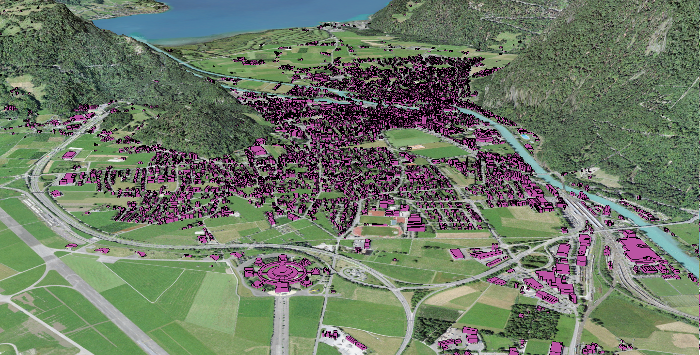
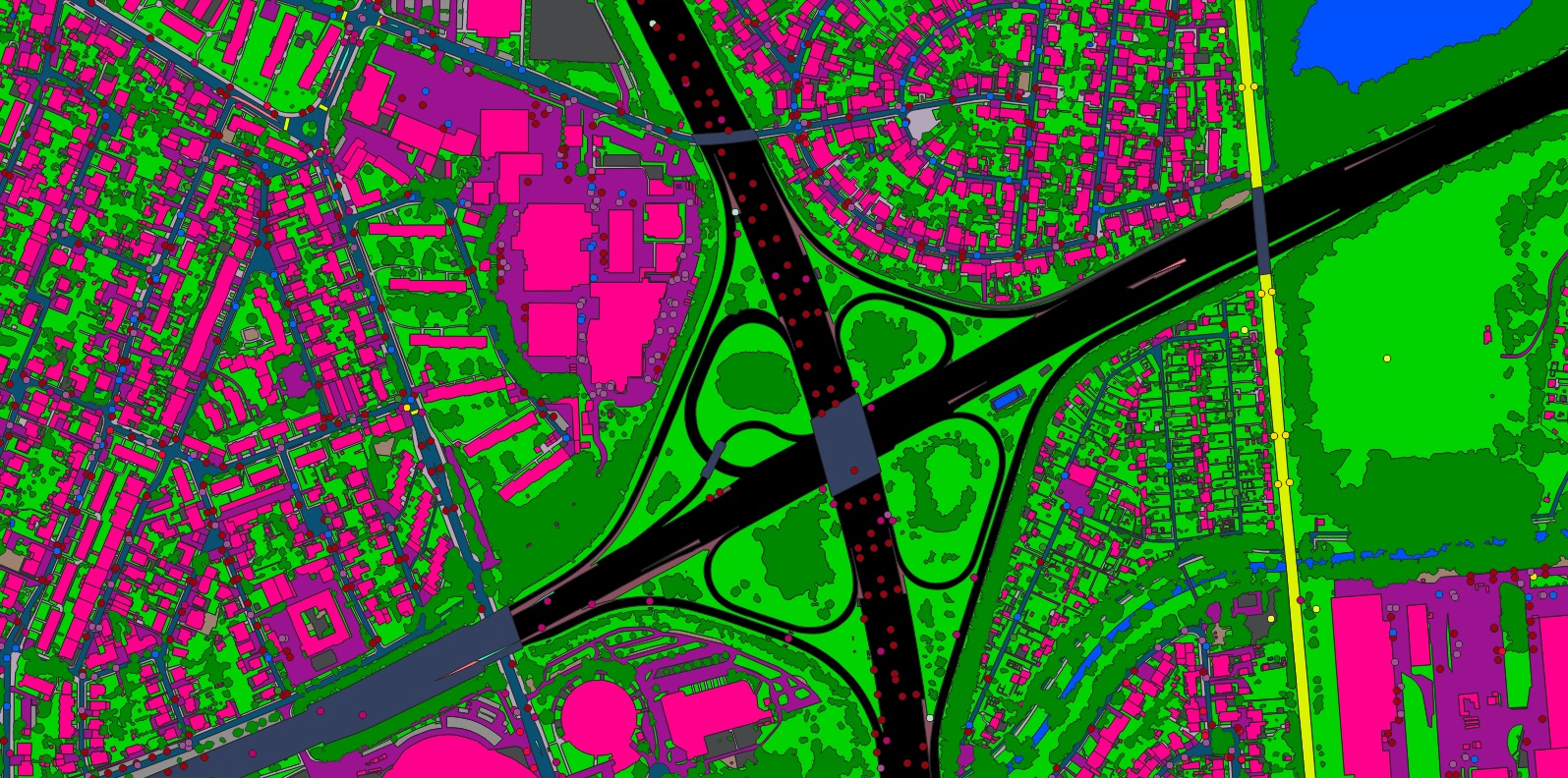
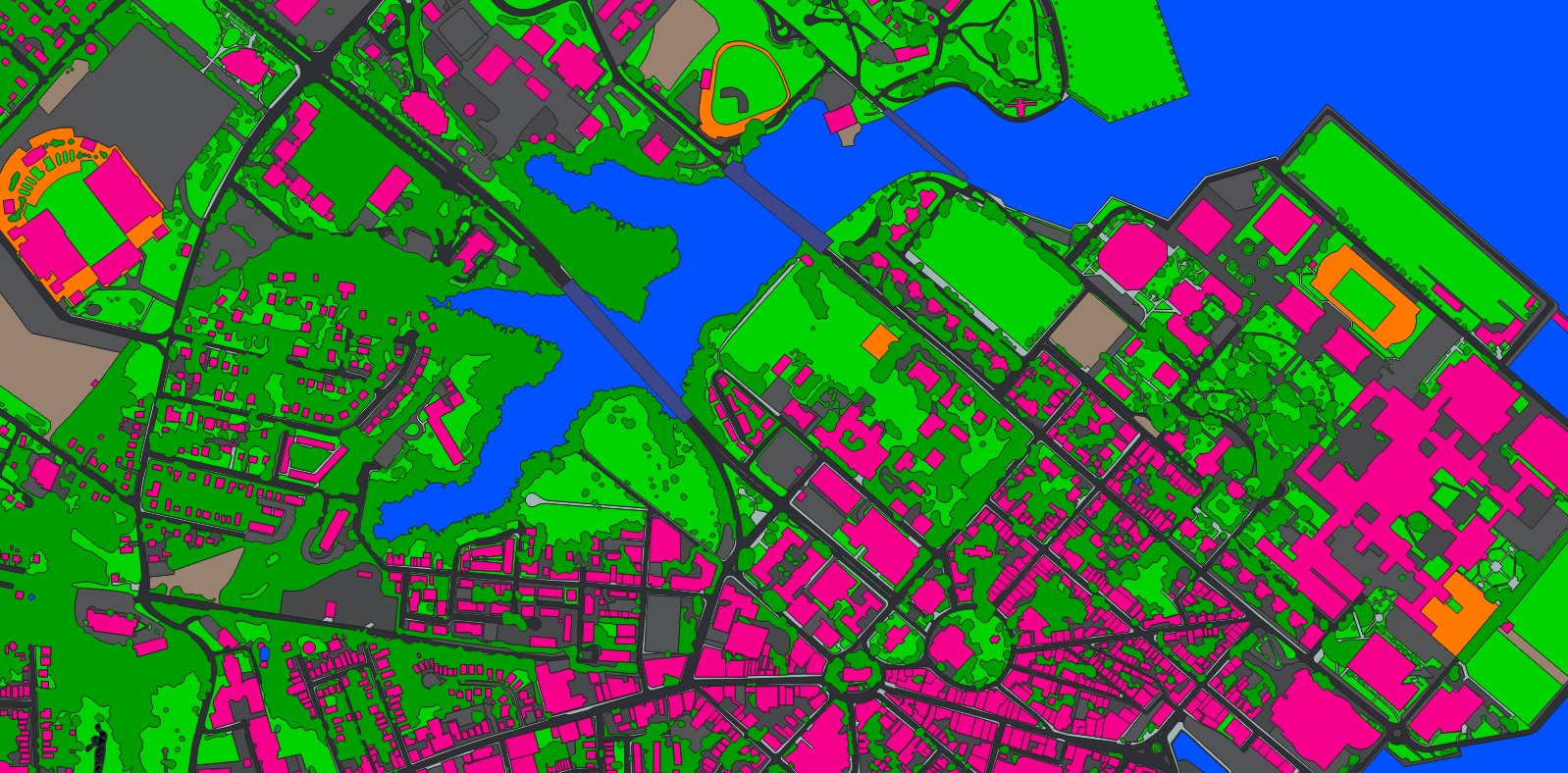
Nazru’s AI-based mapping system has a unique ability to account for the world’s diverse range of environments and terrains. This adaptable capability has been developed and refined over the course of a decade of international HD Vector Mapping experience. Below are a few examples of where Nazru’s AI-based mapping system has been successfully deployed in unique environments.
Bonn, Germany
Nazru’s AI-based mapping system is capable of capturing the curvilinear structure unique to European cities, in addition to capturing the individual row houses that are prominent across the Continent.